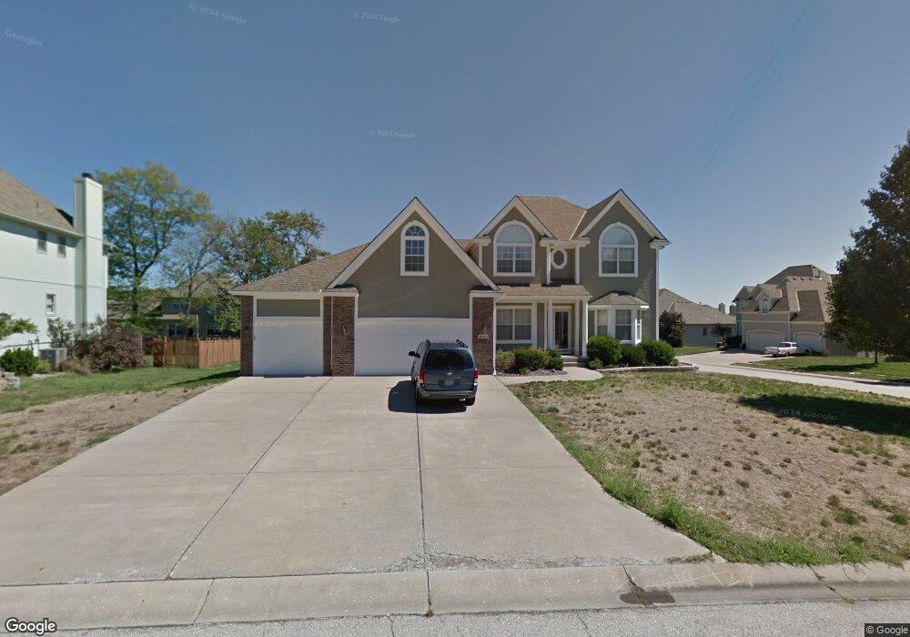
3833 SW Boulder Dr Lees Summit, MO 64082
Estimated Value: $502,563 - $568,000
4
Beds
4
Baths
2,938
Sq Ft
$182/Sq Ft
Est. Value
About This Home
This home is located at 3833 SW Boulder Dr, Lees Summit, MO 64082 and is currently estimated at $535,391, approximately $182 per square foot. 3833 SW Boulder Dr is a home located in Jackson County with nearby schools including Summit Pointe Elementary School, Summit Lakes Middle School, and Lee's Summit West High School.
Ownership History
Date
Name
Owned For
Owner Type
Purchase Details
Closed on
Mar 15, 2004
Sold by
Mcgovern Builders Inc
Bought by
Holden Tod N and Holden Susanne M
Current Estimated Value
Home Financials for this Owner
Home Financials are based on the most recent Mortgage that was taken out on this home.
Original Mortgage
$269,900
Outstanding Balance
$137,747
Interest Rate
7%
Mortgage Type
Purchase Money Mortgage
Estimated Equity
$397,644
Create a Home Valuation Report for This Property
The Home Valuation Report is an in-depth analysis detailing your home's value as well as a comparison with similar homes in the area
Home Values in the Area
Average Home Value in this Area
Purchase History
| Date | Buyer | Sale Price | Title Company |
|---|---|---|---|
| Holden Tod N | -- | Coffelt Land Title Inc |
Source: Public Records
Mortgage History
| Date | Status | Borrower | Loan Amount |
|---|---|---|---|
| Open | Holden Tod N | $269,900 |
Source: Public Records
Tax History
| Year | Tax Paid | Tax Assessment Tax Assessment Total Assessment is a certain percentage of the fair market value that is determined by local assessors to be the total taxable value of land and additions on the property. | Land | Improvement |
|---|---|---|---|---|
| 2025 | $6,036 | $84,680 | $16,650 | $68,030 |
| 2024 | $5,993 | $83,600 | $19,787 | $63,813 |
| 2023 | $5,993 | $83,600 | $19,787 | $63,813 |
| 2022 | $5,169 | $64,030 | $12,322 | $51,708 |
| 2021 | $5,276 | $64,030 | $12,322 | $51,708 |
| 2020 | $5,320 | $63,933 | $12,322 | $51,611 |
| 2019 | $5,174 | $63,933 | $12,322 | $51,611 |
| 2018 | $4,744 | $54,392 | $6,681 | $47,711 |
| 2016 | $4,528 | $51,395 | $7,087 | $44,308 |
Source: Public Records
Map
Nearby Homes
- 3796 SW Boulder Dr
- 3916 SW Granite Ln
- 3940 SW Flintrock Dr
- 3925 SW Flintrock Dr
- 3932 SW Flintrock Dr
- Vacant Lot 3 - SW M-150 Hwy
- 3916 SW Flintrock Dr
- 3904 SW Flintrock Dr
- 3920 SW Stoney Brook Dr
- 1413 SW Whistle Dr
- 1409 SW Whistle Dr
- 4400 Doc Henry Rd
- 1521 SW Cross Creek Dr
- 1508 SW Arborpark Terrace
- 1512 SW Arborpark Terrace
- 1504 SW Arborpark Terrace
- 3925 SW Windsong Dr
- 1813 SW Arbormist Dr
- 4212 SW Stoney Brook Dr
- 1009 SW Drake Cir
- 3829 SW Boulder Dr
- 3832 SW Sandstone Dr
- 3828 SW Sandstone Dr
- 1313 SW Pebble Ln
- 3836 SW Boulder Dr
- 3825 SW Boulder Dr
- 3900 SW Boulder Dr
- 1309 SW Pebble Ln
- 3824 SW Sandstone Dr
- 3828 SW Boulder Dr
- 3904 SW Boulder Dr
- 3824 SW Boulder Dr
- 1320 SW Rylee Ln
- 1312 SW Rylee Ln
- 3901 SW Granite Ln
- 3905 SW Granite Ln
- 3908 SW Boulder Dr
- 3837 SW Granite Ln
- 3821 SW Boulder Dr
- 1308 SW Rylee Ln
Your Personal Tour Guide
Ask me questions while you tour the home.