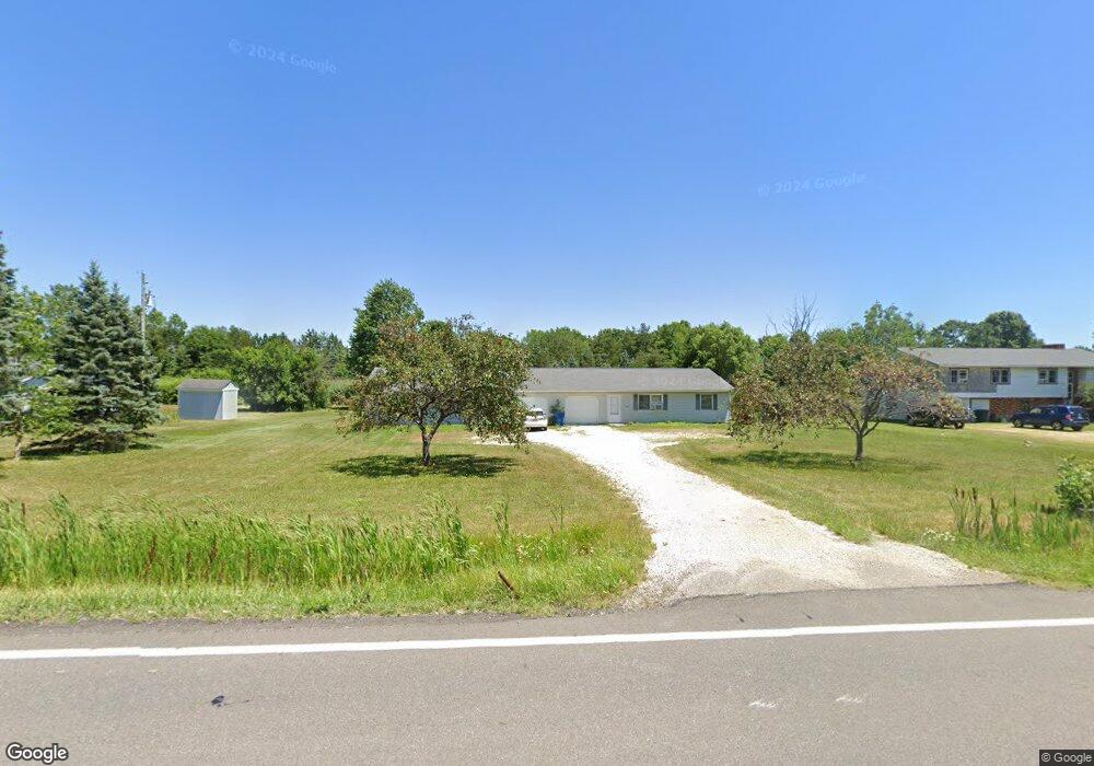
3846 State Route 183 Rootstown, OH 44272
Estimated Value: $235,000 - $264,000
4
Beds
1
Bath
2,200
Sq Ft
$112/Sq Ft
Est. Value
About This Home
This home is located at 3846 State Route 183, Rootstown, OH 44272 and is currently estimated at $247,310, approximately $112 per square foot. 3846 State Route 183 is a home located in Portage County with nearby schools including Southeast High School.
Ownership History
Date
Name
Owned For
Owner Type
Purchase Details
Closed on
Nov 8, 2004
Sold by
7 Jewel Properties Llc
Bought by
Stephanopoulos George and Stephanopoulos Esther P
Current Estimated Value
Home Financials for this Owner
Home Financials are based on the most recent Mortgage that was taken out on this home.
Original Mortgage
$119,200
Outstanding Balance
$57,104
Interest Rate
5.81%
Mortgage Type
Purchase Money Mortgage
Estimated Equity
$190,206
Purchase Details
Closed on
Apr 2, 2004
Sold by
Fisher Ronald K and Fisher Julie M
Bought by
7 Jewel Properties Llc
Purchase Details
Closed on
Jul 18, 2003
Sold by
Mcfee Daniel R
Bought by
Fisher Ronald K and Fisher Julie M
Home Financials for this Owner
Home Financials are based on the most recent Mortgage that was taken out on this home.
Original Mortgage
$108,000
Interest Rate
5.3%
Mortgage Type
Purchase Money Mortgage
Purchase Details
Closed on
May 24, 1993
Bought by
Mcfee Daniel R
Create a Home Valuation Report for This Property
The Home Valuation Report is an in-depth analysis detailing your home's value as well as a comparison with similar homes in the area
Purchase History
| Date | Buyer | Sale Price | Title Company |
|---|---|---|---|
| Stephanopoulos George | $149,000 | Portage Lawyers Title | |
| 7 Jewel Properties Llc | -- | -- | |
| Fisher Ronald K | $180,000 | Approved Statewide Title Age | |
| Mcfee Daniel R | -- | -- |
Source: Public Records
Mortgage History
| Date | Status | Borrower | Loan Amount |
|---|---|---|---|
| Open | Stephanopoulos George | $119,200 | |
| Previous Owner | Fisher Ronald K | $108,000 | |
| Closed | Fisher Ronald K | $13,000 |
Source: Public Records
Tax History
| Year | Tax Paid | Tax Assessment Tax Assessment Total Assessment is a certain percentage of the fair market value that is determined by local assessors to be the total taxable value of land and additions on the property. | Land | Improvement |
|---|---|---|---|---|
| 2025 | $2,782 | $72,910 | $13,790 | $59,120 |
| 2024 | $2,719 | $72,910 | $13,790 | $59,120 |
| 2023 | $2,304 | $55,270 | $11,900 | $43,370 |
| 2022 | $2,390 | $55,270 | $11,900 | $43,370 |
| 2021 | $2,409 | $55,270 | $11,900 | $43,370 |
| 2020 | $2,175 | $47,890 | $10,820 | $37,070 |
| 2019 | $2,181 | $47,890 | $10,820 | $37,070 |
| 2018 | $2,019 | $41,760 | $10,500 | $31,260 |
| 2017 | $2,019 | $41,760 | $10,500 | $31,260 |
| 2016 | $2,013 | $41,760 | $10,500 | $31,260 |
| 2015 | $1,929 | $41,760 | $10,500 | $31,260 |
| 2014 | $1,891 | $39,970 | $10,500 | $29,470 |
| 2013 | $1,845 | $39,970 | $10,500 | $29,470 |
Source: Public Records
Map
Nearby Homes
- 3798 State Route 183
- 6747 Giddings Rd
- 3545 Porter Rd
- 4087 Industry
- 2639 Ohio 183
- 0 Tallmadge Rd Unit 5189301
- 0 Tallmadge Rd Unit 5189314
- 8464 & 8446 Tallmadge Rd
- 8492 & 8476 Tallmadge Rd
- 4200 Hattrick Rd
- 0 John Thomas
- 941 Porter Rd
- 0 Wayland Rd Unit 5191883
- 6605 State Route 5
- 2434 Taft Ave
- 4958 Bassett Rd
- 0 Yale Rd Unit 5190725
- 1491 Whittlesey Ave
- 1454 Hillcrest Dr
- 4079 Siefer Dr
- 3830 State Route 183
- 3820 State Route 183
- 3886 State Route 183
- 3810 State Route 183
- 3865 State Route 183
- 3786 State Route 183
- 3917 State Route 14
- 3776 State Route 183
- 3879 State Route 14
- 3764 Ohio 183
- 3764 State Route 183
- 3920 State Route 14
- 3898 State Route 14
- 3870 State Route 14
- 3866 State Route 14
- 3858 State Route 14
- 3948 State Route 14
- 4177 Ohio 14
- 3821 State Route 14
- 0 Ohio 14
Your Personal Tour Guide
Ask me questions while you tour the home.