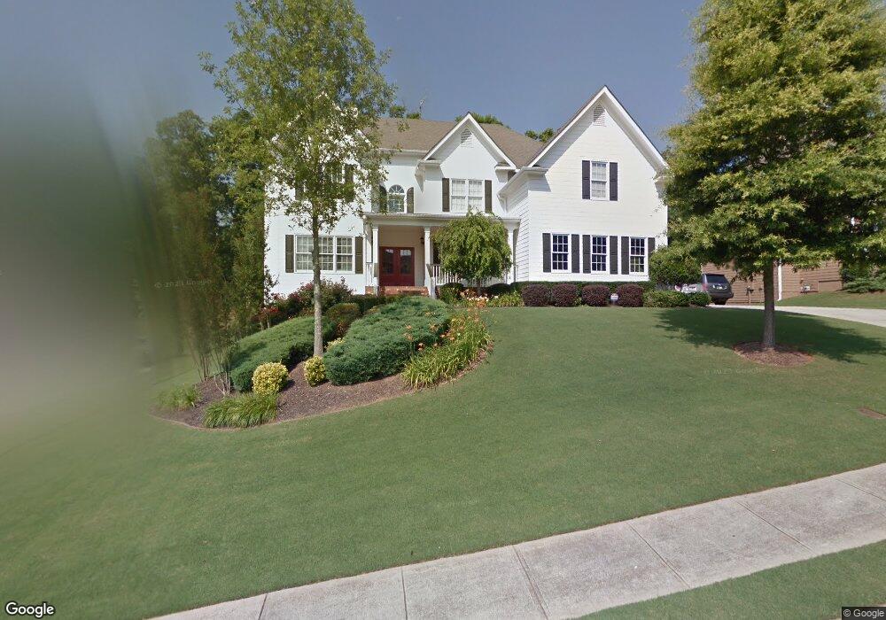
3854 Lost Oak Dr Unit 2 Buford, GA 30519
Estimated Value: $634,528 - $720,000
5
Beds
4
Baths
3,749
Sq Ft
$177/Sq Ft
Est. Value
About This Home
This home is located at 3854 Lost Oak Dr Unit 2, Buford, GA 30519 and is currently estimated at $663,132, approximately $176 per square foot. 3854 Lost Oak Dr Unit 2 is a home located in Gwinnett County with nearby schools including Harmony Elementary School and Glenn C. Jones Middle School.
Ownership History
Date
Name
Owned For
Owner Type
Purchase Details
Closed on
Aug 26, 2005
Sold by
Magnolia Signature Homes Inc
Bought by
Rogers Scott M and Rogers Amanda
Current Estimated Value
Home Financials for this Owner
Home Financials are based on the most recent Mortgage that was taken out on this home.
Original Mortgage
$288,000
Outstanding Balance
$154,577
Interest Rate
6.3%
Mortgage Type
New Conventional
Estimated Equity
$508,555
Create a Home Valuation Report for This Property
The Home Valuation Report is an in-depth analysis detailing your home's value as well as a comparison with similar homes in the area
Home Values in the Area
Average Home Value in this Area
Purchase History
| Date | Buyer | Sale Price | Title Company |
|---|---|---|---|
| Rogers Scott M | $360,000 | -- |
Source: Public Records
Mortgage History
| Date | Status | Borrower | Loan Amount |
|---|---|---|---|
| Open | Rogers Scott M | $288,000 |
Source: Public Records
Tax History
| Year | Tax Paid | Tax Assessment Tax Assessment Total Assessment is a certain percentage of the fair market value that is determined by local assessors to be the total taxable value of land and additions on the property. | Land | Improvement |
|---|---|---|---|---|
| 2025 | $7,949 | $279,680 | $54,400 | $225,280 |
| 2024 | $8,219 | $285,240 | $48,000 | $237,240 |
| 2023 | $8,219 | $224,280 | $33,600 | $190,680 |
| 2022 | $6,939 | $224,280 | $33,600 | $190,680 |
| 2021 | $5,817 | $165,640 | $29,600 | $136,040 |
| 2020 | $5,856 | $165,640 | $29,600 | $136,040 |
| 2019 | $5,367 | $152,040 | $26,400 | $125,640 |
| 2018 | $5,378 | $152,040 | $26,400 | $125,640 |
| 2016 | $5,277 | $146,560 | $26,400 | $120,160 |
| 2015 | $5,062 | $138,080 | $18,400 | $119,680 |
| 2014 | -- | $127,000 | $18,400 | $108,600 |
Source: Public Records
Map
Nearby Homes
- 2727 Lost Mill Trace
- 4041 Lost Mill Ln
- 2551 E Maddox Rd
- 4023 Lost Oak Dr
- 2380 Black Bear Ct
- 2101 E Maddox Rd
- 2352 E Maddox Rd
- 2350 E Maddox Rd
- 2765 Ivy Springs Ct
- 4017 S South Bogan Rd
- 2398 E Maddox Rd
- 3843 Morning Meadow Ln
- 3665 Mystic Dr Unit 2
- 3775 Rolling Creek Dr
- 2195 E Maddox Rd
- 2753 Blue Moon Dr Unit 4
- 2151 E Maddox Rd
- 3944 Hamilton Mill Rd
- 3964 Hamilton Mill Rd
- 2714 Reflection Dr
- 3864 Lost Oak Dr NE
- 3844 Lost Oak Dr Unit 2
- 3864 Lost Oak Dr
- 3810 Quail Creek Dr
- 3810 Quail Creek Dr Unit 55
- 2543 Bogan Bridge Cir
- 3834 Lost Oak Dr Unit 2
- 3833 Lost Oak Dr
- 3873 Lost Oak Dr Unit 2
- 2553 Bogan Bridge Cir Unit 2
- 3800 Quail Creek Dr
- 3824 Lost Oak Dr Unit 2
- 3884 Lost Oak Dr Unit 2
- 3883 Lost Oak Dr
- 2502 Shoals Bluff Ct
- 3790 Quail Creek Dr
- 2552 Bogan Bridge Cir
- 2563 Bogan Bridge Cir
- 2563 Bogan Bridge Cir Unit 34
- 3801 Quail Creek Dr
Your Personal Tour Guide
Ask me questions while you tour the home.