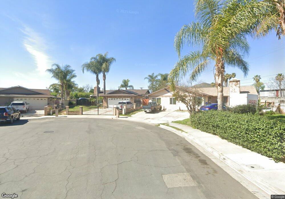
3857 Driving Range Rd Riverside, CA 92509
Rubidoux NeighborhoodEstimated Value: $551,031 - $657,000
4
Beds
2
Baths
1,537
Sq Ft
$393/Sq Ft
Est. Value
About This Home
This home is located at 3857 Driving Range Rd, Riverside, CA 92509 and is currently estimated at $604,758, approximately $393 per square foot. 3857 Driving Range Rd is a home located in Riverside County with nearby schools including Peralta Elementary, Mission Middle School, and Rubidoux High School.
Ownership History
Date
Name
Owned For
Owner Type
Purchase Details
Closed on
Aug 8, 2023
Sold by
Diaz Fabiola
Bought by
Diaz Fabiola Revocable Living Trust and Diaz
Current Estimated Value
Purchase Details
Closed on
Apr 9, 2004
Sold by
Garcia Ramiro and Diaz Fabiola
Bought by
Diaz Fabiola
Home Financials for this Owner
Home Financials are based on the most recent Mortgage that was taken out on this home.
Original Mortgage
$115,000
Interest Rate
5.35%
Mortgage Type
Stand Alone Refi Refinance Of Original Loan
Create a Home Valuation Report for This Property
The Home Valuation Report is an in-depth analysis detailing your home's value as well as a comparison with similar homes in the area
Home Values in the Area
Average Home Value in this Area
Purchase History
| Date | Buyer | Sale Price | Title Company |
|---|---|---|---|
| Diaz Fabiola Revocable Living Trust | -- | None Listed On Document | |
| Diaz Fabiola | -- | Orange Coast Title |
Source: Public Records
Mortgage History
| Date | Status | Borrower | Loan Amount |
|---|---|---|---|
| Previous Owner | Diaz Fabiola | $115,000 |
Source: Public Records
Tax History
| Year | Tax Paid | Tax Assessment Tax Assessment Total Assessment is a certain percentage of the fair market value that is determined by local assessors to be the total taxable value of land and additions on the property. | Land | Improvement |
|---|---|---|---|---|
| 2025 | $3,418 | $319,664 | $76,184 | $243,480 |
| 2023 | $3,418 | $307,253 | $73,227 | $234,026 |
| 2022 | $3,341 | $301,230 | $71,792 | $229,438 |
| 2021 | $3,322 | $295,325 | $70,385 | $224,940 |
| 2020 | $3,290 | $292,298 | $69,664 | $222,634 |
| 2019 | $3,223 | $286,568 | $68,299 | $218,269 |
| 2018 | $3,118 | $280,950 | $66,960 | $213,990 |
| 2017 | $3,084 | $275,443 | $65,648 | $209,795 |
| 2016 | $3,040 | $270,043 | $64,361 | $205,682 |
| 2015 | $2,997 | $265,990 | $63,396 | $202,594 |
| 2014 | $2,753 | $257,000 | $61,000 | $196,000 |
Source: Public Records
Map
Nearby Homes
- 3825 Crestmore Rd Unit 494
- 3825 Crestmore Rd Unit 378
- 3825 Crestmore Rd Unit 480
- 5442 Mission Blvd
- 0 Odell St
- 5342 36th St
- 3895 Twining St
- 3747 Mintern St
- 5191 Westerfield St
- 3934 Pontiac Ave
- 5479 34th St
- 3634 Pioneer Dr
- 0 Mission Blvd Unit IG25268475
- 0 Mission Blvd Unit PW25275749
- 0 Mission Blvd Unit IV23139894
- 4321 Tewa Way
- 5748 Tilton Ave
- 5754 Tilton Ave
- 5244 Holstein Way
- 0 42nd St
- 3863 Driving Range Rd
- 3856 Driving Range Rd
- 3873 Driving Range Rd
- 5357 Bogie Ct
- 3864 Driving Range Rd
- 5345 Bogie Ct
- 3872 Driving Range Rd
- 5369 Bogie Ct
- 3917 Driving Range Rd
- 3927 Driving Range Rd
- 3880 Driving Range Rd
- 3882 Wallace St
- 3937 Driving Range Rd
- 3874 Wallace St
- 3866 Wallace St
- 3947 Driving Range Rd
- 3850 Wallace St
- 5368 Bogie Ct
- 3886 Driving Range Rd
- 3890 Wallace St
Your Personal Tour Guide
Ask me questions while you tour the home.