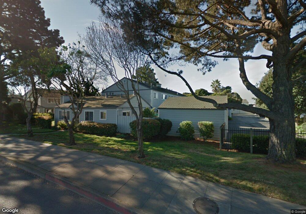
388 Nantucket Way Alameda, CA 94501
South Shore NeighborhoodEstimated Value: $897,000 - $1,007,000
3
Beds
3
Baths
1,472
Sq Ft
$642/Sq Ft
Est. Value
About This Home
This home is located at 388 Nantucket Way, Alameda, CA 94501 and is currently estimated at $944,520, approximately $641 per square foot. 388 Nantucket Way is a home located in Alameda County with nearby schools including Frank Otis Elementary School, Lincoln Middle School, and Alameda High School.
Ownership History
Date
Name
Owned For
Owner Type
Purchase Details
Closed on
Jul 3, 2023
Sold by
Palmer Jennifer Lynn
Bought by
Allen Friedman And Jennifer Palmer Living Tru and Friedman
Current Estimated Value
Purchase Details
Closed on
Jan 24, 2021
Sold by
Palmer Jennifer Lynn and Gary Wiard Palmer Living Trust
Bought by
Palmer Jennifer and Kelly Palmer Special Needs Tru
Purchase Details
Closed on
Mar 30, 2010
Sold by
Palmer Gary W and Palmer Carole A
Bought by
Palmer Gary Wiard and Gary Wiard Palmer Living Trust
Purchase Details
Closed on
Apr 20, 1999
Sold by
Palmer Gary W and Palmer Carole A
Bought by
Palmer Gary W and Palmer Carole A
Create a Home Valuation Report for This Property
The Home Valuation Report is an in-depth analysis detailing your home's value as well as a comparison with similar homes in the area
Home Values in the Area
Average Home Value in this Area
Purchase History
| Date | Buyer | Sale Price | Title Company |
|---|---|---|---|
| Allen Friedman And Jennifer Palmer Living Tru | -- | None Listed On Document | |
| Palmer Jennifer | -- | None Available | |
| Palmer Gary Wiard | -- | None Available | |
| Palmer Gary W | -- | -- |
Source: Public Records
Tax History Compared to Growth
Tax History
| Year | Tax Paid | Tax Assessment Tax Assessment Total Assessment is a certain percentage of the fair market value that is determined by local assessors to be the total taxable value of land and additions on the property. | Land | Improvement |
|---|---|---|---|---|
| 2025 | $3,134 | $95,484 | $47,074 | $55,410 |
| 2024 | $3,134 | $93,475 | $46,151 | $54,324 |
| 2023 | $3,058 | $98,504 | $45,246 | $53,258 |
| 2022 | $3,006 | $89,573 | $44,359 | $52,214 |
| 2021 | $2,957 | $87,680 | $43,489 | $51,191 |
| 2020 | $2,930 | $93,709 | $43,043 | $50,666 |
| 2019 | $2,500 | $91,872 | $42,200 | $49,672 |
| 2018 | $2,453 | $90,071 | $41,372 | $48,699 |
| 2017 | $2,386 | $88,305 | $40,561 | $47,744 |
| 2016 | $2,363 | $86,574 | $39,766 | $46,808 |
| 2015 | $2,346 | $85,273 | $39,168 | $46,105 |
| 2014 | $2,286 | $83,603 | $38,401 | $45,202 |
Source: Public Records
Map
Nearby Homes
- 3171 Bayview Dr
- 3012 Bayview Dr
- 2829 Otis Dr
- 3208 Washington St
- 2839 Washington St
- 2959 Sea View Pkwy
- 642 Centre Ct
- 641 Centre Ct
- 975 Pearl St
- 137 Parfait Ln
- 158 Oak Park Dr
- 136 Brighton Rd
- 1259 Eastshore Dr
- 1024 Regent St
- 1238 Versailles Ave
- 2431 Roosevelt Dr
- 1210 Broadway Unit A
- 1100 Park Ave
- 2620 Encinal Ave
- 147 Cumberland Way
- 384 Nantucket Way
- 390 Nantucket Way
- 382 Nantucket Way
- 378 Nantucket Way
- 3269 Cape Cod Ct
- 376 Nantucket Way
- 3267 Cape Cod Ct
- 3270 Cape Cod Ct
- 3265 Cape Cod Ct
- 3268 Cape Cod Ct
- 387 Anchor Way
- 383 Anchor Way
- 389 Anchor Way
- 381 Anchor Way
- 3263 Cape Cod Ct
- 3266 Cape Cod Ct
- 3261 Cape Cod Ct
- 3264 Cape Cod Ct
- 951 Post St
- 3211 Otis Dr