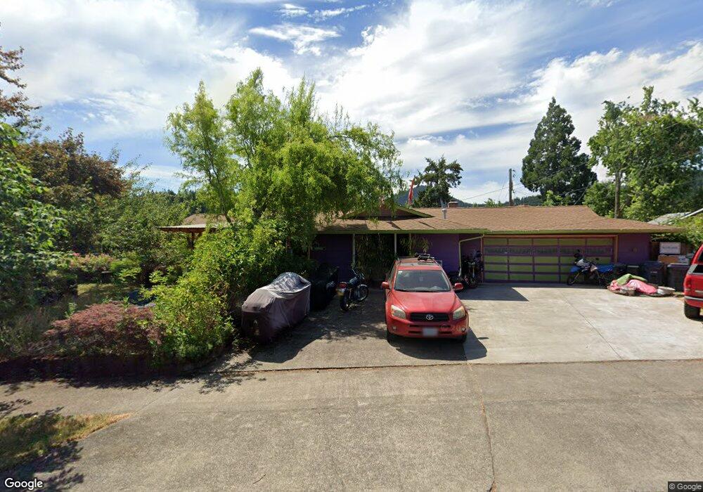
390 E 43rd Ave Eugene, OR 97405
Southeast Eugene NeighborhoodEstimated Value: $499,000 - $557,576
3
Beds
2
Baths
1,500
Sq Ft
$356/Sq Ft
Est. Value
About This Home
This home is located at 390 E 43rd Ave, Eugene, OR 97405 and is currently estimated at $534,644, approximately $356 per square foot. 390 E 43rd Ave is a home located in Lane County with nearby schools including Edgewood Community Elementary School, Spencer Butte Middle School, and South Eugene High School.
Ownership History
Date
Name
Owned For
Owner Type
Purchase Details
Closed on
Feb 1, 2008
Sold by
Rich Sara L
Bought by
Rich Sara L and Buckendahl John
Current Estimated Value
Purchase Details
Closed on
May 23, 2002
Sold by
Culp Diane Lynn
Bought by
Rich Sara L
Home Financials for this Owner
Home Financials are based on the most recent Mortgage that was taken out on this home.
Original Mortgage
$115,600
Outstanding Balance
$49,832
Interest Rate
7.37%
Estimated Equity
$484,812
Purchase Details
Closed on
Aug 7, 2000
Sold by
Culp Lloyd A and Lynn Dianne
Bought by
Culp Diane Lynn
Home Financials for this Owner
Home Financials are based on the most recent Mortgage that was taken out on this home.
Original Mortgage
$100,000
Interest Rate
8.12%
Mortgage Type
Balloon
Create a Home Valuation Report for This Property
The Home Valuation Report is an in-depth analysis detailing your home's value as well as a comparison with similar homes in the area
Home Values in the Area
Average Home Value in this Area
Purchase History
| Date | Buyer | Sale Price | Title Company |
|---|---|---|---|
| Rich Sara L | -- | Cascade Title Co | |
| Rich Sara L | $144,500 | Western Title & Escrow Compa | |
| Culp Diane Lynn | -- | American Title Group |
Source: Public Records
Mortgage History
| Date | Status | Borrower | Loan Amount |
|---|---|---|---|
| Open | Rich Sara L | $115,600 | |
| Previous Owner | Culp Diane Lynn | $100,000 | |
| Closed | Rich Sara L | $28,900 |
Source: Public Records
Tax History
| Year | Tax Paid | Tax Assessment Tax Assessment Total Assessment is a certain percentage of the fair market value that is determined by local assessors to be the total taxable value of land and additions on the property. | Land | Improvement |
|---|---|---|---|---|
| 2025 | $3,880 | $199,140 | -- | -- |
| 2024 | $3,832 | $193,340 | -- | -- |
| 2023 | $3,832 | $187,709 | $0 | $0 |
| 2022 | $3,590 | $182,242 | $0 | $0 |
| 2021 | $3,372 | $176,934 | $0 | $0 |
| 2020 | $3,383 | $171,781 | $0 | $0 |
| 2019 | $3,268 | $166,778 | $0 | $0 |
| 2018 | $3,076 | $157,205 | $0 | $0 |
| 2017 | $2,938 | $157,205 | $0 | $0 |
| 2016 | $2,865 | $152,626 | $0 | $0 |
| 2015 | $2,783 | $148,181 | $0 | $0 |
| 2014 | $2,727 | $143,865 | $0 | $0 |
Source: Public Records
Map
Nearby Homes
- 4295 Ferry St
- 395 E 46th Ave
- 4023 Donald St Unit K
- 170 E 40th Ave
- 4734 Brookwood St
- 4425 Hilyard St
- 4845 Brookwood St
- 434 E 39th Ave
- 17 Westbrook Way
- 21 Westbrook Way
- 36 Westbrook Way
- 0 E 39th Ave
- 275 E 39th Ave
- 4364 Fox Hollow Rd
- 4320 Fox Hollow Rd
- 910 E 43rd Ave
- 4427 Fox Hollow Rd Unit 7
- 4429 Fox Hollow Rd Unit 3
- 4680 W Hillside Dr
- 278 Rockridge Ct
- 4350 Donald St
- 350 E 43rd Ave
- 0 Donald St Unit 1505957
- 0 Donald St Unit 15144108
- 0 Donald St Unit 4901
- 395 E 43rd Ave
- 4390 Donald St
- 355 E 43rd Ave
- 4315 Mill St
- 4355 Mill St
- 4250 Donald St
- 4410 Donald St
- 415 E 43rd Ave
- 4295 Mill St
- 4395 Mill St
- 4255 Donald St
- 4265 Southridge Ct
- 4200 Donald St
- 4430 Donald St
- 4275 Mill St
Your Personal Tour Guide
Ask me questions while you tour the home.