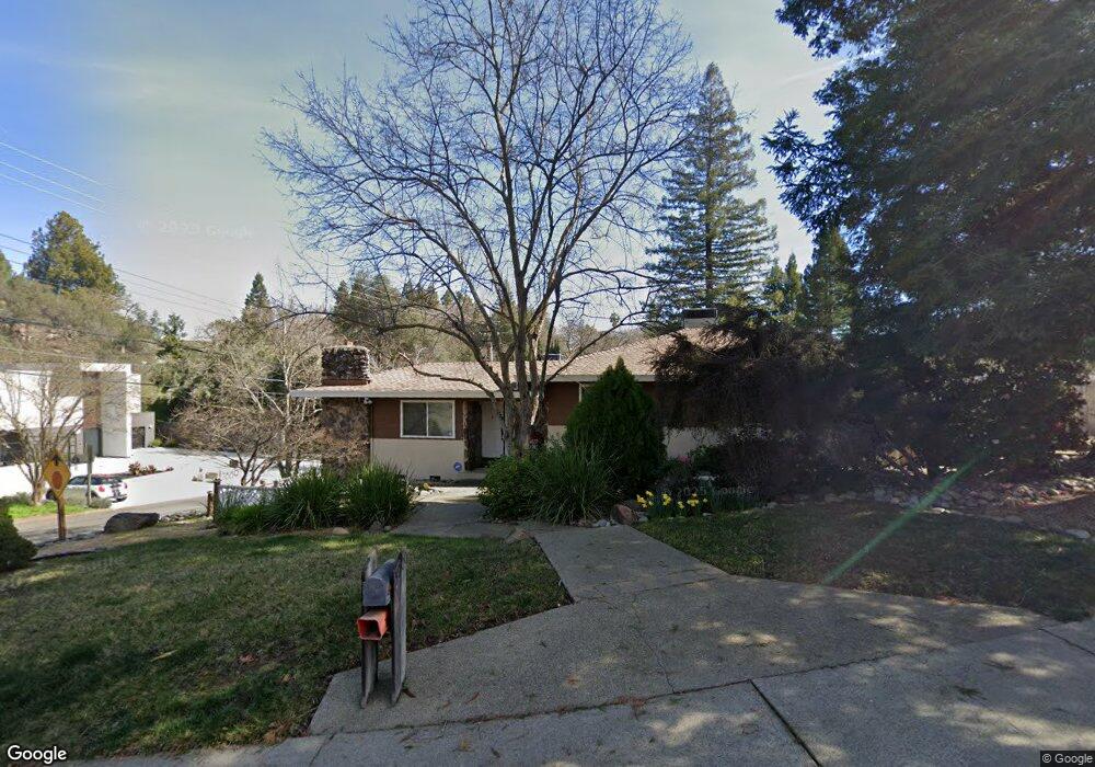
3900 Oak Hurst Cir Fair Oaks, CA 95628
Estimated Value: $813,618 - $933,000
3
Beds
3
Baths
2,836
Sq Ft
$301/Sq Ft
Est. Value
About This Home
This home is located at 3900 Oak Hurst Cir, Fair Oaks, CA 95628 and is currently estimated at $853,405, approximately $300 per square foot. 3900 Oak Hurst Cir is a home located in Sacramento County with nearby schools including Carmichael Elementary School, John Barrett Middle School, and Del Campo High School.
Ownership History
Date
Name
Owned For
Owner Type
Purchase Details
Closed on
Jun 30, 2005
Sold by
Phillips Frederick M and Phillips Susan E
Bought by
Phillips Frederick M and Phillips Susan E
Current Estimated Value
Purchase Details
Closed on
Feb 24, 2005
Sold by
Lepori Donald S
Bought by
Phillips Frederick M and Phillips Susan E
Home Financials for this Owner
Home Financials are based on the most recent Mortgage that was taken out on this home.
Original Mortgage
$130,000
Outstanding Balance
$66,430
Interest Rate
5.73%
Mortgage Type
Purchase Money Mortgage
Estimated Equity
$786,975
Purchase Details
Closed on
Jul 22, 1998
Sold by
Seymour Alan W and Seymour Elizabeth A
Bought by
Lepori Donald S
Home Financials for this Owner
Home Financials are based on the most recent Mortgage that was taken out on this home.
Original Mortgage
$150,500
Interest Rate
10.5%
Create a Home Valuation Report for This Property
The Home Valuation Report is an in-depth analysis detailing your home's value as well as a comparison with similar homes in the area
Home Values in the Area
Average Home Value in this Area
Purchase History
| Date | Buyer | Sale Price | Title Company |
|---|---|---|---|
| Phillips Frederick M | -- | -- | |
| Phillips Frederick M | $580,000 | First American Title Co | |
| Lepori Donald S | $215,000 | Financial Title Company |
Source: Public Records
Mortgage History
| Date | Status | Borrower | Loan Amount |
|---|---|---|---|
| Open | Phillips Frederick M | $130,000 | |
| Previous Owner | Lepori Donald S | $150,500 | |
| Closed | Lepori Donald S | $43,000 |
Source: Public Records
Tax History
| Year | Tax Paid | Tax Assessment Tax Assessment Total Assessment is a certain percentage of the fair market value that is determined by local assessors to be the total taxable value of land and additions on the property. | Land | Improvement |
|---|---|---|---|---|
| 2025 | $9,638 | $808,450 | $278,771 | $529,679 |
| 2024 | $9,638 | $792,599 | $273,305 | $519,294 |
| 2023 | $9,356 | $777,059 | $267,947 | $509,112 |
| 2022 | $9,320 | $761,824 | $262,694 | $499,130 |
| 2021 | $9,139 | $746,888 | $257,544 | $489,344 |
| 2020 | $8,463 | $694,686 | $239,544 | $455,142 |
| 2019 | $8,127 | $671,195 | $231,444 | $439,751 |
| 2018 | $7,719 | $639,234 | $220,423 | $418,811 |
| 2017 | $7,282 | $597,416 | $206,003 | $391,413 |
| 2016 | $6,482 | $558,334 | $192,527 | $365,807 |
| 2015 | $6,217 | $536,861 | $185,123 | $351,738 |
| 2014 | $6,085 | $526,334 | $181,493 | $344,841 |
Source: Public Records
Map
Nearby Homes
- 3937 Orangewood Dr
- 0 Ridge St Unit 225129517
- 0 Ridge St Unit 224054501
- 4215 New York Ave
- 8044 Sacramento St
- 4291 Watkins Dr
- 11334 Mother Lode Cir
- 4134 Bannister Rd
- 7731 Winding Way
- 4040 Minnesota Ave
- 4134-lot 1 Bannister Rd
- 11316 Gold Country Blvd
- 4111 Sunrise Blvd
- 7431 Heidi Ct
- 3909 Edgevale Ct
- 11224 Sauk River Ct
- 11305 Sutters Mill Cir
- 4532 Crestridge Rd
- 11360 Gold Country Blvd
- 8157 Winding Way
- 3910 Oak Hurst Cir
- 7890 Magnolia Ave
- 3901 Oak Hurst Cir
- 7885 Magnolia Ave
- 7881 Magnolia Ave
- 3905 Oak Hurst Cir
- 3914 Oak Hurst Cir
- 4009 Pennsylvania Ave
- 7889 Magnolia Ave
- 7873 Magnolia Ave
- 3979 Oak Hurst Cir
- 3980 Oak Hurst Cir
- 7856 Magnolia Ave
- 7843 Magnolia Ave
- 3918 Oak Hurst Cir
- 7841 Magnolia Ave
- 3976 Oak Hurst Cir
- 4015 Pennsylvania Ave
- 3971 Oak Hurst Cir
- 7852 Magnolia Ave
Your Personal Tour Guide
Ask me questions while you tour the home.