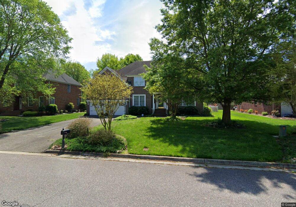
3925 Colony Pointe Dr Chesapeake, VA 23321
Western Branch NeighborhoodEstimated Value: $624,000 - $756,000
5
Beds
3
Baths
3,600
Sq Ft
$191/Sq Ft
Est. Value
About This Home
This home is located at 3925 Colony Pointe Dr, Chesapeake, VA 23321 and is currently estimated at $686,410, approximately $190 per square foot. 3925 Colony Pointe Dr is a home located in Chesapeake City with nearby schools including Edwin W. Chittum Elementary School, Jolliff Middle School, and Western Branch High School.
Ownership History
Date
Name
Owned For
Owner Type
Purchase Details
Closed on
Jul 26, 2018
Sold by
Davis William Holladay and Davis Kimberly Hollandsworth
Bought by
Kolongo Nsekenene and Kolongo Therese S
Current Estimated Value
Home Financials for this Owner
Home Financials are based on the most recent Mortgage that was taken out on this home.
Original Mortgage
$368,000
Outstanding Balance
$320,291
Interest Rate
4.6%
Mortgage Type
New Conventional
Estimated Equity
$366,119
Purchase Details
Closed on
Oct 22, 2012
Sold by
Holladay Davis William
Bought by
Davis Trust
Purchase Details
Closed on
Dec 10, 2001
Sold by
Parsons Hms Inc
Bought by
Davis William H
Home Financials for this Owner
Home Financials are based on the most recent Mortgage that was taken out on this home.
Original Mortgage
$248,000
Interest Rate
6.6%
Create a Home Valuation Report for This Property
The Home Valuation Report is an in-depth analysis detailing your home's value as well as a comparison with similar homes in the area
Home Values in the Area
Average Home Value in this Area
Purchase History
| Date | Buyer | Sale Price | Title Company |
|---|---|---|---|
| Kolongo Nsekenene | $460,000 | Attorney | |
| Davis Trust | -- | -- | |
| Davis William H | $311,000 | -- |
Source: Public Records
Mortgage History
| Date | Status | Borrower | Loan Amount |
|---|---|---|---|
| Open | Kolongo Nsekenene | $368,000 | |
| Previous Owner | Davis William H | $248,000 |
Source: Public Records
Tax History Compared to Growth
Tax History
| Year | Tax Paid | Tax Assessment Tax Assessment Total Assessment is a certain percentage of the fair market value that is determined by local assessors to be the total taxable value of land and additions on the property. | Land | Improvement |
|---|---|---|---|---|
| 2025 | $6,487 | $631,500 | $165,000 | $466,500 |
| 2024 | $6,487 | $642,300 | $160,000 | $482,300 |
| 2023 | $5,715 | $607,000 | $150,000 | $457,000 |
| 2022 | $5,933 | $587,400 | $150,000 | $437,400 |
| 2021 | $4,863 | $463,100 | $120,000 | $343,100 |
| 2020 | $4,737 | $451,100 | $120,000 | $331,100 |
| 2019 | $4,737 | $451,100 | $120,000 | $331,100 |
| 2018 | $4,601 | $438,200 | $115,000 | $323,200 |
| 2017 | $4,601 | $438,200 | $115,000 | $323,200 |
| 2016 | $4,601 | $438,200 | $115,000 | $323,200 |
| 2015 | $4,687 | $446,400 | $120,000 | $326,400 |
| 2014 | $4,551 | $433,400 | $120,000 | $313,400 |
Source: Public Records
Map
Nearby Homes
- 4195 Taughtline Loop
- 4183 Taughtline Loop
- 4308 Center Mast Crest
- 4232 Schooner Trail
- 4132 Taughtline Loop
- 7.7 Sondej Ave
- MM Magnolia 2 W
- MM Rosewood 2
- MM Rosewood
- MM Bayberry
- MM Bradford 2
- MM Dogwood 2
- MM Bayberry 2
- 1625 Hydenwood Crescent
- 4305 Mast Head Way
- 1543 Burrowin Dr
- 4019 Sea Cliff Rd
- 4020 Sea Cliff Rd
- 4235 Meander Way
- 4227 Meander Way
- 3921 Colony Pointe Dr
- 3929 Colony Pointe Dr
- 3917 Colony Pointe Dr
- 3924 Colony Pointe Dr
- 3933 Colony Pointe Dr
- 3928 Colony Pointe Dr
- 3920 Colony Pointe Dr
- 3916 Colony Pointe Dr
- 3913 Colony Pointe Dr
- 3932 Colony Pointe Dr
- 1733 Dock Landing Rd
- 3936 Colony Pointe Dr
- 3912 Colony Pointe Dr
- 3909 Colony Pointe Dr
- 3908 Colony Pointe Dr
- 3905 Whites Landing
- 3909 Whites Landing
- 3909 Whites Landing
- 1813 Dock Landing Rd
- 3905 Colony Pointe Dr