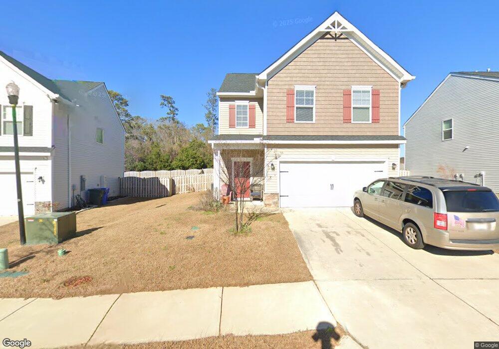
393 Council Loop Columbia, SC 29209
Southeast Columbia NeighborhoodEstimated Value: $303,000 - $340,299
3
Beds
3
Baths
2,307
Sq Ft
$136/Sq Ft
Est. Value
About This Home
This home is located at 393 Council Loop, Columbia, SC 29209 and is currently estimated at $314,325, approximately $136 per square foot. 393 Council Loop is a home located in Richland County with nearby schools including Annie Burnside Elementary School, Crayton Middle School, and A. C. Flora High School.
Ownership History
Date
Name
Owned For
Owner Type
Purchase Details
Closed on
May 24, 2022
Sold by
Richardson Farr Ceren
Bought by
Farr Ceren Richardson
Current Estimated Value
Purchase Details
Closed on
Dec 6, 2021
Sold by
Farr Ceren Richardson
Bought by
Farr Ceren Richardson and Farr Magnus Alexander
Purchase Details
Closed on
Mar 20, 2020
Sold by
Stanley Martin Companies Llc
Bought by
Farr Ceren Richarson
Home Financials for this Owner
Home Financials are based on the most recent Mortgage that was taken out on this home.
Original Mortgage
$213,417
Interest Rate
3.4%
Mortgage Type
New Conventional
Create a Home Valuation Report for This Property
The Home Valuation Report is an in-depth analysis detailing your home's value as well as a comparison with similar homes in the area
Home Values in the Area
Average Home Value in this Area
Purchase History
| Date | Buyer | Sale Price | Title Company |
|---|---|---|---|
| Farr Ceren Richardson | -- | Harvey & Vallini Llc | |
| Farr Ceren Richardson | -- | Harvey & Vallini Llc | |
| Farr Ceren Richarson | $213,417 | None Available |
Source: Public Records
Mortgage History
| Date | Status | Borrower | Loan Amount |
|---|---|---|---|
| Previous Owner | Farr Ceren Richarson | $213,417 |
Source: Public Records
Tax History Compared to Growth
Tax History
| Year | Tax Paid | Tax Assessment Tax Assessment Total Assessment is a certain percentage of the fair market value that is determined by local assessors to be the total taxable value of land and additions on the property. | Land | Improvement |
|---|---|---|---|---|
| 2023 | $0 | $0 | $0 | $0 |
| 2021 | $1,584 | $8,536 | $1,340 | $7,196 |
| 2020 | $1,584 | $8,020 | $0 | $0 |
Source: Public Records
Map
Nearby Homes
- 360 Council Loop
- 797 Phipps Ln
- 296 Council Loop
- 300 E Lake Trail
- 225 E Lake Trail
- 174 Preston Green Dr
- 31 Silverleaf Ct
- 11 Paperbark Ct
- 25 Willow Hurst Ct
- 349 Eastfair Dr
- 184 Springway Dr
- 1527 Burnside Ave
- 26 Vendue Ct
- 208 Wheat Farm Rd
- 217 Wheat Farm Rd
- The Yarmouth Plan at Garners Mill
- 113 Colonial Commons Ln
- 8025 Skylark Dr
- 101 Colonial Commons Ln
- 242 Wheat Farm Rd
- 389 Council Loop
- 397 Council Loop
- 388 Council Loop
- 401 Council Loop
- 385 Council Loop
- 392 Council Loop
- 396 Council Loop
- 405 Council Loop
- 400 Council Loop
- 381 Council Loop
- 380 Council Loop
- 404 Council Loop
- 409 Council Loop Unit 200
- 409 Council Loop
- 620 Scribes Ln
- 376 Council Loop
- 616 Scribes Ln
- 377 Council Loop
- 408 Council Loop
- 624 Scribes Ln