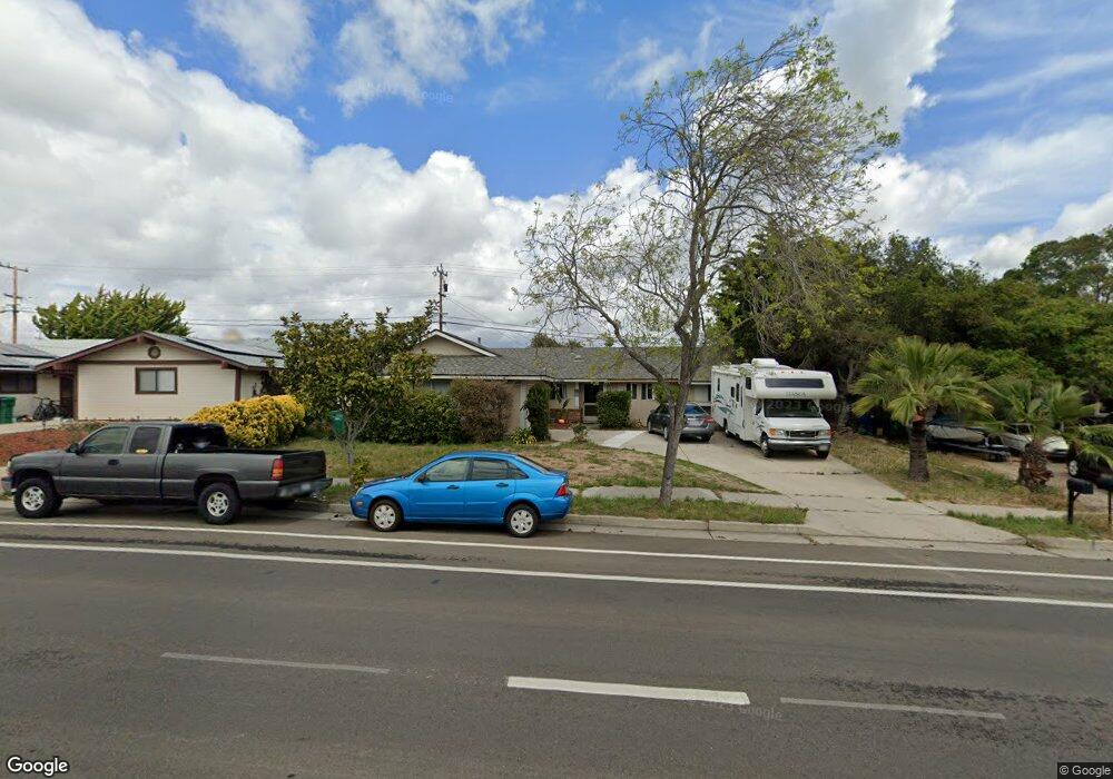
3943 Constellation Rd Unit 1 Lompoc, CA 93436
Estimated Value: $509,497 - $603,000
3
Beds
2
Baths
1,218
Sq Ft
$458/Sq Ft
Est. Value
About This Home
This home is located at 3943 Constellation Rd Unit 1, Lompoc, CA 93436 and is currently estimated at $557,874, approximately $458 per square foot. 3943 Constellation Rd Unit 1 is a home located in Santa Barbara County with nearby schools including Buena Vista Elementary School, Cabrillo High School, and Olive Grove Charter - Lompoc.
Ownership History
Date
Name
Owned For
Owner Type
Purchase Details
Closed on
Mar 21, 2002
Sold by
Roughen Douglas S and Roughen Douglas
Bought by
Roughen Douglas S
Current Estimated Value
Purchase Details
Closed on
Aug 18, 2000
Sold by
M Tr 6-3-92 Roughen Alice M Trustee, Roughen
Bought by
Roughen Douglas
Home Financials for this Owner
Home Financials are based on the most recent Mortgage that was taken out on this home.
Original Mortgage
$110,400
Interest Rate
7.66%
Create a Home Valuation Report for This Property
The Home Valuation Report is an in-depth analysis detailing your home's value as well as a comparison with similar homes in the area
Home Values in the Area
Average Home Value in this Area
Purchase History
| Date | Buyer | Sale Price | Title Company |
|---|---|---|---|
| Roughen Douglas S | -- | -- | |
| Roughen Douglas | $138,000 | Fidelity National Title Co |
Source: Public Records
Mortgage History
| Date | Status | Borrower | Loan Amount |
|---|---|---|---|
| Previous Owner | Roughen Douglas | $110,400 |
Source: Public Records
Tax History
| Year | Tax Paid | Tax Assessment Tax Assessment Total Assessment is a certain percentage of the fair market value that is determined by local assessors to be the total taxable value of land and additions on the property. | Land | Improvement |
|---|---|---|---|---|
| 2025 | $1,069 | $64,908 | $17,062 | $47,846 |
| 2023 | $1,069 | $62,389 | $16,400 | $45,989 |
| 2022 | $1,057 | $61,167 | $16,079 | $45,088 |
| 2021 | $1,065 | $59,968 | $15,764 | $44,204 |
| 2020 | $1,057 | $59,354 | $15,603 | $43,751 |
| 2019 | $1,046 | $58,192 | $15,298 | $42,894 |
| 2018 | $1,035 | $57,052 | $14,999 | $42,053 |
| 2017 | $933 | $55,934 | $14,705 | $41,229 |
| 2016 | $650 | $54,838 | $14,417 | $40,421 |
| 2014 | $636 | $52,958 | $13,923 | $39,035 |
Source: Public Records
Map
Nearby Homes
- 232 Vega Ave
- 3939 Mesa Circle Dr
- 3916 Mesa Circle Dr Unit A
- 106 Galaxy Way Unit 3
- 250 Saint Andrews Way
- 113 Gemini Ave
- 4490 Sirius Ave
- 3834 Jupiter Ave
- 372 Oak Hill Dr
- 649 Burning Tree Way
- 0 Oak Hill Dr Unit 24-783
- 3725 Jupiter Ave
- 240 Oak Hill Dr
- 758 Voyager Rd
- 972 Pellham Dr
- 3660 Rucker Rd
- 1445 Calle Marana
- 832 Onstott Rd
- 1141 Pellham Dr
- 778 Tamarisk Dr
- 3935 Constellation Rd
- 3951 Constellation Rd
- 3954 Rigel Ave
- 3959 Constellation Rd
- 3950 Rigel Ave Unit Home in the Village
- 3962 Rigel Ave
- 3946 Constellation Rd
- 3936 Constellation Rd Unit 1
- 3915 Constellation Rd
- 3956 Constellation Rd
- 3966 Rigel Ave
- 3967 Constellation Rd
- 3946 Rigel Ave
- 0 Constellation Rd
- 3951 Rigel Ave
- 3957 Rigel Ave
- 3974 Rigel Ave
Your Personal Tour Guide
Ask me questions while you tour the home.