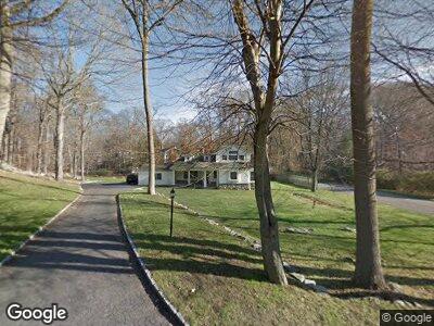
4 Acorn Ln Westport, CT 06880
Staples NeighborhoodEstimated Value: $1,604,000 - $1,903,000
4
Beds
4
Baths
3,133
Sq Ft
$558/Sq Ft
Est. Value
About This Home
This home is located at 4 Acorn Ln, Westport, CT 06880 and is currently estimated at $1,749,011, approximately $558 per square foot. 4 Acorn Ln is a home located in Fairfield County with nearby schools including Long Lots School, Bedford Middle School, and Staples High School.
Ownership History
Date
Name
Owned For
Owner Type
Purchase Details
Closed on
Feb 28, 2001
Sold by
Beispel Rick and Beispel Allison
Bought by
George Mark and George Elizabeth
Current Estimated Value
Home Financials for this Owner
Home Financials are based on the most recent Mortgage that was taken out on this home.
Original Mortgage
$458,000
Interest Rate
7%
Purchase Details
Closed on
May 2, 1995
Sold by
Poster Dennis and Poster Joan
Bought by
Beispel Rick and Beispel Allison
Create a Home Valuation Report for This Property
The Home Valuation Report is an in-depth analysis detailing your home's value as well as a comparison with similar homes in the area
Home Values in the Area
Average Home Value in this Area
Purchase History
| Date | Buyer | Sale Price | Title Company |
|---|---|---|---|
| George Mark | $572,500 | -- | |
| George Mark | $572,500 | -- | |
| Beispel Rick | $412,000 | -- | |
| Beispel Rick | $412,000 | -- |
Source: Public Records
Mortgage History
| Date | Status | Borrower | Loan Amount |
|---|---|---|---|
| Open | George Elizabeth J | $775,000 | |
| Closed | Poster Dennis | $906,000 | |
| Closed | George Mark A | $906,194 | |
| Closed | George Mark A | $900,000 | |
| Closed | Poster Dennis | $458,000 |
Source: Public Records
Tax History Compared to Growth
Tax History
| Year | Tax Paid | Tax Assessment Tax Assessment Total Assessment is a certain percentage of the fair market value that is determined by local assessors to be the total taxable value of land and additions on the property. | Land | Improvement |
|---|---|---|---|---|
| 2024 | $14,140 | $759,400 | $395,000 | $364,400 |
| 2023 | $13,935 | $759,400 | $395,000 | $364,400 |
| 2022 | $13,722 | $759,400 | $395,000 | $364,400 |
| 2021 | $13,722 | $759,400 | $395,000 | $364,400 |
| 2020 | $13,774 | $846,300 | $417,000 | $429,300 |
| 2019 | $14,269 | $846,300 | $417,000 | $429,300 |
| 2018 | $14,269 | $846,300 | $417,000 | $429,300 |
| 2017 | $14,269 | $846,300 | $417,000 | $429,300 |
| 2016 | $14,269 | $846,300 | $417,000 | $429,300 |
| 2015 | $13,200 | $729,700 | $351,700 | $378,000 |
| 2014 | $13,091 | $729,700 | $351,700 | $378,000 |
Source: Public Records
Map
Nearby Homes
- 19 Joann Cir
- 26 Hitchcock Rd
- 14 Reimer Rd
- 35 Pumpkin Hill Rd
- 33 Pumpkin Hill Rd
- 19 Twin Circle Dr
- 8 Twin Circle Dr
- 10 Dover Rd
- 157 North Ave
- 7 Brookside Dr
- 5 Brookside Dr
- 113 Roseville Rd
- 96 Compo Rd N
- 11 Gault Park Dr
- 4 Plumtree Ln
- 27 Blue Ribbon Dr
- 5 Elwil Dr
- 41 Burr Farms Rd
- 158 Compo Rd N
- 9 Daybreak Commons Unit 9