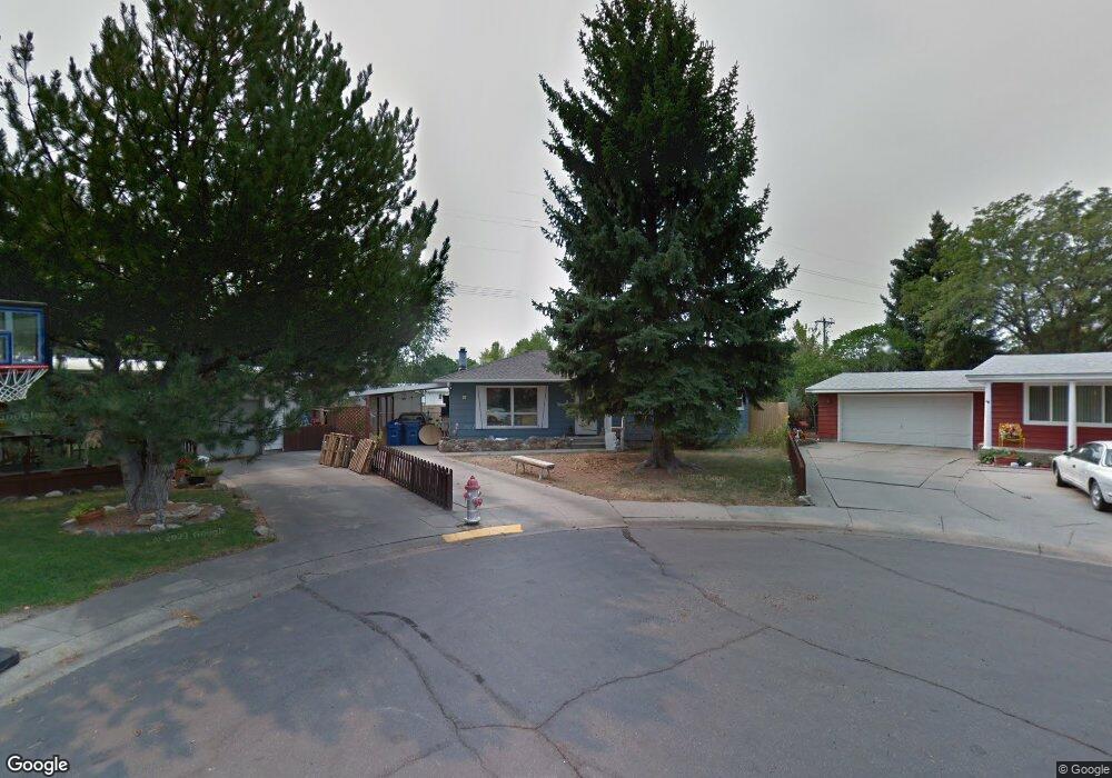
4 Campbell Dr Billings, MT 59102
West End NeighborhoodEstimated Value: $292,000 - $338,000
3
Beds
2
Baths
1,158
Sq Ft
$270/Sq Ft
Est. Value
About This Home
This home is located at 4 Campbell Dr, Billings, MT 59102 and is currently estimated at $312,384, approximately $269 per square foot. 4 Campbell Dr is a home located in Yellowstone County with nearby schools including Miles Avenue School, Will James Junior High School, and Billings West High School.
Ownership History
Date
Name
Owned For
Owner Type
Purchase Details
Closed on
May 25, 2022
Sold by
Daniel Hawkey
Bought by
Lighthouse Homes Llc
Current Estimated Value
Home Financials for this Owner
Home Financials are based on the most recent Mortgage that was taken out on this home.
Original Mortgage
$247,497
Outstanding Balance
$230,039
Interest Rate
5.25%
Mortgage Type
New Conventional
Estimated Equity
$82,345
Purchase Details
Closed on
Jan 26, 2005
Sold by
Ady Suzanne Kydland
Bought by
Ady Suzanne Kydland
Create a Home Valuation Report for This Property
The Home Valuation Report is an in-depth analysis detailing your home's value as well as a comparison with similar homes in the area
Home Values in the Area
Average Home Value in this Area
Purchase History
| Date | Buyer | Sale Price | Title Company |
|---|---|---|---|
| Lighthouse Homes Llc | -- | None Listed On Document | |
| Ady Suzanne Kydland | -- | None Available |
Source: Public Records
Mortgage History
| Date | Status | Borrower | Loan Amount |
|---|---|---|---|
| Open | Lighthouse Homes Llc | $247,497 |
Source: Public Records
Tax History
| Year | Tax Paid | Tax Assessment Tax Assessment Total Assessment is a certain percentage of the fair market value that is determined by local assessors to be the total taxable value of land and additions on the property. | Land | Improvement |
|---|---|---|---|---|
| 2025 | $2,650 | $280,700 | $54,196 | $226,504 |
| 2024 | $2,650 | $270,600 | $49,422 | $221,178 |
| 2023 | $2,659 | $270,600 | $49,422 | $221,178 |
| 2022 | $2,013 | $175,900 | $0 | $0 |
| 2021 | $1,918 | $175,900 | $0 | $0 |
| 2020 | $1,902 | $166,000 | $0 | $0 |
| 2019 | $1,817 | $166,000 | $0 | $0 |
| 2018 | $2,043 | $168,400 | $0 | $0 |
| 2017 | $1,812 | $168,400 | $0 | $0 |
| 2016 | $1,706 | $160,400 | $0 | $0 |
| 2015 | $1,668 | $160,400 | $0 | $0 |
| 2014 | $1,507 | $76,532 | $0 | $0 |
Source: Public Records
Map
Nearby Homes
- 16 19th St W
- 2201 Hewitt Dr
- 2016 Monad Rd
- 2 Mcbride St
- 1736 Broadwater Ave
- 2422 Miles Ave
- 1925 Yellowstone Ave
- 0 Wyatt Cir Unit 356590
- 2013 Clark Ave
- 1415 & 1417 Lynn Ave
- 2300 Clark Ave
- 2124 Lewis Ave
- 1627 Yellowstone Ave
- 1119 21st St W
- 1705 Clark Ave
- 1537 Wyoming Ave Unit D
- 1704 Lewis Ave
- 1540 Yellowstone Ave Unit D
- 2 Rodeo Place
- 1147 18th St W Unit 3
- 10 Campbell Dr
- 3 Campbell Dr
- 16 Campbell Dr
- 2016 Central Ave
- 9 Campbell Dr
- 2008 Central Ave
- 4 Birchwood Dr
- 2075 Central Ave
- 22 Campbell Dr
- 21 Campbell Dr
- 4 N Crestwood Dr
- 10 Birchwood Dr
- 10 N Crestwood Dr
- 28 Campbell Dr
- 2017 Concord Dr
- 16 N Crestwood Dr
- 2023 Concord Dr
- 2009 Concord Dr
- 2070 Glasser Place
- 27 Campbell Dr