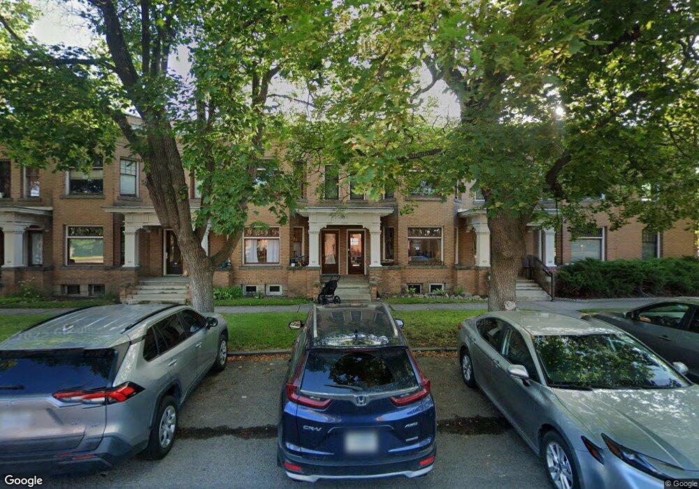
400 Roosevelt St Missoula, MT 59801
Rose Park NeighborhoodEstimated Value: $463,000 - $575,000
1
Bed
1
Bath
959
Sq Ft
$527/Sq Ft
Est. Value
About This Home
This home is located at 400 Roosevelt St, Missoula, MT 59801 and is currently estimated at $505,478, approximately $527 per square foot. 400 Roosevelt St is a home located in Missoula County with nearby schools including Paxson School, Washington Middle School, and Hellgate High School.
Ownership History
Date
Name
Owned For
Owner Type
Purchase Details
Closed on
Oct 2, 2024
Sold by
Starrett Heidi Ann
Bought by
Heidi Ann Starrett Revocable Living Trust and Starrett
Current Estimated Value
Purchase Details
Closed on
Mar 29, 2021
Sold by
University Flats Llc
Bought by
Starrett Heidi
Home Financials for this Owner
Home Financials are based on the most recent Mortgage that was taken out on this home.
Original Mortgage
$275,500
Interest Rate
2.8%
Mortgage Type
New Conventional
Purchase Details
Closed on
Nov 20, 2012
Sold by
Hefty Eric and Hefty Chery
Bought by
Mountain West Bank Na
Create a Home Valuation Report for This Property
The Home Valuation Report is an in-depth analysis detailing your home's value as well as a comparison with similar homes in the area
Home Values in the Area
Average Home Value in this Area
Purchase History
| Date | Buyer | Sale Price | Title Company |
|---|---|---|---|
| Heidi Ann Starrett Revocable Living Trust | -- | None Listed On Document | |
| Starrett Heidi | -- | First American Title Ins Co | |
| Mountain West Bank Na | -- | Stewart Title Company |
Source: Public Records
Mortgage History
| Date | Status | Borrower | Loan Amount |
|---|---|---|---|
| Previous Owner | Starrett Heidi | $275,500 |
Source: Public Records
Tax History
| Year | Tax Paid | Tax Assessment Tax Assessment Total Assessment is a certain percentage of the fair market value that is determined by local assessors to be the total taxable value of land and additions on the property. | Land | Improvement |
|---|---|---|---|---|
| 2025 | $4,167 | $545,508 | $336,068 | $209,440 |
| 2024 | $3,607 | $296,400 | $19,794 | $276,606 |
| 2023 | $3,891 | $296,400 | $19,794 | $276,606 |
| 2022 | $3,654 | $240,200 | $0 | $0 |
| 2021 | $2,918 | $240,200 | $0 | $0 |
| 2020 | $1,819 | $109,100 | $0 | $0 |
| 2019 | $1,821 | $109,100 | $0 | $0 |
| 2018 | $1,851 | $107,900 | $0 | $0 |
| 2017 | $1,293 | $107,900 | $0 | $0 |
| 2016 | $1,768 | $107,000 | $0 | $0 |
| 2015 | $1,675 | $107,000 | $0 | $0 |
| 2014 | $1,699 | $61,115 | $0 | $0 |
Source: Public Records
Map
Nearby Homes
- 1005 Gerald Ave
- 225 Eddy Ave
- 300 Connell Ave
- 120 S 4th St W Unit 8
- 120 S 4th St W Unit 4 and 6
- 1325 Gerald Ave
- 415 S 6th St E
- 131 W Florence St
- 542 Eddy Ave
- 512 S 2nd St W
- 131 S Higgins Ave Unit 5-3
- 812 Ash St
- 701 S 2nd St W
- 722, 724, 728, 730, Rollins St
- 470 Strand Ave
- 8862 Santa Anita Rd
- 8876 Santa Anita Rd
- 443 Kensington Ave
- 105 E Pine St
- 921 E Beckwith Ave
- 400 Roosevelt St
- 400 Roosevelt St
- 400 Roosevelt St
- 400 Roosevelt St
- 400 Roosevelt St
- 400 Roosevelt St
- 400 Roosevelt St
- 400 Roosevelt St
- 400 Roosevelt St
- 400 Roosevelt St
- 400 Roosevelt St Unit 404
- 400 Roosevelt St Unit 402
- 400 Roosevelt St Unit 412
- 400 Roosevelt St Unit 408
- 400 Roosevelt St Unit 416
- 400 Roosevelt St Unit 414
- 400 Roosevelt St Unit 406
- 400 Roosevelt St Unit 418
- 400 Roosevelt St Unit 400
- 412 Roosevelt St
Your Personal Tour Guide
Ask me questions while you tour the home.