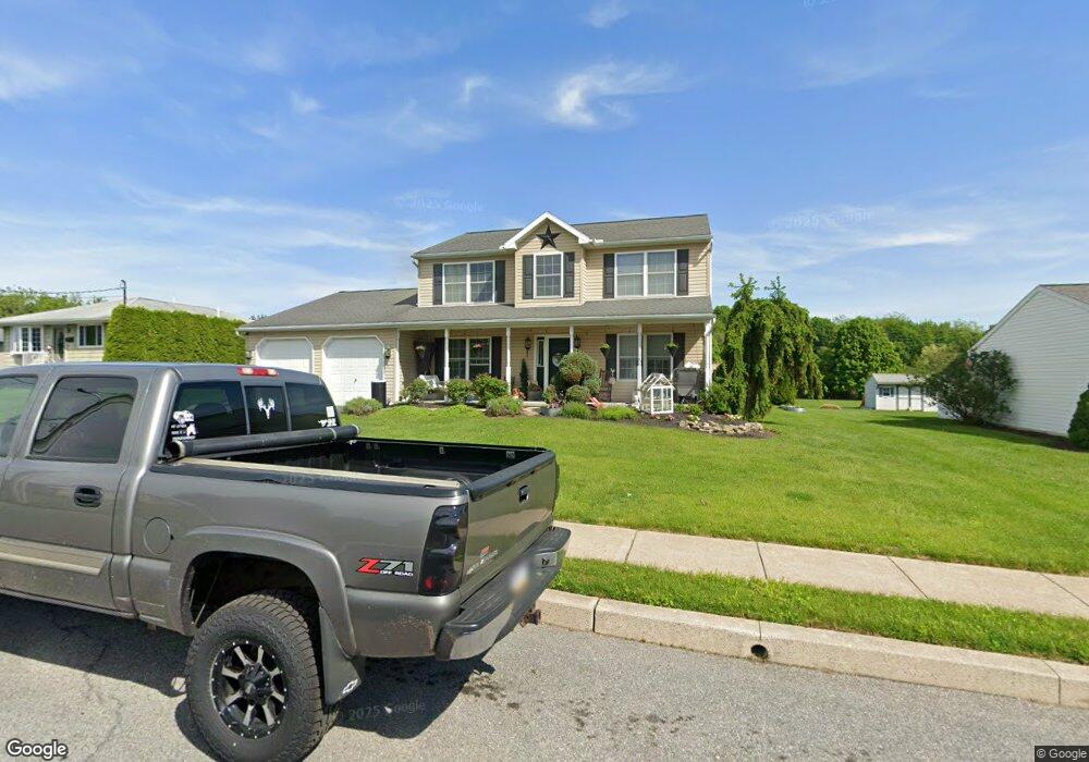
401 E Penn St Topton, PA 19562
Estimated Value: $413,912 - $464,000
3
Beds
3
Baths
2,320
Sq Ft
$188/Sq Ft
Est. Value
About This Home
This home is located at 401 E Penn St, Topton, PA 19562 and is currently estimated at $436,978, approximately $188 per square foot. 401 E Penn St is a home located in Berks County with nearby schools including Brandywine Heights Elementary School, Brandywine Intermediate School, and Brandywine Heights High School.
Ownership History
Date
Name
Owned For
Owner Type
Purchase Details
Closed on
Feb 11, 2005
Sold by
Stoudt Dale M and Stoudt Eric L
Bought by
Frack Daniel P and Frack Crystal A
Current Estimated Value
Home Financials for this Owner
Home Financials are based on the most recent Mortgage that was taken out on this home.
Original Mortgage
$160,000
Interest Rate
5.95%
Mortgage Type
Fannie Mae Freddie Mac
Create a Home Valuation Report for This Property
The Home Valuation Report is an in-depth analysis detailing your home's value as well as a comparison with similar homes in the area
Home Values in the Area
Average Home Value in this Area
Purchase History
| Date | Buyer | Sale Price | Title Company |
|---|---|---|---|
| Frack Daniel P | $203,000 | -- |
Source: Public Records
Mortgage History
| Date | Status | Borrower | Loan Amount |
|---|---|---|---|
| Previous Owner | Frack Daniel P | $160,000 |
Source: Public Records
Tax History
| Year | Tax Paid | Tax Assessment Tax Assessment Total Assessment is a certain percentage of the fair market value that is determined by local assessors to be the total taxable value of land and additions on the property. | Land | Improvement |
|---|---|---|---|---|
| 2025 | $2,989 | $170,200 | $43,200 | $127,000 |
| 2024 | $9,000 | $170,200 | $43,200 | $127,000 |
| 2023 | $7,177 | $170,200 | $43,200 | $127,000 |
| 2022 | $8,447 | $170,200 | $43,200 | $127,000 |
| 2021 | $8,389 | $170,200 | $43,200 | $127,000 |
| 2020 | $8,331 | $170,200 | $43,200 | $127,000 |
| 2019 | $8,076 | $170,200 | $43,200 | $127,000 |
| 2018 | $7,998 | $170,200 | $43,200 | $127,000 |
| 2017 | $7,782 | $170,200 | $43,200 | $127,000 |
| 2016 | $2,205 | $170,200 | $43,200 | $127,000 |
| 2015 | $2,205 | $170,200 | $43,200 | $127,000 |
| 2014 | $2,205 | $170,200 | $43,200 | $127,000 |
Source: Public Records
Map
Nearby Homes
- 238 Penn St
- 3 Woodland Ln
- 11 Woodland Ln
- 32 N Main St
- 0 S Park Ave
- 0 Chestnut St
- 344 Chestnut St
- 19 Roth Ave
- 0 Grim Rd
- 119 Smoketown Rd
- 10104 Fernwood Ln
- 147 Smoketown Rd
- 385 Albright Rd
- 929 Orange Tip Way
- 97 S Kemp Rd
- 0 Siegfriedale Rd
- 28 High View Ln
- 1649 Thorndale Rd
- 1649 Thorndale Rd Unit LOT 70
- 9131 N Primrose Cir
- 339 Penn St
- 405 E Penn St
- 325 Penn St
- 409 E Penn St
- 400 E Penn St
- 338 Penn St
- 404 E Penn St
- 319 Penn St
- 328 Penn St
- 413 E Penn St
- 408 E Penn St
- 405 E Smith St
- 318 Penn St
- 407 E Smith St
- 325 E Smith St
- 417 E Penn St
- 412 E Penn St
- 508 E Smith St Unit LOT 3
- 504 E Smith St Unit LOT 2
- 500 E Smith St Unit LOT 1
Your Personal Tour Guide
Ask me questions while you tour the home.