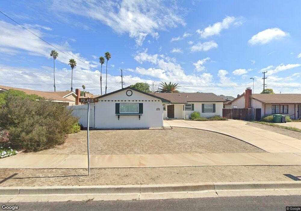
4067 Polaris Ave Unit 1 Lompoc, CA 93436
Estimated Value: $453,000 - $608,000
4
Beds
2
Baths
1,296
Sq Ft
$425/Sq Ft
Est. Value
About This Home
This home is located at 4067 Polaris Ave Unit 1, Lompoc, CA 93436 and is currently estimated at $550,626, approximately $424 per square foot. 4067 Polaris Ave Unit 1 is a home located in Santa Barbara County with nearby schools including Buena Vista Elementary School, Cabrillo High School, and Olive Grove Charter - Lompoc.
Ownership History
Date
Name
Owned For
Owner Type
Purchase Details
Closed on
Jun 8, 2020
Sold by
Wilkins Thomas M and The Wilkins Family Trust
Bought by
Bagdasarian Fred and Bagdasarian Bertha
Current Estimated Value
Purchase Details
Closed on
Apr 24, 2014
Sold by
Wilkins Thomas M and Wilkins Hedwig
Bought by
Wilkins Family Trust and Wilkins Hedwig
Purchase Details
Closed on
Jan 29, 2003
Sold by
Wilkins Thomas M and Wilkins Hedwig
Bought by
Wilkins Thomas M and Wilkins Hedwig
Home Financials for this Owner
Home Financials are based on the most recent Mortgage that was taken out on this home.
Original Mortgage
$100,000
Interest Rate
5.97%
Purchase Details
Closed on
Jun 23, 1995
Sold by
Pellant Michael Jon and Pellant Debra Kay
Bought by
Wilkins Thomas M and Wilkins Hedwig
Home Financials for this Owner
Home Financials are based on the most recent Mortgage that was taken out on this home.
Original Mortgage
$133,000
Interest Rate
7.63%
Create a Home Valuation Report for This Property
The Home Valuation Report is an in-depth analysis detailing your home's value as well as a comparison with similar homes in the area
Home Values in the Area
Average Home Value in this Area
Purchase History
| Date | Buyer | Sale Price | Title Company |
|---|---|---|---|
| Bagdasarian Fred | $350,000 | Fidelity National Title Co | |
| Wilkins Family Trust | -- | None Available | |
| Wilkins Thomas M | -- | First American Title | |
| Wilkins Thomas M | $140,000 | Chicago Title Co |
Source: Public Records
Mortgage History
| Date | Status | Borrower | Loan Amount |
|---|---|---|---|
| Previous Owner | Wilkins Thomas M | $100,000 | |
| Previous Owner | Wilkins Thomas M | $133,000 |
Source: Public Records
Tax History
| Year | Tax Paid | Tax Assessment Tax Assessment Total Assessment is a certain percentage of the fair market value that is determined by local assessors to be the total taxable value of land and additions on the property. | Land | Improvement |
|---|---|---|---|---|
| 2025 | $4,495 | $382,771 | $125,767 | $257,004 |
| 2023 | $4,495 | $367,909 | $120,884 | $247,025 |
| 2022 | $4,425 | $360,696 | $118,514 | $242,182 |
| 2021 | $4,473 | $353,625 | $116,191 | $237,434 |
| 2020 | $2,754 | $212,639 | $83,532 | $129,107 |
| 2019 | $2,714 | $208,471 | $81,895 | $126,576 |
| 2018 | $2,677 | $204,385 | $80,290 | $124,095 |
| 2017 | $2,543 | $200,378 | $78,716 | $121,662 |
| 2016 | $2,229 | $196,450 | $77,173 | $119,277 |
| 2015 | $2,212 | $193,500 | $76,014 | $117,486 |
| 2014 | $2,179 | $189,710 | $74,525 | $115,185 |
Source: Public Records
Map
Nearby Homes
- 232 Vega Ave
- 3939 Mesa Circle Dr
- 3922 Mesa Circle Dr
- 3916 Mesa Circle Dr Unit A
- 113 Gemini Ave
- 4447 Falcon Dr
- 6 Stanford Cir
- 250 Saint Andrews Way
- 18 Galaxy Way
- 4166 Oakwood Ct
- 4173 Oakwood Ct
- 73 Stanford Cir
- 372 Oak Hill Dr
- 384 Falcon Crest Dr
- 649 Burning Tree Way
- 0 Oak Hill Dr Unit 24-783
- 240 Oak Hill Dr
- 372 Falcon Crest Dr
- 3843 Cassini Cir Unit 3
- 4473 Greenbrier Rd
- 4075 Polaris Ave
- 4059 Polaris Ave
- 4070 Constellation Rd
- 4076 Constellation Rd
- 4060 Constellation Rd
- 4083 Polaris Ave
- 4051 Polaris Ave Unit 1
- 4062 Polaris Ave Unit 1
- 235 Regulus Ave
- 4052 Constellation Rd
- 4041 Polaris Ave Unit 1
- 4052 Polaris Ave
- 4091 Polaris Ave
- 4092 Constellation Rd
- 4046 Constellation Rd
- 241 Regulus Ave
- 228 Aldebaran Ave
- 4042 Polaris Ave
Your Personal Tour Guide
Ask me questions while you tour the home.