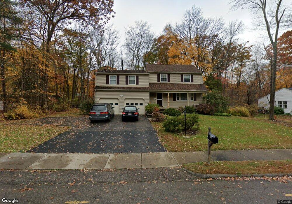
408 Paula Ln Franklin, MA 02038
Estimated Value: $730,418 - $863,000
5
Beds
4
Baths
2,341
Sq Ft
$342/Sq Ft
Est. Value
About This Home
This home is located at 408 Paula Ln, Franklin, MA 02038 and is currently estimated at $800,855, approximately $342 per square foot. 408 Paula Ln is a home located in Norfolk County with nearby schools including John F. Kennedy Memorial School, Horace Mann Middle School, and Franklin High School.
Ownership History
Date
Name
Owned For
Owner Type
Purchase Details
Closed on
Jan 21, 1992
Sold by
Doherty John P and Dohety Genevaa P
Bought by
Greenhalgh James P and Greenhalgh Virginia
Current Estimated Value
Create a Home Valuation Report for This Property
The Home Valuation Report is an in-depth analysis detailing your home's value as well as a comparison with similar homes in the area
Purchase History
| Date | Buyer | Sale Price | Title Company |
|---|---|---|---|
| Greenhalgh James P | $177,500 | -- |
Source: Public Records
Mortgage History
| Date | Status | Borrower | Loan Amount |
|---|---|---|---|
| Open | Greenhalgh James P | $175,000 | |
| Closed | Greenhalgh James P | $233,857 | |
| Closed | Greenhalgh James P | $25,000 | |
| Closed | Greenhalgh James P | $149,000 |
Source: Public Records
Tax History
| Year | Tax Paid | Tax Assessment Tax Assessment Total Assessment is a certain percentage of the fair market value that is determined by local assessors to be the total taxable value of land and additions on the property. | Land | Improvement |
|---|---|---|---|---|
| 2025 | $7,044 | $606,200 | $327,000 | $279,200 |
| 2024 | $6,849 | $580,900 | $327,000 | $253,900 |
| 2023 | $6,767 | $537,900 | $284,000 | $253,900 |
| 2022 | $6,203 | $441,500 | $215,100 | $226,400 |
| 2021 | $6,075 | $414,700 | $239,100 | $175,600 |
| 2020 | $5,676 | $391,200 | $223,300 | $167,900 |
| 2019 | $5,624 | $383,600 | $215,400 | $168,200 |
| 2018 | $5,336 | $364,200 | $211,400 | $152,800 |
| 2017 | $5,109 | $350,400 | $197,600 | $152,800 |
| 2016 | $5,610 | $386,900 | $200,300 | $186,600 |
| 2015 | $5,666 | $381,800 | $195,200 | $186,600 |
| 2014 | $5,170 | $357,800 | $171,200 | $186,600 |
Source: Public Records
Map
Nearby Homes
- 276 Pond St
- 201 Crossfield Rd
- 41 Kimberlee Ave
- 8 Riverstone Way
- 25 Brookview Rd
- 1801 Franklin Crossing Rd Unit 1801
- 27 Dover Cir
- 214 Conlyn Ave
- 602 Franklin Crossing Rd Unit 602
- 834-836 W Central St
- 60 Pine St
- 17 Pine St
- 20 Hawthorne Village Unit A
- 70 Oak St
- 18 Mary Anne Dr
- 8 Woodhaven Dr
- 5 Stone Ridge Rd
- 204 Lincoln St
- 8 Apache Rd
- 29 Elm St
- 400 Paula Ln
- 416 Paula Ln
- 409 Coronation Dr
- 401 Coronation Dr
- 417 Coronation Dr
- 409 Paula Ln
- 417 Paula Ln
- 401 Paula Ln
- 392 Paula Ln
- 422 Paula Ln
- 393 Coronation Dr
- 447 Oakland Pkwy
- 425 Paula Ln
- 393 Paula Ln
- 425 Coronation Dr
- 408 Brenda Ln
- 410 Coronation Dr
- 440 Beverly Rd
- 402 Coronation Dr
- 416 Brenda Ln
Your Personal Tour Guide
Ask me questions while you tour the home.