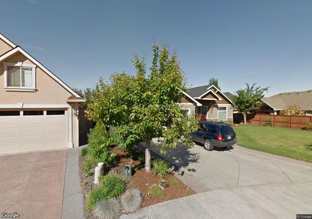
41 Aspen Ct Eagle Point, OR 97524
Estimated Value: $590,639 - $685,000
3
Beds
3
Baths
2,750
Sq Ft
$232/Sq Ft
Est. Value
About This Home
This home is located at 41 Aspen Ct, Eagle Point, OR 97524 and is currently estimated at $638,410, approximately $232 per square foot. 41 Aspen Ct is a home located in Jackson County with nearby schools including Eagle Point Middle School, White Mountain Middle School, and Eagle Point High School.
Ownership History
Date
Name
Owned For
Owner Type
Purchase Details
Closed on
Nov 18, 2011
Sold by
Gregoric Michael
Bought by
Schlosser Michael G
Current Estimated Value
Home Financials for this Owner
Home Financials are based on the most recent Mortgage that was taken out on this home.
Original Mortgage
$231,966
Outstanding Balance
$154,337
Interest Rate
3.75%
Mortgage Type
FHA
Estimated Equity
$484,073
Purchase Details
Closed on
Aug 12, 2004
Sold by
Pacific Northwest Building & Design Llc
Bought by
Gregoric Michael
Home Financials for this Owner
Home Financials are based on the most recent Mortgage that was taken out on this home.
Original Mortgage
$303,200
Interest Rate
5.9%
Mortgage Type
Purchase Money Mortgage
Create a Home Valuation Report for This Property
The Home Valuation Report is an in-depth analysis detailing your home's value as well as a comparison with similar homes in the area
Home Values in the Area
Average Home Value in this Area
Purchase History
| Date | Buyer | Sale Price | Title Company |
|---|---|---|---|
| Schlosser Michael G | $238,000 | First American Title | |
| Gregoric Michael | $379,000 | Amerititle |
Source: Public Records
Mortgage History
| Date | Status | Borrower | Loan Amount |
|---|---|---|---|
| Open | Schlosser Michael G | $231,966 | |
| Previous Owner | Gregoric Michael | $303,200 | |
| Closed | Gregoric Michael | $75,800 |
Source: Public Records
Tax History
| Year | Tax Paid | Tax Assessment Tax Assessment Total Assessment is a certain percentage of the fair market value that is determined by local assessors to be the total taxable value of land and additions on the property. | Land | Improvement |
|---|---|---|---|---|
| 2026 | $5,512 | $388,270 | $128,000 | $260,270 |
| 2025 | $5,382 | $393,330 | $72,840 | $320,490 |
| 2024 | $5,382 | $381,880 | $70,720 | $311,160 |
| 2023 | $5,200 | $370,760 | $68,660 | $302,100 |
| 2022 | $5,058 | $370,760 | $68,660 | $302,100 |
| 2021 | $4,908 | $359,970 | $66,660 | $293,310 |
| 2020 | $5,214 | $349,490 | $64,720 | $284,770 |
| 2019 | $5,134 | $329,440 | $61,000 | $268,440 |
| 2018 | $5,037 | $319,850 | $59,220 | $260,630 |
| 2017 | $4,913 | $319,850 | $59,220 | $260,630 |
| 2016 | $4,817 | $301,500 | $55,820 | $245,680 |
| 2015 | $4,660 | $301,500 | $55,820 | $245,680 |
| 2014 | $4,526 | $284,200 | $52,630 | $231,570 |
Source: Public Records
Map
Nearby Homes
- 869 St Andrews Way
- 964 Pumpkin Ridge
- 888 Arrowhead Trail
- 936 Arrowhead Trail
- 995 Pumpkin Ridge
- 997 Arrowhead Trail
- 131 Spanish Bay Ct
- 1043 Arrowhead Trail
- 74 Eagle View Dr
- 279 Robert Trent Jones Blvd
- 421 Stevens Rd Unit 20
- 421 Stevens Rd Unit 14
- 421 Stevens Rd Unit 52
- 374 Leandra Ln
- 522 Meadow Ln
- 235 Prairie Landing Dr
- 621 S Shasta Ave
- 407 S Shasta Ave
- 1140 Pumpkin Ridge Unit 336
- 1146 Pumpkin Unit 335
- 35 Aspen Ct
- 821 St Andrews Way
- 827 Saint Andrews Way
- 827 St Andrews Way
- 815 St Andrews Way
- 833 St Andrews Way
- 839 Saint Andrews Way
- 845 St Andrews Way
- 29 Aspen Ct
- 156 Aspen Ct
- 30 Aspen Ct
- 851 St Andrews Way
- 23 Aspen Ct
- 857 St Andrews Way
- 810 St Andrews Way
- 863 St Andrews Way
- 118 Bellerive Dr
- 828 St Andrews Way
- 18 Aspen Ct
- 834 St Andrews Way
Your Personal Tour Guide
Ask me questions while you tour the home.