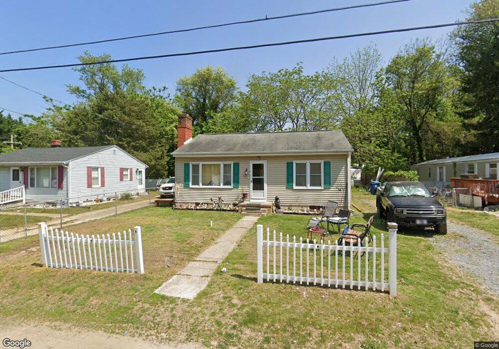
41 Carter Rd Dover, DE 19901
Highland Acres NeighborhoodEstimated Value: $179,000 - $191,000
3
Beds
1
Bath
768
Sq Ft
$240/Sq Ft
Est. Value
About This Home
This home is located at 41 Carter Rd, Dover, DE 19901 and is currently estimated at $184,606, approximately $240 per square foot. 41 Carter Rd is a home located in Kent County with nearby schools including W. Reily Brown Elementary School, Fred Fifer Middle School, and Caesar Rodney High School.
Ownership History
Date
Name
Owned For
Owner Type
Purchase Details
Closed on
Feb 12, 2015
Sold by
Patterson Robert L
Bought by
Patterson Robert L and Patterson Roland N
Current Estimated Value
Home Financials for this Owner
Home Financials are based on the most recent Mortgage that was taken out on this home.
Original Mortgage
$92,866
Outstanding Balance
$71,396
Interest Rate
4.02%
Mortgage Type
VA
Estimated Equity
$113,210
Purchase Details
Closed on
Dec 18, 2014
Sold by
Grohe Clifford A and Grohe Linda S
Bought by
Patterson Robert L
Home Financials for this Owner
Home Financials are based on the most recent Mortgage that was taken out on this home.
Original Mortgage
$92,866
Outstanding Balance
$71,396
Interest Rate
4.02%
Mortgage Type
VA
Estimated Equity
$113,210
Purchase Details
Closed on
Mar 12, 2008
Sold by
Journey On Llc
Bought by
Grohe Clifford A and Grohe Linda S
Purchase Details
Closed on
Jul 26, 2005
Sold by
Grohe Clifford A and Grohe Linda S
Bought by
Journey On Llc
Create a Home Valuation Report for This Property
The Home Valuation Report is an in-depth analysis detailing your home's value as well as a comparison with similar homes in the area
Home Values in the Area
Average Home Value in this Area
Purchase History
| Date | Buyer | Sale Price | Title Company |
|---|---|---|---|
| Patterson Robert L | -- | None Available | |
| Patterson Robert L | $89,900 | None Available | |
| Grohe Clifford A | -- | None Available | |
| Journey On Llc | -- | None Available |
Source: Public Records
Mortgage History
| Date | Status | Borrower | Loan Amount |
|---|---|---|---|
| Open | Patterson Robert L | $92,866 |
Source: Public Records
Tax History
| Year | Tax Paid | Tax Assessment Tax Assessment Total Assessment is a certain percentage of the fair market value that is determined by local assessors to be the total taxable value of land and additions on the property. | Land | Improvement |
|---|---|---|---|---|
| 2025 | $742 | $181,100 | $54,900 | $126,200 |
| 2024 | $740 | $181,100 | $54,900 | $126,200 |
| 2023 | $395 | $14,700 | $4,700 | $10,000 |
| 2022 | $375 | $14,700 | $4,700 | $10,000 |
| 2021 | $360 | $14,700 | $4,700 | $10,000 |
| 2020 | $354 | $14,700 | $4,700 | $10,000 |
| 2019 | $340 | $14,700 | $4,700 | $10,000 |
| 2018 | $328 | $14,700 | $4,700 | $10,000 |
| 2017 | $319 | $14,700 | $0 | $0 |
| 2016 | $313 | $14,700 | $0 | $0 |
| 2015 | $263 | $14,700 | $0 | $0 |
| 2014 | $251 | $14,700 | $0 | $0 |
Source: Public Records
Map
Nearby Homes
- 91 Stevens St
- 224 Shamrock Ave
- 142 Carter Ln
- 288 Cambridge Rd
- 386 David Hall Rd
- 2043 Highland Ave
- 100 S Shore Dr
- 55 Boyd Cir
- 89 S Shore Dr
- 21 N West St
- 48 John Collins Cir
- 237 E Camden Wyoming Ave
- 699 S Old Mill Rd
- 1694 S State St
- 2158 S State St
- 12 S Nace Ln
- 248 Webbs Ln
- 126 Center St
- 7 Steele Rd
- 5 Waterwheel Cir
Your Personal Tour Guide
Ask me questions while you tour the home.