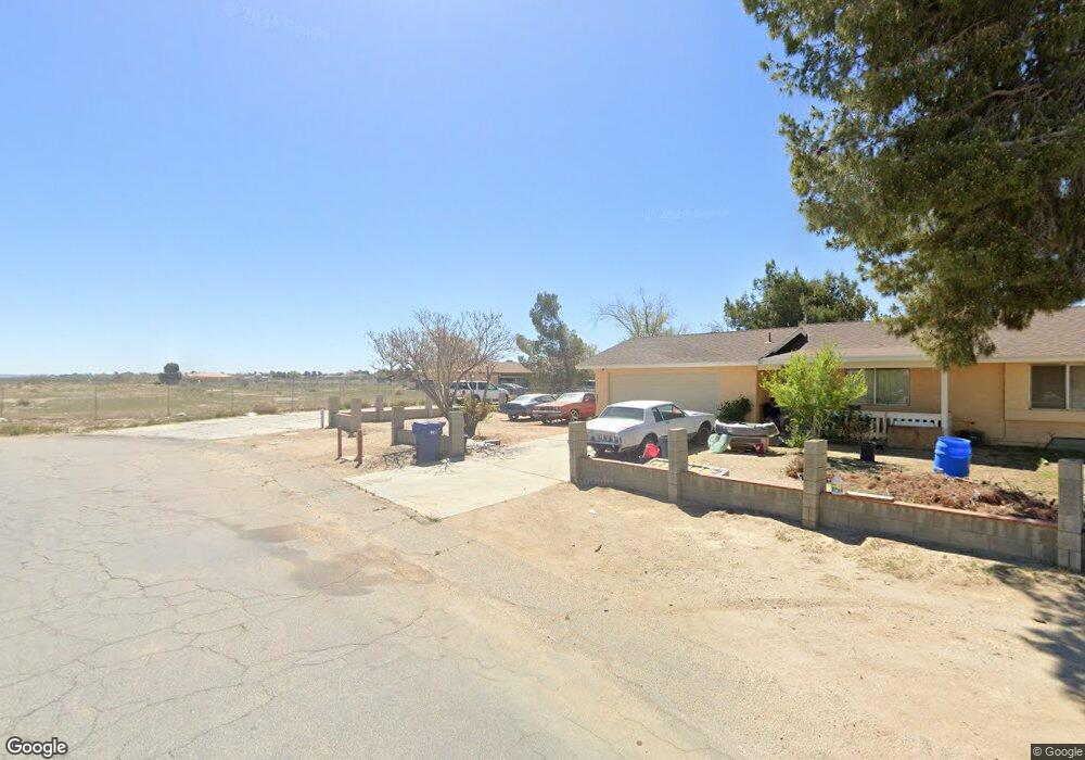
41304 159th St E Lancaster, CA 93535
Estimated Value: $387,943 - $438,000
3
Beds
2
Baths
1,661
Sq Ft
$248/Sq Ft
Est. Value
About This Home
This home is located at 41304 159th St E, Lancaster, CA 93535 and is currently estimated at $411,486, approximately $247 per square foot. 41304 159th St E is a home located in Los Angeles County with nearby schools including Challenger Middle School, Vista San Gabriel Elementary School, and Littlerock High School.
Ownership History
Date
Name
Owned For
Owner Type
Purchase Details
Closed on
Jun 21, 2014
Sold by
Surratt William
Bought by
Surratt William and Surratt William Benjamin
Current Estimated Value
Purchase Details
Closed on
Jul 1, 2009
Sold by
Deutsche Bank National Trust Company
Bought by
Surratt William
Purchase Details
Closed on
Apr 13, 2009
Sold by
Dellinger James L and Dellinger Margaret
Bought by
Deutsche Bank National Trust Company and Gsamp 2006-Fm1
Create a Home Valuation Report for This Property
The Home Valuation Report is an in-depth analysis detailing your home's value as well as a comparison with similar homes in the area
Home Values in the Area
Average Home Value in this Area
Purchase History
| Date | Buyer | Sale Price | Title Company |
|---|---|---|---|
| Surratt William | -- | None Available | |
| Surratt William | $60,500 | First American Title | |
| Deutsche Bank National Trust Company | $82,000 | None Available |
Source: Public Records
Tax History
| Year | Tax Paid | Tax Assessment Tax Assessment Total Assessment is a certain percentage of the fair market value that is determined by local assessors to be the total taxable value of land and additions on the property. | Land | Improvement |
|---|---|---|---|---|
| 2025 | $1,188 | $77,691 | $15,481 | $62,210 |
| 2024 | $1,188 | $76,169 | $15,178 | $60,991 |
| 2023 | $1,174 | $74,677 | $14,881 | $59,796 |
| 2022 | $1,157 | $73,214 | $14,590 | $58,624 |
| 2021 | $1,126 | $71,779 | $14,304 | $57,475 |
| 2020 | $1,102 | $71,044 | $14,158 | $56,886 |
| 2019 | $1,091 | $69,652 | $13,881 | $55,771 |
| 2018 | $1,069 | $68,287 | $13,609 | $54,678 |
| 2016 | $995 | $65,637 | $13,082 | $52,555 |
| 2015 | $982 | $64,652 | $12,886 | $51,766 |
| 2014 | $1,001 | $63,386 | $12,634 | $50,752 |
Source: Public Records
Map
Nearby Homes
- 15842 Greenrock Ave
- 133 East Ave N
- 0 160th St E Unit IV26018473
- 0 158 Ste Vic Lanfair Ave E Unit 238656
- 41060 158th St E
- 8 162nd St E
- 0 165th Ste Drt Vic Ave M
- 41331 156th St E
- 16254 Mossdale Ave
- 0 East Ave N
- 40578 163rd St E
- 15232 Greenrock Ave
- 16105 Newmont Ave
- 16173 Newmont Ave
- 0 Vac Cor Avenue N Drt 166th Unit DRT 24-372887
- 0 Cor 166th Unit Ste Drt
- 40734 163rd St E
- 15142 Lanfair Ave
- 16622 Mossdale Ave
- 18500 East Ave N
- 41302 159th St E
- 15874 Greenrock Ave
- 41300 159th St E
- 0 Vac 160th Ste Vic Ave Unit 1201301
- 0 Vac 160th Ste Vic Ave Unit 1208665
- 15866 Greenrock Ave
- 41315 159th St E
- 0 160th Ave N #Vic Unit 18005043
- 15867 Greenrock Ave
- 15854 Greenrock Ave
- 15855 Greenrock Ave
- 41330 159th St E
- 15843 Greenrock Ave
- 15834 Greenrock Ave
- 15835 Greenrock Ave
- 41134 159th St E
- 41350 159th St E
- 15827 Greenrock Ave
- 41132 159th St E
- 0 Greenrock Ave Unit 18004985
Your Personal Tour Guide
Ask me questions while you tour the home.