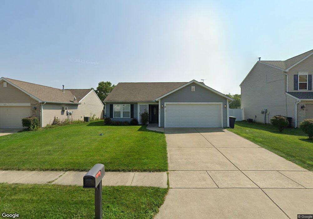
4137 Langley Dr Lafayette, IN 47909
Estimated Value: $218,254 - $271,000
Studio
--
Bath
1,240
Sq Ft
$200/Sq Ft
Est. Value
About This Home
This home is located at 4137 Langley Dr, Lafayette, IN 47909 and is currently estimated at $248,314, approximately $200 per square foot. 4137 Langley Dr is a home located in Tippecanoe County with nearby schools including Wea Ridge Elementary School, Wea Ridge Middle School, and McCutcheon High School.
Ownership History
Date
Name
Owned For
Owner Type
Purchase Details
Closed on
Apr 19, 2007
Sold by
Hud
Bought by
Atkinson Kenneth W
Current Estimated Value
Purchase Details
Closed on
Jan 9, 2007
Sold by
Wells Fargo Bank Na
Bought by
Hud
Purchase Details
Closed on
Nov 7, 2006
Sold by
Anderson Melissa K
Bought by
Wells Fargo Bank Na
Purchase Details
Closed on
Feb 13, 2003
Sold by
Crossmann Communities Partnership
Bought by
Anderson Melissa K
Home Financials for this Owner
Home Financials are based on the most recent Mortgage that was taken out on this home.
Original Mortgage
$111,223
Interest Rate
6.06%
Mortgage Type
FHA
Purchase Details
Closed on
Feb 11, 2003
Sold by
Saddlebrook Development Llc
Bought by
Crossmann Communities Partnership
Home Financials for this Owner
Home Financials are based on the most recent Mortgage that was taken out on this home.
Original Mortgage
$111,223
Interest Rate
6.06%
Mortgage Type
FHA
Create a Home Valuation Report for This Property
The Home Valuation Report is an in-depth analysis detailing your home's value as well as a comparison with similar homes in the area
Purchase History
| Date | Buyer | Sale Price | Title Company |
|---|---|---|---|
| Atkinson Kenneth W | -- | Village Title Inc | |
| Hud | -- | None Available | |
| Wells Fargo Bank Na | $128,485 | None Available | |
| Anderson Melissa K | -- | -- | |
| Crossmann Communities Partnership | -- | -- |
Source: Public Records
Mortgage History
| Date | Status | Borrower | Loan Amount |
|---|---|---|---|
| Previous Owner | Anderson Melissa K | $111,223 |
Source: Public Records
Tax History
| Year | Tax Paid | Tax Assessment Tax Assessment Total Assessment is a certain percentage of the fair market value that is determined by local assessors to be the total taxable value of land and additions on the property. | Land | Improvement |
|---|---|---|---|---|
| 2024 | $1,849 | $184,900 | $16,000 | $168,900 |
| 2023 | $1,630 | $170,200 | $16,000 | $154,200 |
| 2022 | $1,545 | $154,900 | $16,000 | $138,900 |
| 2021 | $1,297 | $134,400 | $16,000 | $118,400 |
| 2020 | $1,118 | $125,000 | $16,000 | $109,000 |
| 2019 | $987 | $116,700 | $16,000 | $100,700 |
| 2018 | $889 | $111,500 | $16,000 | $95,500 |
| 2017 | $842 | $107,300 | $16,000 | $91,300 |
| 2016 | $799 | $106,000 | $16,000 | $90,000 |
| 2014 | $718 | $101,900 | $16,000 | $85,900 |
| 2013 | $633 | $94,700 | $12,000 | $82,700 |
Source: Public Records
Map
Nearby Homes
- 4108 Langley Dr
- 4101 Lofton Dr
- 813 Braxton Dr N
- 4130 Cheyenne Dr
- 4006 John Adams Rd
- 8151 John Adams Rd
- 8165 John Adams Rd
- 8171 John Adams Rd
- 8157 John Adams Rd
- TBD John Adams Rd
- 17 Brazos Cir
- 4369 Stergen Dr
- 4153 Fiddlesticks Dr
- 4129 Fiddlesticks Dr
- 4102 Ivanhoe St
- 3713 John Adams Rd
- 4052 Fiddlesticks Dr
- 4436 Stergen Dr
- 4100 Homerton St
- 1007 Waterstone Dr
Your Personal Tour Guide
Ask me questions while you tour the home.