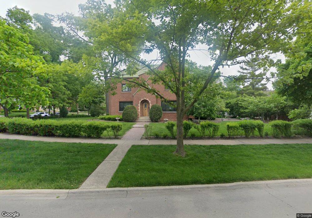
415 Nuttall Rd Riverside, IL 60546
Estimated Value: $681,000 - $812,000
5
Beds
3
Baths
2,560
Sq Ft
$294/Sq Ft
Est. Value
About This Home
This home is located at 415 Nuttall Rd, Riverside, IL 60546 and is currently estimated at $751,950, approximately $293 per square foot. 415 Nuttall Rd is a home located in Cook County with nearby schools including A F Ames Elementary School, L J Hauser Jr High School, and Riverside Brookfield High School.
Ownership History
Date
Name
Owned For
Owner Type
Purchase Details
Closed on
Dec 23, 2006
Sold by
Orfei Laura L
Bought by
Orfei Dante
Current Estimated Value
Home Financials for this Owner
Home Financials are based on the most recent Mortgage that was taken out on this home.
Original Mortgage
$640,000
Interest Rate
2.5%
Mortgage Type
Negative Amortization
Create a Home Valuation Report for This Property
The Home Valuation Report is an in-depth analysis detailing your home's value as well as a comparison with similar homes in the area
Home Values in the Area
Average Home Value in this Area
Purchase History
| Date | Buyer | Sale Price | Title Company |
|---|---|---|---|
| Orfei Dante | -- | Lawyers Title Insurance Corp |
Source: Public Records
Mortgage History
| Date | Status | Borrower | Loan Amount |
|---|---|---|---|
| Previous Owner | Orfei Dante | $640,000 |
Source: Public Records
Tax History
| Year | Tax Paid | Tax Assessment Tax Assessment Total Assessment is a certain percentage of the fair market value that is determined by local assessors to be the total taxable value of land and additions on the property. | Land | Improvement |
|---|---|---|---|---|
| 2025 | $17,555 | $56,632 | $8,914 | $47,718 |
| 2024 | $17,555 | $60,842 | $13,124 | $47,718 |
| 2023 | $16,013 | $60,842 | $13,124 | $47,718 |
| 2022 | $16,013 | $47,965 | $11,484 | $36,481 |
| 2021 | $16,247 | $50,139 | $11,483 | $38,656 |
| 2020 | $15,861 | $50,139 | $11,483 | $38,656 |
| 2019 | $13,353 | $44,112 | $10,499 | $33,613 |
| 2018 | $12,957 | $44,112 | $10,499 | $33,613 |
| 2017 | $14,872 | $48,367 | $10,499 | $37,868 |
| 2016 | $14,003 | $42,261 | $9,186 | $33,075 |
| 2015 | $13,639 | $42,261 | $9,186 | $33,075 |
| 2014 | $13,424 | $42,261 | $9,186 | $33,075 |
| 2013 | $11,637 | $39,932 | $9,186 | $30,746 |
Source: Public Records
Map
Nearby Homes
- 367 Bartram Rd
- 410 Repton Rd
- 101 Southcote Rd
- 315 Bartram Rd
- 2527 Keystone Ave
- 305 Desplaines Ave
- 2433 Keystone Ave
- 231 Bartram Rd
- 8117 W 30th St
- 2311 Park Ave
- 236 Maplewood Rd
- 2245 Des Plaines Ave Unit A
- 220 Maplewood Rd
- 2230 Keystone Ave
- 2233 Des Plaines Ave
- 2252 Northgate Ave
- 269 Shenstone Rd
- 562 Byrd Rd
- 478 Kent Rd
- 571 Byrd Rd
Your Personal Tour Guide
Ask me questions while you tour the home.