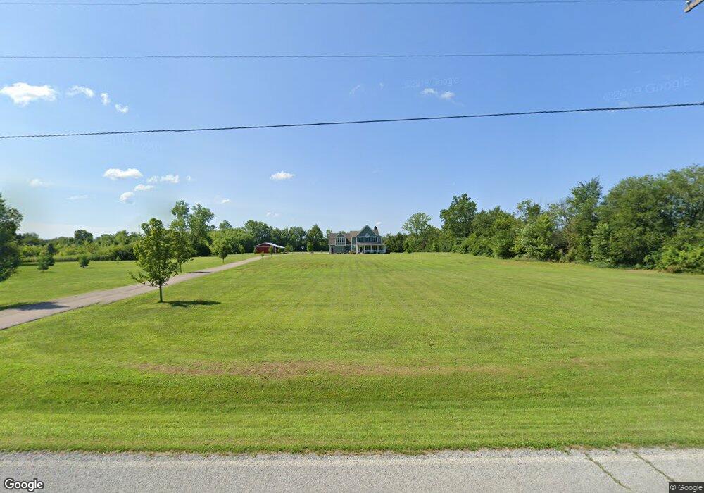
4151 Miller Rd Unit 2 Springfield, OH 45502
Estimated Value: $488,000 - $805,000
4
Beds
3
Baths
4,112
Sq Ft
$157/Sq Ft
Est. Value
About This Home
This home is located at 4151 Miller Rd Unit 2, Springfield, OH 45502 and is currently estimated at $645,325, approximately $156 per square foot. 4151 Miller Rd Unit 2 is a home located in Clark County with nearby schools including Northwestern Elementary School and Northwestern Junior/Senior High School.
Ownership History
Date
Name
Owned For
Owner Type
Purchase Details
Closed on
Apr 19, 2017
Sold by
Jordan Karen Gale and Jordan Karen G
Bought by
Karen Gale Jordan Revocable Trust
Current Estimated Value
Purchase Details
Closed on
Apr 7, 2017
Sold by
Jordan Joseph R and Jordan Joseph Robert
Bought by
Revocable Trust Agreement Of Joseph Robe
Purchase Details
Closed on
Jun 29, 2012
Sold by
Bailey Michael A and Bailey Tina L
Bought by
Jordan Joseph R and Jordan Karen G
Create a Home Valuation Report for This Property
The Home Valuation Report is an in-depth analysis detailing your home's value as well as a comparison with similar homes in the area
Purchase History
| Date | Buyer | Sale Price | Title Company |
|---|---|---|---|
| Karen Gale Jordan Revocable Trust | -- | None Available | |
| Revocable Trust Agreement Of Joseph Robe | -- | None Available | |
| Jordan Joseph R | $51,000 | Attorney |
Source: Public Records
Tax History
| Year | Tax Paid | Tax Assessment Tax Assessment Total Assessment is a certain percentage of the fair market value that is determined by local assessors to be the total taxable value of land and additions on the property. | Land | Improvement |
|---|---|---|---|---|
| 2025 | $8,788 | $227,500 | $26,470 | $201,030 |
| 2024 | $8,350 | $182,400 | $23,110 | $159,290 |
| 2023 | $8,350 | $182,400 | $23,110 | $159,290 |
| 2022 | $8,578 | $182,400 | $23,110 | $159,290 |
| 2021 | $7,425 | $140,300 | $17,640 | $122,660 |
| 2020 | $7,498 | $140,300 | $17,640 | $122,660 |
| 2019 | $8,364 | $157,980 | $17,640 | $140,340 |
| 2018 | $7,002 | $130,070 | $16,030 | $114,040 |
| 2017 | $7,188 | $130,075 | $16,034 | $114,041 |
| 2016 | $7,046 | $130,075 | $16,034 | $114,041 |
| 2015 | $6,926 | $127,891 | $16,034 | $111,857 |
| 2014 | $4,865 | $89,860 | $16,034 | $73,826 |
| 2013 | $509 | $9,471 | $9,471 | $0 |
Source: Public Records
Map
Nearby Homes
- 22 Sunset Dr
- 3457 Stoney Creek St
- 3361 Turner Dr E Unit C130
- 3314 Scotsdale Dr
- 2137 Manhattan Blvd
- 23 Rock Run
- 3460 Hanson Rd
- 2818 Anita Dr
- 780 W Eva Cir
- 3145 Troy Rd
- 917 White Oak Dr
- 4119 Southwest Ct
- 2705 Ash Dr
- 925 Upper Valley Pike
- 00 Upper Valley Pike
- 2743 Ironwood Dr
- 2805 Cottonwood Dr
- 4461 New Carlisle Pike
- 3819 New Carlisle Pike
- 4472 Saint Paris Pike
- 4151 Miller Rd
- 4130 Miller Rd
- 4087 Miller Rd
- 4100 Miller Rd
- 4066 Miller Rd
- 1995 Ballentine Pike
- 1995 Ballentine Pike Unit 3
- 4243 Miller Rd
- 4101 Young Ave
- 4022 Miller Rd
- 1989 Ballentine Pike
- 1989 Ballentine Pike Unit 4
- 2203 Leon Ln
- 2236 Leon Ln
- 2204 Leon Ln
- 1983 Ballentine Pike
- 4036 Young Ave
- 2245 Leon Ln
- 1971 Ballentine Pike
- 1994 Ballentine Pike
Your Personal Tour Guide
Ask me questions while you tour the home.