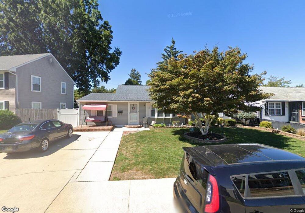
417 Burnside Blvd Wilmington, DE 19804
Estimated Value: $281,000 - $307,000
3
Beds
1
Bath
1,362
Sq Ft
$213/Sq Ft
Est. Value
About This Home
This home is located at 417 Burnside Blvd, Wilmington, DE 19804 and is currently estimated at $290,277, approximately $213 per square foot. 417 Burnside Blvd is a home located in New Castle County with nearby schools including Richey Elementary School, Stanton Middle School, and The John Dickinson School.
Ownership History
Date
Name
Owned For
Owner Type
Purchase Details
Closed on
Sep 25, 2009
Sold by
Myers Daniel M
Bought by
Collazo Phillip
Current Estimated Value
Home Financials for this Owner
Home Financials are based on the most recent Mortgage that was taken out on this home.
Original Mortgage
$191,468
Outstanding Balance
$126,485
Interest Rate
5.31%
Mortgage Type
FHA
Estimated Equity
$163,792
Purchase Details
Closed on
May 11, 2007
Sold by
Collazo Doris M
Bought by
Myers Daniel M and Myers Doris M
Home Financials for this Owner
Home Financials are based on the most recent Mortgage that was taken out on this home.
Original Mortgage
$170,000
Interest Rate
6.18%
Mortgage Type
Purchase Money Mortgage
Create a Home Valuation Report for This Property
The Home Valuation Report is an in-depth analysis detailing your home's value as well as a comparison with similar homes in the area
Home Values in the Area
Average Home Value in this Area
Purchase History
| Date | Buyer | Sale Price | Title Company |
|---|---|---|---|
| Collazo Phillip | $195,000 | None Available | |
| Myers Daniel M | -- | None Available | |
| Myers Daniel M | -- | First American Title Ins Co |
Source: Public Records
Mortgage History
| Date | Status | Borrower | Loan Amount |
|---|---|---|---|
| Open | Collazo Phillip | $191,468 | |
| Previous Owner | Myers Daniel M | $170,000 |
Source: Public Records
Tax History Compared to Growth
Tax History
| Year | Tax Paid | Tax Assessment Tax Assessment Total Assessment is a certain percentage of the fair market value that is determined by local assessors to be the total taxable value of land and additions on the property. | Land | Improvement |
|---|---|---|---|---|
| 2024 | $1,513 | $39,900 | $8,200 | $31,700 |
| 2023 | $1,340 | $39,900 | $8,200 | $31,700 |
| 2022 | $1,348 | $39,900 | $8,200 | $31,700 |
| 2021 | $1,348 | $39,900 | $8,200 | $31,700 |
| 2020 | $1,351 | $39,900 | $8,200 | $31,700 |
| 2019 | $1,579 | $39,900 | $8,200 | $31,700 |
| 2018 | $1,323 | $39,900 | $8,200 | $31,700 |
| 2017 | $1,308 | $39,900 | $8,200 | $31,700 |
| 2016 | $1,248 | $39,900 | $8,200 | $31,700 |
| 2015 | $1,171 | $39,900 | $8,200 | $31,700 |
| 2014 | $1,086 | $39,900 | $8,200 | $31,700 |
Source: Public Records
Map
Nearby Homes
- 602 Erdman Rd
- 318 Atkinson Rd
- 405 N Augustine St
- 516 Becker Ave
- 6 Grosvenor Ct Unit 14
- 6 Colefax Ct
- 1217 Newport Gap Pike
- 203 Latimer St
- 37 Read Ave
- 0 Kiamensi Rd
- 208 Harding Ave
- 409 Boxwood Rd
- 104 Laurel Ln
- 444 Forest Dr
- 3419 LOT 3 Old Capitol Trail
- 3419 LOT 2 Old Capitol Trail
- 3419 LOT 4 Old Capitol Trail
- 0 Exmore Ave
- 0 Central Ave
- 3423 Clayton Ave
- 419 Burnside Blvd
- 415 Burnside Blvd
- 0 None Unit DENC2057736
- 203 Bec Ave
- 414 Bennington Rd
- 416 Bennington Rd
- 413 Burnside Blvd
- 421 Burnside Blvd
- 412 Bennington Rd
- 418 Burnside Blvd
- 416 Burnside Blvd
- 420 Burnside Blvd
- 411 Burnside Blvd
- 418 Bennington Rd
- 414 Burnside Blvd
- 410 Bennington Rd
- 412 Burnside Blvd
- 409 Burnside Blvd
- 410 Burnside Blvd
- 600 Erdman Rd