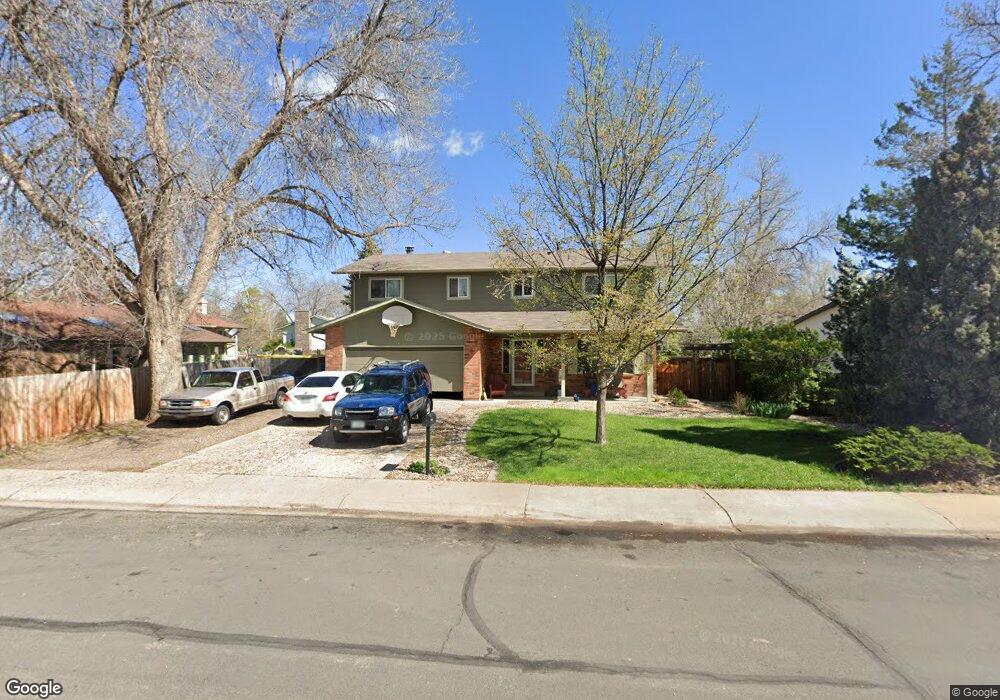
418 Bobolink Ct Fort Collins, CO 80526
Estimated Value: $575,000 - $605,000
5
Beds
3
Baths
3,439
Sq Ft
$171/Sq Ft
Est. Value
About This Home
This home is located at 418 Bobolink Ct, Fort Collins, CO 80526 and is currently estimated at $588,561, approximately $171 per square foot. 418 Bobolink Ct is a home located in Larimer County with nearby schools including Beattie Elementary School, Blevins Middle School, and Rocky Mountain High School.
Ownership History
Date
Name
Owned For
Owner Type
Purchase Details
Closed on
Apr 17, 2006
Sold by
Fannie Mae
Bought by
Flug Abraham
Current Estimated Value
Home Financials for this Owner
Home Financials are based on the most recent Mortgage that was taken out on this home.
Original Mortgage
$164,000
Outstanding Balance
$102,218
Interest Rate
7.87%
Mortgage Type
Purchase Money Mortgage
Estimated Equity
$486,343
Purchase Details
Closed on
Dec 9, 2005
Sold by
Lindsey Sam J and Lindsey Nancy A
Bought by
Washington Mutual Bank Fa
Purchase Details
Closed on
Jul 17, 2002
Sold by
Vaughan Randy R and Vaughan Robin D
Bought by
Lindsey Sam J and Lindsey Nancy A
Home Financials for this Owner
Home Financials are based on the most recent Mortgage that was taken out on this home.
Original Mortgage
$213,303
Interest Rate
6.73%
Purchase Details
Closed on
Feb 1, 1996
Sold by
Bollig Ralph Loren
Bought by
Vaughan Rndy R
Create a Home Valuation Report for This Property
The Home Valuation Report is an in-depth analysis detailing your home's value as well as a comparison with similar homes in the area
Home Values in the Area
Average Home Value in this Area
Purchase History
| Date | Buyer | Sale Price | Title Company |
|---|---|---|---|
| Flug Abraham | $205,000 | Security Title | |
| Washington Mutual Bank Fa | -- | -- | |
| Lindsey Sam J | $219,900 | -- | |
| Vaughan Rndy R | $134,500 | -- |
Source: Public Records
Mortgage History
| Date | Status | Borrower | Loan Amount |
|---|---|---|---|
| Open | Flug Abraham | $164,000 | |
| Previous Owner | Lindsey Sam J | $213,303 |
Source: Public Records
Tax History Compared to Growth
Tax History
| Year | Tax Paid | Tax Assessment Tax Assessment Total Assessment is a certain percentage of the fair market value that is determined by local assessors to be the total taxable value of land and additions on the property. | Land | Improvement |
|---|---|---|---|---|
| 2025 | $3,541 | $40,589 | $2,680 | $37,909 |
| 2024 | $3,369 | $40,589 | $2,680 | $37,909 |
| 2022 | $2,838 | $30,052 | $2,780 | $27,272 |
| 2021 | $2,868 | $30,917 | $2,860 | $28,057 |
| 2020 | $2,609 | $27,885 | $2,860 | $25,025 |
| 2019 | $2,620 | $27,885 | $2,860 | $25,025 |
| 2018 | $2,219 | $24,343 | $2,880 | $21,463 |
| 2017 | $2,211 | $24,343 | $2,880 | $21,463 |
| 2016 | $1,925 | $21,086 | $3,184 | $17,902 |
| 2015 | $1,911 | $21,080 | $3,180 | $17,900 |
| 2014 | -- | $19,840 | $3,180 | $16,660 |
Source: Public Records
Map
Nearby Homes
- 431 W Swallow Rd
- 3113 Colony Dr
- 630 Homestead Ct
- 2918 Rocky Mountain Ct
- 2716 Ringneck Dr
- 600 Republic Dr
- 3151 Worthington Ave
- 3440 Windmill Dr Unit 3-4
- 3440 Windmill Dr Unit 5-2
- 3036 Rustic Ct
- 720 Arbor Ave Unit 6
- 3378 Gunnison Dr
- 814 Arbor Ave Unit C
- 3565 Windmill Dr Unit 1
- 3565 Windmill Dr Unit N3
- 818 Wagonwheel Dr
- 3106 Lymen St
- 1115 W Swallow Rd Unit 20
- 2612 Harvard St
- 812 Coronado Ave
- 3112 Killdeer Dr
- 412 Bobolink Ct
- 447 W Swallow Rd
- 443 W Swallow Rd
- 453 W Swallow Rd
- 413 Bobolink Ct
- 406 Bobolink Ct
- 437 W Swallow Rd
- 3124 Killdeer Dr
- 407 Bobolink Ct
- 3113 Killdeer Dr
- 3107 Killdeer Dr
- 400 Bobolink Ct
- 3119 Killdeer Dr
- 3101 Killdeer Dr
- 401 Bobolink Ct
- 3125 Killdeer Dr
- 418 Cardinal Ct
- 412 Cardinal Ct
- 3200 Killdeer Dr