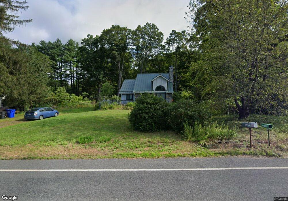
42 Plumtree Rd Sunderland, MA 01375
Estimated Value: $428,655 - $497,000
3
Beds
2
Baths
1,715
Sq Ft
$271/Sq Ft
Est. Value
About This Home
This home is located at 42 Plumtree Rd, Sunderland, MA 01375 and is currently estimated at $464,664, approximately $270 per square foot. 42 Plumtree Rd is a home located in Franklin County with nearby schools including Sunderland Elementary School and Frontier Regional School.
Ownership History
Date
Name
Owned For
Owner Type
Purchase Details
Closed on
May 30, 2008
Sold by
Hawkowl Julie H
Bought by
Hawkowl Julie H and Gradijan Mark D
Current Estimated Value
Home Financials for this Owner
Home Financials are based on the most recent Mortgage that was taken out on this home.
Original Mortgage
$202,000
Interest Rate
5.91%
Mortgage Type
Purchase Money Mortgage
Purchase Details
Closed on
Jan 12, 2001
Sold by
George Andrew D
Bought by
Chapman J Davis and Hokans Juile
Home Financials for this Owner
Home Financials are based on the most recent Mortgage that was taken out on this home.
Original Mortgage
$134,400
Interest Rate
7.64%
Mortgage Type
Purchase Money Mortgage
Purchase Details
Closed on
Jun 2, 2000
Sold by
First Union Nb
Bought by
George Andrew D
Purchase Details
Closed on
Feb 23, 2000
Sold by
Perchak James M
Bought by
First Union Nb
Create a Home Valuation Report for This Property
The Home Valuation Report is an in-depth analysis detailing your home's value as well as a comparison with similar homes in the area
Home Values in the Area
Average Home Value in this Area
Purchase History
| Date | Buyer | Sale Price | Title Company |
|---|---|---|---|
| Hawkowl Julie H | -- | -- | |
| Hawkowl Julie H | $113,500 | -- | |
| Chapman J Davis | $168,000 | -- | |
| George Andrew D | $118,000 | -- | |
| First Union Nb | $115,650 | -- |
Source: Public Records
Mortgage History
| Date | Status | Borrower | Loan Amount |
|---|---|---|---|
| Open | First Union Nb | $196,000 | |
| Closed | Hawkowl Julie H | $202,000 | |
| Previous Owner | First Union Nb | $135,000 | |
| Previous Owner | First Union Nb | $134,400 |
Source: Public Records
Tax History Compared to Growth
Tax History
| Year | Tax Paid | Tax Assessment Tax Assessment Total Assessment is a certain percentage of the fair market value that is determined by local assessors to be the total taxable value of land and additions on the property. | Land | Improvement |
|---|---|---|---|---|
| 2025 | $48 | $370,800 | $115,300 | $255,500 |
| 2024 | $4,872 | $370,800 | $115,300 | $255,500 |
| 2023 | $4,451 | $347,700 | $104,800 | $242,900 |
| 2022 | $4,457 | $303,200 | $89,900 | $213,300 |
| 2021 | $2,644 | $270,500 | $83,300 | $187,200 |
| 2020 | $6,749 | $270,500 | $83,300 | $187,200 |
| 2019 | $4,139 | $270,000 | $80,900 | $189,100 |
| 2018 | $3,807 | $253,800 | $77,600 | $176,200 |
| 2017 | $3,655 | $254,900 | $77,600 | $177,300 |
| 2016 | $3,639 | $248,200 | $76,100 | $172,100 |
| 2015 | $3,512 | $245,400 | $76,100 | $169,300 |
| 2014 | $3,431 | $245,400 | $76,100 | $169,300 |
Source: Public Records
Map
Nearby Homes
- 23 Plumtree Rd
- 15 S Plain Rd
- 139 Plumtree Rd
- 410 Old Montague Rd
- 119 Long Plain Rd
- 394 River Dr
- 113 Juggler Meadow Rd
- 75 State St
- 146 Old Amherst Rd
- Lot 3A-3 Leverett Rd
- 73 Depot Rd
- 958 E Pleasant St
- 0 Henry St
- 7 Roosevelt St
- 66 Harlow Dr
- 13 Harlow Dr
- 24 Old Amherst Rd
- 110 Grantwood Dr
- 24 Moorland St
- 259 Long Plain Rd