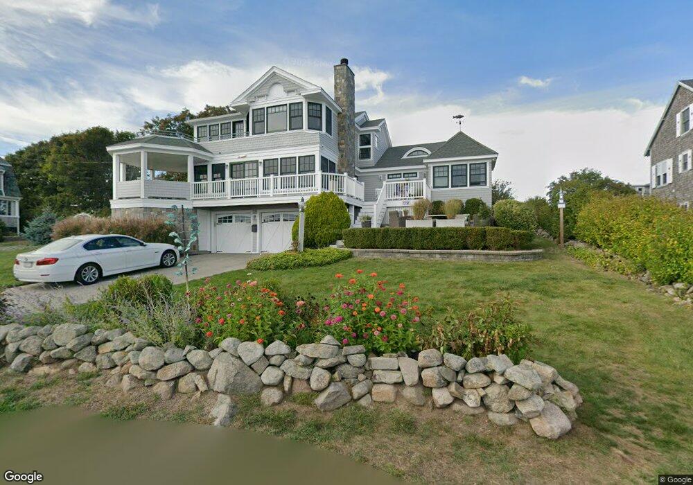
42 Salt Island Rd Gloucester, MA 01930
East Gloucester NeighborhoodEstimated Value: $1,017,000 - $2,395,000
4
Beds
2
Baths
1,709
Sq Ft
$1,091/Sq Ft
Est. Value
About This Home
This home is located at 42 Salt Island Rd, Gloucester, MA 01930 and is currently estimated at $1,864,786, approximately $1,091 per square foot. 42 Salt Island Rd is a home located in Essex County with nearby schools including East Gloucester Elementary School, Ralph B O'maley Middle School, and Gloucester High School.
Ownership History
Date
Name
Owned For
Owner Type
Purchase Details
Closed on
Jan 15, 2016
Sold by
Hollis Michael and Hollis Carolyn
Bought by
Michael J Hollis Ret
Current Estimated Value
Purchase Details
Closed on
Jul 25, 2006
Sold by
Salt Island Rt
Bought by
Hollis Carolyn and Hollis Michael
Create a Home Valuation Report for This Property
The Home Valuation Report is an in-depth analysis detailing your home's value as well as a comparison with similar homes in the area
Home Values in the Area
Average Home Value in this Area
Purchase History
| Date | Buyer | Sale Price | Title Company |
|---|---|---|---|
| Michael J Hollis Ret | -- | -- | |
| Hollis Carolyn | $799,900 | -- |
Source: Public Records
Tax History Compared to Growth
Tax History
| Year | Tax Paid | Tax Assessment Tax Assessment Total Assessment is a certain percentage of the fair market value that is determined by local assessors to be the total taxable value of land and additions on the property. | Land | Improvement |
|---|---|---|---|---|
| 2025 | $18,015 | $1,853,400 | $768,800 | $1,084,600 |
| 2024 | $17,676 | $1,816,600 | $732,000 | $1,084,600 |
| 2023 | $16,962 | $1,601,700 | $653,700 | $948,000 |
| 2022 | $16,418 | $1,399,700 | $568,800 | $830,900 |
| 2021 | $15,841 | $1,273,400 | $516,700 | $756,700 |
| 2020 | $15,707 | $1,273,900 | $487,200 | $786,700 |
| 2019 | $15,359 | $1,210,300 | $487,200 | $723,100 |
| 2018 | $15,168 | $1,173,100 | $487,200 | $685,900 |
| 2017 | $14,794 | $1,121,600 | $464,300 | $657,300 |
| 2016 | $14,278 | $1,049,100 | $440,300 | $608,800 |
| 2015 | $8,359 | $612,400 | $440,300 | $172,100 |
Source: Public Records
Map
Nearby Homes
- 33 Highview Rd
- 26 Marina Dr
- 29 Harrison Ave
- 10 Amero Ct
- 20 Haskell St
- 9 Rocky Pasture Rd
- 20 Calder St
- 86 E Main St
- 97 E Main St
- 100 E Main St
- 36 Links Rd
- 27 Hodgkins Rd
- 30 Chapel St Unit B
- 22 Taylor St Unit 1
- 197 E Main St
- 197 E Main St Unit 1
- 197 E Main St Unit 2
- 197 E Main St Unit 1 & 2
- 160 Prospect St Unit 3
- 4 Mount Vernon St
- 3 Warwick Rd
- 44 Salt Island Rd
- 4 Warwick Rd
- 5 Warwick Rd
- 6 Warwick Rd
- 7 Palfrey Rd
- 7 Palfrey Rd Unit 2a
- 8 Warwick Rd
- 38 Salt Island Rd
- 39 Salt Island Rd
- 37 Salt Island Rd
- 5 Palfrey Rd
- 41 Salt Island Rd
- 7 Warwick Rd
- 7 Prospect Terrace
- 12 Palfrey Rd
- 46 Salt Island Rd
- 10 Warwick Rd
- 10 Palfrey Rd
- 3 Palfrey Rd