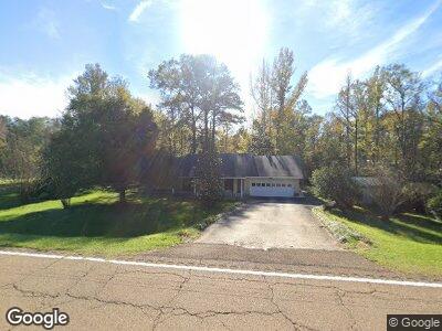
42048 Highway 28 Georgetown, MS 39078
Estimated Value: $115,000 - $156,824
--
Bed
2
Baths
2,052
Sq Ft
$63/Sq Ft
Est. Value
About This Home
This home is located at 42048 Highway 28, Georgetown, MS 39078 and is currently estimated at $129,706, approximately $63 per square foot. 42048 Highway 28 is a home located in Copiah County with nearby schools including Crystal Springs Elementary School, Crystal Springs Middle School, and Crystal Springs High School.
Ownership History
Date
Name
Owned For
Owner Type
Purchase Details
Closed on
May 14, 2018
Sold by
Unknown
Bought by
Hayes Michael W
Current Estimated Value
Home Financials for this Owner
Home Financials are based on the most recent Mortgage that was taken out on this home.
Original Mortgage
$66,300
Outstanding Balance
$41,764
Interest Rate
4.4%
Mortgage Type
Stand Alone Refi Refinance Of Original Loan
Estimated Equity
$85,780
Create a Home Valuation Report for This Property
The Home Valuation Report is an in-depth analysis detailing your home's value as well as a comparison with similar homes in the area
Home Values in the Area
Average Home Value in this Area
Purchase History
| Date | Buyer | Sale Price | Title Company |
|---|---|---|---|
| Hayes Michael W | $66,300 | -- | |
| Hayes Michael W | -- | -- |
Source: Public Records
Mortgage History
| Date | Status | Borrower | Loan Amount |
|---|---|---|---|
| Open | Hayes Michael W | $66,300 | |
| Closed | Hayes Michael W | $66,300 |
Source: Public Records
Tax History Compared to Growth
Tax History
| Year | Tax Paid | Tax Assessment Tax Assessment Total Assessment is a certain percentage of the fair market value that is determined by local assessors to be the total taxable value of land and additions on the property. | Land | Improvement |
|---|---|---|---|---|
| 2024 | $1,378 | $12,302 | $0 | $0 |
| 2023 | $1,378 | $12,302 | $0 | $0 |
| 2022 | $1,394 | $12,302 | $0 | $0 |
| 2021 | $1,352 | $12,302 | $0 | $0 |
| 2020 | $1,346 | $11,930 | $0 | $0 |
| 2019 | $1,364 | $11,930 | $0 | $0 |
| 2018 | $51 | $7,953 | $0 | $0 |
| 2017 | $84 | $8,360 | $0 | $0 |
| 2016 | $84 | $8,263 | $0 | $0 |
| 2015 | $86 | $8,263 | $0 | $0 |
| 2014 | $86 | $8,263 | $0 | $0 |
Source: Public Records
Map
Nearby Homes
- 5146 New Hope Rd
- 0 Rails Rd
- 0 Railroad Ave
- 0 Broad St
- 1061 E Poplar St
- 0 Rials Rd
- 0 Knight Rd
- 00 Steel Creek Rd
- 9307a Mississippi 28
- 866 Old River Rd
- 0 Runnels Rd Unit 140947
- 2048 Ashley Rd
- 8079 Harmony Rd
- 1145 Hopewell Rd
- 1088 Hopewell Rd
- 0 Bethesda Rd Unit 4087995
- 0 Bethesda Rd Unit 4082888
- 589 Simpson Highway 28 W
- 2088 Swamp Ln
- 2137 Ruby Rd