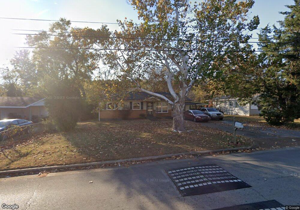
4233 Teejay Dr NW Huntsville, AL 35810
Estimated Value: $157,477 - $187,000
4
Beds
2
Baths
1,402
Sq Ft
$123/Sq Ft
Est. Value
About This Home
This home is located at 4233 Teejay Dr NW, Huntsville, AL 35810 and is currently estimated at $173,119, approximately $123 per square foot. 4233 Teejay Dr NW is a home located in Madison County with nearby schools including Rolling Hills Elementary School, Ronald E. McNair Junior High School, and Jemison High School.
Ownership History
Date
Name
Owned For
Owner Type
Purchase Details
Closed on
Mar 25, 2024
Sold by
Clark Property Management
Bought by
Limestone Property Group
Current Estimated Value
Home Financials for this Owner
Home Financials are based on the most recent Mortgage that was taken out on this home.
Original Mortgage
$293,826
Interest Rate
6.77%
Mortgage Type
New Conventional
Purchase Details
Closed on
May 27, 2008
Sold by
Wells Fargo Financial Alabama Inc
Bought by
Clark Robert
Home Financials for this Owner
Home Financials are based on the most recent Mortgage that was taken out on this home.
Original Mortgage
$28,000
Interest Rate
5.86%
Mortgage Type
Purchase Money Mortgage
Purchase Details
Closed on
Oct 29, 2004
Sold by
Ray Odessa and Brown James
Bought by
Wells Fargo Financial Alabama Inc
Create a Home Valuation Report for This Property
The Home Valuation Report is an in-depth analysis detailing your home's value as well as a comparison with similar homes in the area
Home Values in the Area
Average Home Value in this Area
Purchase History
| Date | Buyer | Sale Price | Title Company |
|---|---|---|---|
| Limestone Property Group | $360,000 | Jacob Title | |
| Clark Robert | -- | -- | |
| Wells Fargo Financial Alabama Inc | $79,000 | -- |
Source: Public Records
Mortgage History
| Date | Status | Borrower | Loan Amount |
|---|---|---|---|
| Closed | Limestone Property Group | $293,826 | |
| Previous Owner | Clark Robert | $28,000 |
Source: Public Records
Tax History Compared to Growth
Tax History
| Year | Tax Paid | Tax Assessment Tax Assessment Total Assessment is a certain percentage of the fair market value that is determined by local assessors to be the total taxable value of land and additions on the property. | Land | Improvement |
|---|---|---|---|---|
| 2024 | $1,114 | $19,200 | $3,600 | $15,600 |
| 2023 | $1,114 | $17,700 | $3,600 | $14,100 |
| 2022 | $797 | $13,740 | $2,340 | $11,400 |
| 2021 | $797 | $13,740 | $2,340 | $11,400 |
| 2020 | $724 | $12,480 | $1,560 | $10,920 |
| 2019 | $724 | $12,480 | $1,560 | $10,920 |
| 2018 | $698 | $12,040 | $0 | $0 |
| 2017 | $684 | $11,800 | $0 | $0 |
| 2016 | $684 | $11,800 | $0 | $0 |
| 2015 | $684 | $11,800 | $0 | $0 |
| 2014 | $695 | $11,980 | $0 | $0 |
Source: Public Records
Map
Nearby Homes
- 4330 Barry St NW
- 202 Gwynns Fall Trail
- 6207 Achievement Cir NW
- Lot 2 Memorial Pkwy N
- 6202 NW Achievement Cir NW
- 4812 Joy Dr NW
- 3728 Oakdale Ct NW
- 4206 Irondale Dr NW
- 3602 Oakdale Cir NW
- The Asheville Plan at Blue Spring
- The Richmond Plan at Blue Spring
- The Chelsea A Plan at Blue Spring
- The Franklin Plan at Blue Spring
- The Daphne Plan at Blue Spring
- The Butler Plan at Blue Spring
- The Shelby A Plan at Blue Spring
- The Everett Plan at Blue Spring
- 2703 Oakdale Terrace NW
- 4802 Benjamins Blooms Loop NW Unit 4802
- 3931 Pulaski Pike
- 4235 Tee Jay Dr NW
- 4231 Teejay Dr NW
- 4237 Teejay Dr NW
- 4229 Teejay Dr NW
- 4242 Tee Jay Dr NW
- 4242 Teejay Dr NW
- 4227 Teejay Dr NW
- 4239 Teejay Dr NW
- 4238 Teejay Dr NW
- 2515 Jeri St NW
- 4244 Teejay Dr NW
- 4236 Tee Jay Dr NW
- 4225 Teejay Dr NW
- 4241 Tee Jay Dr NW
- 4236 Teejay Dr NW
- 2514 Jerri St NW Jeri St NW
- 4241 Teejay Dr NW
- 2513 Jeri St NW
- 4246 Teejay Dr NW
- 4232 Keith St NW