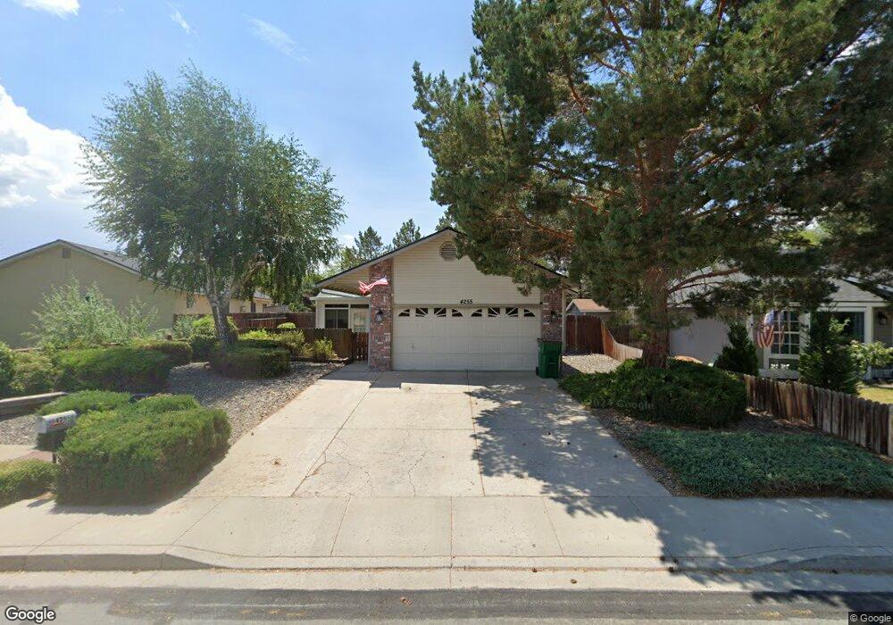
4255 Stampede Dr Carson City, NV 89701
Riverview NeighborhoodEstimated Value: $435,000 - $466,000
3
Beds
2
Baths
1,328
Sq Ft
$337/Sq Ft
Est. Value
About This Home
This home is located at 4255 Stampede Dr, Carson City, NV 89701 and is currently estimated at $448,055, approximately $337 per square foot. 4255 Stampede Dr is a home located in Carson City with nearby schools including Empire Elementary School, Eagle Valley Middle School, and Carson High School.
Ownership History
Date
Name
Owned For
Owner Type
Purchase Details
Closed on
Apr 28, 2017
Sold by
Rouse David C and Rathjen Rouse Marcy E
Bought by
Rouse Family Enterprises Llc
Current Estimated Value
Purchase Details
Closed on
Oct 3, 2005
Sold by
Green Lindsey A and Green Nicholas L
Bought by
Rouse David C and Rouse Marcy E Rathjen
Purchase Details
Closed on
Jan 6, 2005
Sold by
Green Lindsey A and Green Nicholas L
Bought by
Green Lindsey A and Green Nicholas L
Home Financials for this Owner
Home Financials are based on the most recent Mortgage that was taken out on this home.
Original Mortgage
$175,000
Interest Rate
5.69%
Mortgage Type
New Conventional
Create a Home Valuation Report for This Property
The Home Valuation Report is an in-depth analysis detailing your home's value as well as a comparison with similar homes in the area
Home Values in the Area
Average Home Value in this Area
Purchase History
| Date | Buyer | Sale Price | Title Company |
|---|---|---|---|
| Rouse Family Enterprises Llc | -- | None Available | |
| Rouse David C | $299,000 | First Amer Title Co Of Nv | |
| Green Lindsey A | -- | None Available |
Source: Public Records
Mortgage History
| Date | Status | Borrower | Loan Amount |
|---|---|---|---|
| Previous Owner | Green Lindsey A | $175,000 |
Source: Public Records
Tax History Compared to Growth
Tax History
| Year | Tax Paid | Tax Assessment Tax Assessment Total Assessment is a certain percentage of the fair market value that is determined by local assessors to be the total taxable value of land and additions on the property. | Land | Improvement |
|---|---|---|---|---|
| 2025 | $2,533 | $70,920 | $27,300 | $43,620 |
| 2024 | $2,368 | $72,028 | $27,300 | $44,728 |
| 2023 | $2,193 | $69,601 | $27,300 | $42,301 |
| 2022 | $2,031 | $62,095 | $23,625 | $38,470 |
| 2021 | $1,881 | $59,018 | $21,525 | $37,493 |
| 2020 | $1,881 | $56,230 | $19,075 | $37,155 |
| 2019 | $1,749 | $56,086 | $19,075 | $37,011 |
| 2018 | $1,669 | $54,908 | $19,075 | $35,833 |
| 2017 | $1,602 | $54,365 | $18,550 | $35,815 |
| 2016 | $1,562 | $52,185 | $15,400 | $36,785 |
| 2015 | $1,558 | $52,297 | $15,313 | $36,984 |
| 2014 | $1,512 | $45,475 | $12,250 | $33,225 |
Source: Public Records
Map
Nearby Homes
- 4349 Stampede Dr
- 1808 Rock Ct
- 1856 Rock Ct
- 4070 Quinn Dr
- 1628 Brown St
- 4071 Quinn Dr
- 4001 Quinn Dr
- 61 Condor Cir
- 1329 Stanford Dr
- 3913 Pheasant Dr
- 3905 Pheasant Dr
- 3954 Village Dr
- 3400 Woodside Dr Unit 23
- 3932 Village Dr
- 3404 Selby St
- 3523 Stanton Dr
- 3316 Woodside Dr Unit 14
- 3316 Woodside Dr Unit 16
- 855 Sundance Ct
- 6 Kit Sierra Loop
- 4221 Stampede Dr
- 1792 Gregg St
- 4185 Stampede Dr
- 4172 Sweetwater Dr
- 4148 Sweetwater Dr
- 4148 Sweetwater Dr Unit Dr.
- 4250 Stampede Dr
- 4222 Stampede Dr
- 4161 Stampede Dr
- 4186 Stampede Dr
- 4124 Sweetwater Dr
- 1753 Walker Dr
- 4303 Stampede Dr
- 4173 Sweetwater Dr
- 1775 Walker Dr
- 4174 Stampede Dr
- 1890 Gregg St
- 4141 Stampede Dr
- 4100 Sweetwater Dr
- 4158 Stampede Dr