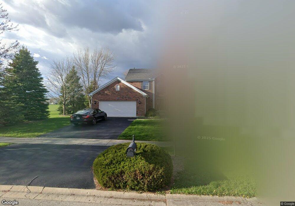
426 Lennox Dr Unit 1 Oswego, IL 60543
Northwest Oswego NeighborhoodEstimated Value: $454,000 - $490,000
4
Beds
3
Baths
2,755
Sq Ft
$171/Sq Ft
Est. Value
About This Home
This home is located at 426 Lennox Dr Unit 1, Oswego, IL 60543 and is currently estimated at $470,986, approximately $170 per square foot. 426 Lennox Dr Unit 1 is a home located in Kendall County with nearby schools including Fox Chase Elementary School, Traughber Junior High School, and Oswego High School.
Ownership History
Date
Name
Owned For
Owner Type
Purchase Details
Closed on
Oct 4, 2002
Sold by
Richard Smykal Inc
Bought by
Perry Kevin S
Current Estimated Value
Home Financials for this Owner
Home Financials are based on the most recent Mortgage that was taken out on this home.
Original Mortgage
$219,055
Outstanding Balance
$93,044
Interest Rate
6.34%
Estimated Equity
$377,942
Create a Home Valuation Report for This Property
The Home Valuation Report is an in-depth analysis detailing your home's value as well as a comparison with similar homes in the area
Home Values in the Area
Average Home Value in this Area
Purchase History
| Date | Buyer | Sale Price | Title Company |
|---|---|---|---|
| Perry Kevin S | $279,500 | -- |
Source: Public Records
Mortgage History
| Date | Status | Borrower | Loan Amount |
|---|---|---|---|
| Open | Perry Kevin S | $219,055 |
Source: Public Records
Tax History Compared to Growth
Tax History
| Year | Tax Paid | Tax Assessment Tax Assessment Total Assessment is a certain percentage of the fair market value that is determined by local assessors to be the total taxable value of land and additions on the property. | Land | Improvement |
|---|---|---|---|---|
| 2024 | $10,669 | $138,574 | $29,309 | $109,265 |
| 2023 | $9,618 | $122,632 | $25,937 | $96,695 |
| 2022 | $9,618 | $112,506 | $23,795 | $88,711 |
| 2021 | $9,561 | $108,179 | $22,880 | $85,299 |
| 2020 | $9,262 | $104,018 | $22,000 | $82,018 |
| 2019 | $9,106 | $100,864 | $22,000 | $78,864 |
| 2018 | $9,052 | $96,557 | $25,664 | $70,893 |
| 2017 | $8,466 | $88,584 | $23,545 | $65,039 |
| 2016 | $4,161 | $86,004 | $22,859 | $63,145 |
| 2015 | $8,196 | $81,136 | $21,565 | $59,571 |
| 2014 | -- | $76,543 | $20,344 | $56,199 |
| 2013 | -- | $77,316 | $20,549 | $56,767 |
Source: Public Records
Map
Nearby Homes
- 1415 State Route 31
- 2100 Light Rd Unit 109
- 2300 Light Rd Unit 209
- 107 Kristine St
- 2600 Light Rd Unit 210
- 608 Clearwater Ct
- 602 Clearwater Ct Unit 2
- 141 River Mist Dr
- 458 Greenview Ln
- 156 River Mist Dr
- 2110 State Route 31
- 409 Fawn Dr
- 7.43 Acres Vacant La State Route 31
- 505 Parkland Ct
- 11-13 W Anchor Rd
- 5.43 B-3 Commercial State Route 31
- 338 Millstream Ln Unit 1
- 435 Fawn Dr
- 125 Presidential Blvd Unit 3248
- 805 Cougar Ln
- 424 Lennox Dr Unit 1
- 422 Lennox Dr Unit 1
- 425 Lennox Dr Unit 1
- 423 Lennox Dr Unit 1
- 420 Lennox Dr
- 427 Lennox Dr Unit 1
- 421 Lennox Dr
- 418 Lennox Dr
- 419 Lennox Dr Unit 1
- 240 Fox Chase Dr N
- 242 Fox Chase Dr N
- 238 Fox Chase Dr N Unit 1
- 416 Lennox Dr Unit 1
- 244 Fox Chase Dr N
- 417 Lennox Dr Unit 1
- 236 Fox Chase Dr N
- 234 Fox Chase Dr N
- 414 Lennox Dr
- 415 Lennox Dr Unit 1
- 232 Fox Chase Dr N Unit 1