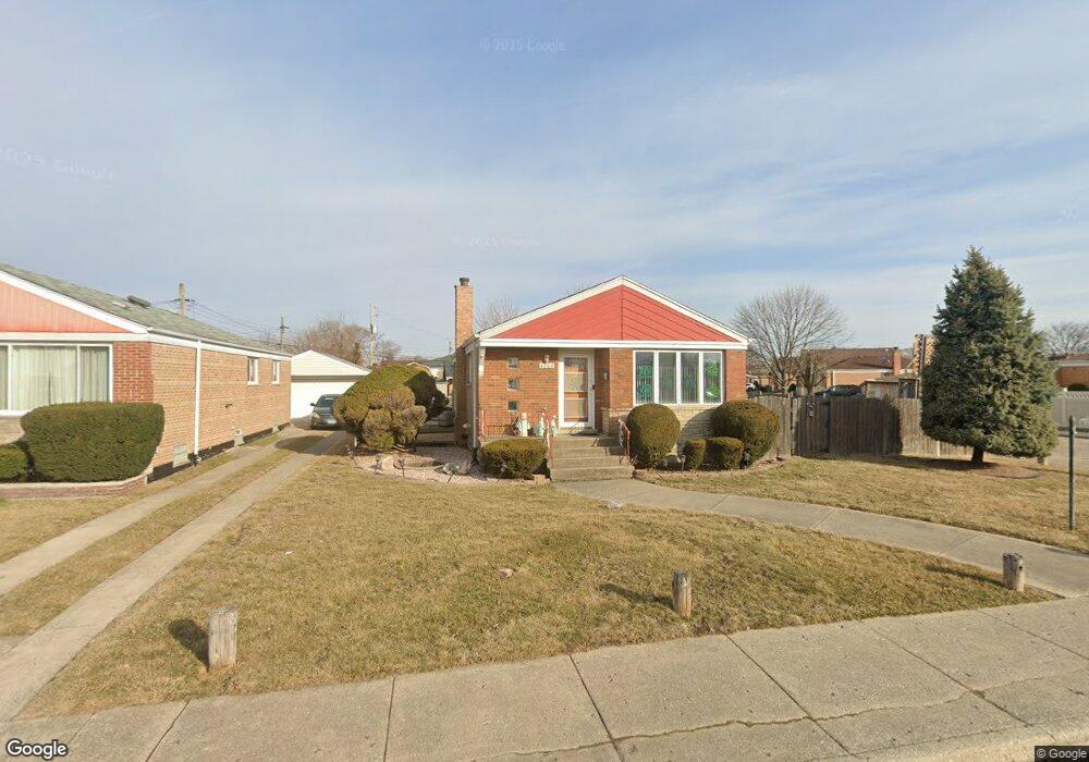
4262 W 81st St Chicago, IL 60652
Scottsdale NeighborhoodEstimated Value: $301,795 - $332,000
3
Beds
2
Baths
1,010
Sq Ft
$314/Sq Ft
Est. Value
About This Home
This home is located at 4262 W 81st St, Chicago, IL 60652 and is currently estimated at $316,949, approximately $313 per square foot. 4262 W 81st St is a home located in Cook County with nearby schools including Stevenson Elementary School, Bogan Computer Technical High School, and St Bede-Venerable School.
Ownership History
Date
Name
Owned For
Owner Type
Purchase Details
Closed on
Feb 11, 2003
Sold by
Lilja Gail M
Bought by
Benz Louis J and Lilja Gail M
Current Estimated Value
Home Financials for this Owner
Home Financials are based on the most recent Mortgage that was taken out on this home.
Original Mortgage
$92,460
Interest Rate
5.9%
Mortgage Type
Unknown
Purchase Details
Closed on
Oct 15, 1997
Sold by
Steffek Robert R and Steffek Marilyn A
Bought by
Lilja Gail M
Home Financials for this Owner
Home Financials are based on the most recent Mortgage that was taken out on this home.
Original Mortgage
$100,800
Interest Rate
7.43%
Create a Home Valuation Report for This Property
The Home Valuation Report is an in-depth analysis detailing your home's value as well as a comparison with similar homes in the area
Home Values in the Area
Average Home Value in this Area
Purchase History
| Date | Buyer | Sale Price | Title Company |
|---|---|---|---|
| Benz Louis J | -- | -- | |
| Benz Louis J | -- | -- | |
| Lilja Gail M | $126,000 | Attorneys Natl Title Network |
Source: Public Records
Mortgage History
| Date | Status | Borrower | Loan Amount |
|---|---|---|---|
| Closed | Benz Louis J | $92,460 | |
| Closed | Lilja Gail M | $100,800 |
Source: Public Records
Tax History Compared to Growth
Tax History
| Year | Tax Paid | Tax Assessment Tax Assessment Total Assessment is a certain percentage of the fair market value that is determined by local assessors to be the total taxable value of land and additions on the property. | Land | Improvement |
|---|---|---|---|---|
| 2024 | $3,195 | $22,000 | $3,780 | $18,220 |
| 2023 | $3,076 | $21,000 | $4,725 | $16,275 |
| 2022 | $3,076 | $21,000 | $4,725 | $16,275 |
| 2021 | $3,041 | $21,000 | $4,725 | $16,275 |
| 2020 | $3,397 | $18,218 | $4,725 | $13,493 |
| 2019 | $3,453 | $20,470 | $4,725 | $15,745 |
| 2018 | $3,394 | $20,470 | $4,725 | $15,745 |
| 2017 | $2,821 | $16,358 | $4,095 | $12,263 |
| 2016 | $2,801 | $16,358 | $4,095 | $12,263 |
| 2015 | $2,541 | $16,358 | $4,095 | $12,263 |
| 2014 | $2,119 | $13,877 | $3,780 | $10,097 |
| 2013 | $2,067 | $13,877 | $3,780 | $10,097 |
Source: Public Records
Map
Nearby Homes
- 4263 W 81st St
- 8100 S Kildare Ave
- 4327 W 81st St
- 7964 S Tripp Ave
- 7917 S Kostner Ave
- 8069 S Kolmar Ave
- 8053 S Kenton Ave
- 7932 S Pulaski Rd Unit 301
- 8001 S Kilpatrick Ave
- 7817 S Kenton Ave
- 3928 W 82nd Place
- 8100 S Kilpatrick Ave
- 7746 S Kolmar Ave
- 4244 W 77th St Unit 102
- 4222 W 77th St Unit 202
- 4222 W 77th St Unit 204
- 4300 W Ford City Dr Unit A1301
- 4350 W Ford City Dr Unit B1402
- 7845 S Kilpatrick Ave
- 8515 S Kedvale Ave
- 4266 W 81st St
- 8036 S Kildare Ave
- 4270 W 81st St
- 4250 W 81st St
- 4274 W 81st St
- 8032 S Kildare Ave
- 4246 W 81st St
- 8033 S Kildare Ave
- 8045 S Kirkland Ave
- 4267 W 81st St
- 8041 S Kirkland Ave
- 4259 W 81st St
- 8028 S Kildare Ave
- 4271 W 81st St
- 4280 W 81st St
- 8037 S Kirkland Ave
- 4242 W 81st St
- 8029 S Kildare Ave
- 4275 W 81st St
- 8024 S Kildare Ave