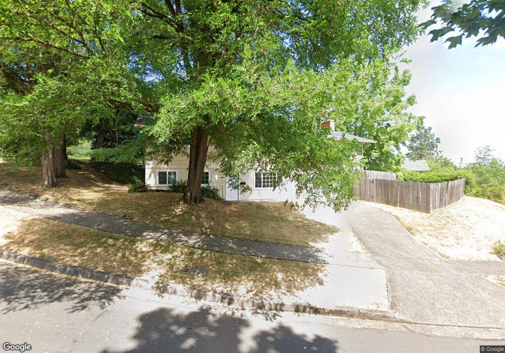
4290 Oak St Eugene, OR 97405
Southeast Eugene NeighborhoodEstimated Value: $593,000 - $667,000
5
Beds
3
Baths
2,406
Sq Ft
$262/Sq Ft
Est. Value
About This Home
This home is located at 4290 Oak St, Eugene, OR 97405 and is currently estimated at $630,171, approximately $261 per square foot. 4290 Oak St is a home located in Lane County with nearby schools including Edgewood Community Elementary School, Spencer Butte Middle School, and South Eugene High School.
Ownership History
Date
Name
Owned For
Owner Type
Purchase Details
Closed on
Jul 7, 2011
Sold by
Hoover Andrew A and Clarke Katharine G
Bought by
Hoover Andrew A and Clarke Katharine G
Current Estimated Value
Purchase Details
Closed on
Feb 10, 2010
Sold by
Degeorge Gary Alan and Degeorge Clare Beth
Bought by
Hoover Andrew A and Clarke Katharine G
Purchase Details
Closed on
Jun 4, 2008
Sold by
Fischer Tiffanie
Bought by
Degeorge Gary Alan and Degeorge Clare Beth
Purchase Details
Closed on
Sep 26, 2006
Sold by
Mchugh Bodylski James and Mchugh Bodylski Morgan T
Bought by
Fischer Tiffanie
Home Financials for this Owner
Home Financials are based on the most recent Mortgage that was taken out on this home.
Original Mortgage
$263,920
Interest Rate
6.53%
Mortgage Type
Unknown
Purchase Details
Closed on
May 28, 2004
Sold by
Harvest Investment Group Llc
Bought by
Mchugh Bodylski James and Mchugh Bodylski Morgan T
Home Financials for this Owner
Home Financials are based on the most recent Mortgage that was taken out on this home.
Original Mortgage
$172,500
Interest Rate
6.37%
Mortgage Type
New Conventional
Purchase Details
Closed on
Apr 9, 2004
Sold by
Locey J Michael and Locey Helen E
Bought by
Harvest Investment Group Llc
Home Financials for this Owner
Home Financials are based on the most recent Mortgage that was taken out on this home.
Original Mortgage
$172,500
Interest Rate
6.37%
Mortgage Type
New Conventional
Create a Home Valuation Report for This Property
The Home Valuation Report is an in-depth analysis detailing your home's value as well as a comparison with similar homes in the area
Home Values in the Area
Average Home Value in this Area
Purchase History
| Date | Buyer | Sale Price | Title Company |
|---|---|---|---|
| Hoover Andrew A | -- | None Available | |
| Hoover Andrew A | $274,000 | First American | |
| Degeorge Gary Alan | $228,001 | None Available | |
| Fischer Tiffanie | $329,900 | Fidelity National Title Insu | |
| Mchugh Bodylski James | $230,000 | Western Pioneer Title Co | |
| Harvest Investment Group Llc | $165,000 | Western Pioneer Title Co |
Source: Public Records
Mortgage History
| Date | Status | Borrower | Loan Amount |
|---|---|---|---|
| Previous Owner | Fischer Tiffanie | $263,920 | |
| Previous Owner | Mchugh Bodylski James | $172,500 | |
| Previous Owner | Harvest Investment Group Llc | $100,000 | |
| Closed | Harvest Investment Group Llc | $65,000 | |
| Closed | Mchugh Bodylski James | $34,500 |
Source: Public Records
Tax History
| Year | Tax Paid | Tax Assessment Tax Assessment Total Assessment is a certain percentage of the fair market value that is determined by local assessors to be the total taxable value of land and additions on the property. | Land | Improvement |
|---|---|---|---|---|
| 2025 | $5,172 | $265,440 | -- | -- |
| 2024 | $5,107 | $257,709 | -- | -- |
| 2023 | $5,107 | $250,203 | $0 | $0 |
| 2022 | $4,785 | $242,916 | $0 | $0 |
| 2021 | $4,494 | $235,841 | $0 | $0 |
| 2020 | $4,510 | $228,972 | $0 | $0 |
| 2019 | $4,356 | $222,303 | $0 | $0 |
| 2018 | $4,100 | $209,543 | $0 | $0 |
| 2017 | $3,916 | $209,543 | $0 | $0 |
| 2016 | $3,819 | $203,440 | $0 | $0 |
| 2015 | $3,710 | $197,515 | $0 | $0 |
| 2014 | $3,635 | $191,762 | $0 | $0 |
Source: Public Records
Map
Nearby Homes
- 170 E 40th Ave
- 17 Westbrook Way
- 21 Westbrook Way
- 395 E 46th Ave
- 36 Westbrook Way
- 4023 Donald St Unit K
- 4295 Ferry St
- 434 E 39th Ave
- 275 E 39th Ave
- 4734 Brookwood St
- 278 Rockridge Ct
- 0 E 39th Ave
- 320 Dellwood Dr
- 4425 Hilyard St
- 4845 Brookwood St
- 126 Treehill Loop Unit 126
- 75 W 35th Place
- 143 Treehill Loop Unit 143
- 152 Treehill Loop Unit 152
- 151 Treehill Loop Unit 151
Your Personal Tour Guide
Ask me questions while you tour the home.