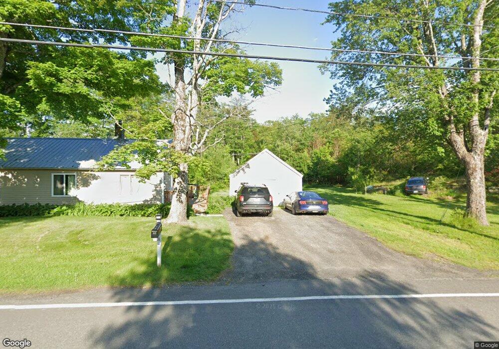
43 Gilsum Mine Rd Alstead, NH 03602
Estimated Value: $276,000 - $369,000
3
Beds
1
Bath
1,481
Sq Ft
$205/Sq Ft
Est. Value
About This Home
This home is located at 43 Gilsum Mine Rd, Alstead, NH 03602 and is currently estimated at $303,802, approximately $205 per square foot. 43 Gilsum Mine Rd is a home located in Cheshire County with nearby schools including Alstead Primary School, Vilas Elementary School, and Fall Mountain Regional High School.
Ownership History
Date
Name
Owned For
Owner Type
Purchase Details
Closed on
May 20, 2022
Sold by
Davis Gary A
Bought by
Davis Gary A and Davis Lisa
Current Estimated Value
Home Financials for this Owner
Home Financials are based on the most recent Mortgage that was taken out on this home.
Original Mortgage
$84,000
Outstanding Balance
$69,826
Interest Rate
4.43%
Mortgage Type
Stand Alone Refi Refinance Of Original Loan
Estimated Equity
$233,976
Purchase Details
Closed on
Mar 16, 2005
Sold by
Vilamarim Sharon A
Bought by
Davis 2Nd Gary
Home Financials for this Owner
Home Financials are based on the most recent Mortgage that was taken out on this home.
Original Mortgage
$112,000
Interest Rate
6%
Mortgage Type
Adjustable Rate Mortgage/ARM
Create a Home Valuation Report for This Property
The Home Valuation Report is an in-depth analysis detailing your home's value as well as a comparison with similar homes in the area
Home Values in the Area
Average Home Value in this Area
Purchase History
| Date | Buyer | Sale Price | Title Company |
|---|---|---|---|
| Davis Gary A | -- | None Available | |
| Davis Gary A | -- | None Available | |
| Davis 2Nd Gary | $140,000 | -- |
Source: Public Records
Mortgage History
| Date | Status | Borrower | Loan Amount |
|---|---|---|---|
| Open | Davis Gary A | $84,000 | |
| Closed | Davis Gary A | $84,000 | |
| Previous Owner | Davis 2Nd Gary | $112,000 |
Source: Public Records
Tax History Compared to Growth
Tax History
| Year | Tax Paid | Tax Assessment Tax Assessment Total Assessment is a certain percentage of the fair market value that is determined by local assessors to be the total taxable value of land and additions on the property. | Land | Improvement |
|---|---|---|---|---|
| 2024 | $4,133 | $153,200 | $62,800 | $90,400 |
| 2023 | $3,896 | $153,200 | $62,800 | $90,400 |
| 2022 | $3,775 | $153,200 | $62,800 | $90,400 |
| 2021 | $3,562 | $153,200 | $62,800 | $90,400 |
| 2020 | $3,741 | $153,200 | $62,800 | $90,400 |
| 2019 | $3,601 | $129,300 | $44,700 | $84,600 |
| 2018 | $3,498 | $129,300 | $44,700 | $84,600 |
| 2017 | $3,448 | $129,300 | $44,700 | $84,600 |
| 2016 | $3,479 | $129,300 | $44,700 | $84,600 |
| 2015 | $3,430 | $129,300 | $44,700 | $84,600 |
| 2014 | $3,649 | $153,300 | $51,000 | $102,300 |
| 2013 | $4,108 | $153,300 | $51,000 | $102,300 |
Source: Public Records
Map
Nearby Homes
- 27 Shadowland Rd
- 32 Blueberry Hill Ln
- 178 North Rd
- 00 Alstead Center Rd
- 473 Pratt Rd
- 172 Nh-Rte 123 Route
- 6 Mill St
- 55 Sunset Cir
- 0 Washington Pond Rd Unit 113
- 16 Vilas Rd
- 33 Maclean Rd
- 1076 Nh Route 123a
- 96 Maclean Rd
- 16 Nash Corner Rd
- 100 River St
- 363 March Hill Rd
- 00 Cold River Rd Unit 3014.0
- 29&31 White Brook Rd
- 563 Holden Hill Rd
- 67 Lang Rd
- 52 Gilsum Mine Rd
- 62 Gilsum Mine Rd
- 16 Pumphouse Ln
- 14 Pumphouse Ln
- 64 Gilsum Mine Rd
- 10 Pumphouse Ln
- 8 Pumphouse Ln
- 11 Pumphouse Ln
- 11 Pumphouse Rd
- 4 Pumphouse Ln
- 7 Pumphouse Ln
- 5 Lake Warren
- 3 Pumphouse Ln
- 5 Gilsum Mine Rd
- 15 Eel Rock Rd
- 8 Gilsum Mine Rd
- 22 Eel Rock Rd
- 23 Eel Rock Rd
- 1086 Forest Rd
- 00 Gilsum Mine Rd