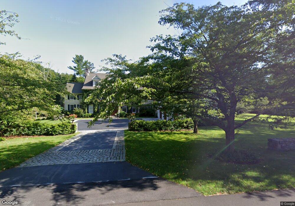
43 Whipstick Rd Ridgefield, CT 06877
Estimated Value: $1,847,000 - $3,088,000
5
Beds
6
Baths
6,099
Sq Ft
$407/Sq Ft
Est. Value
About This Home
This home is located at 43 Whipstick Rd, Ridgefield, CT 06877 and is currently estimated at $2,483,027, approximately $407 per square foot. 43 Whipstick Rd is a home located in Fairfield County with nearby schools including Branchville Elementary School, Ridgefield High School, and St. Mary School.
Ownership History
Date
Name
Owned For
Owner Type
Purchase Details
Closed on
Jan 9, 1998
Sold by
Demuro Mark and Dimuro Lisa
Bought by
Sica Richard and Vandam-Sica Andrea
Current Estimated Value
Purchase Details
Closed on
Aug 1, 1996
Sold by
Tracy David H
Bought by
Demuro Lisa and Demuro Mark
Purchase Details
Closed on
Jun 2, 1994
Sold by
Betz Ferdinand L and Betz Patricia
Bought by
Tracy David H
Create a Home Valuation Report for This Property
The Home Valuation Report is an in-depth analysis detailing your home's value as well as a comparison with similar homes in the area
Home Values in the Area
Average Home Value in this Area
Purchase History
| Date | Buyer | Sale Price | Title Company |
|---|---|---|---|
| Sica Richard | $799,900 | -- | |
| Demuro Lisa | $735,000 | -- | |
| Tracy David H | $35,000 | -- |
Source: Public Records
Mortgage History
| Date | Status | Borrower | Loan Amount |
|---|---|---|---|
| Open | Tracy David H | $515,000 | |
| Open | Tracy David H | $999,931 |
Source: Public Records
Tax History Compared to Growth
Tax History
| Year | Tax Paid | Tax Assessment Tax Assessment Total Assessment is a certain percentage of the fair market value that is determined by local assessors to be the total taxable value of land and additions on the property. | Land | Improvement |
|---|---|---|---|---|
| 2025 | $38,348 | $1,400,070 | $355,880 | $1,044,190 |
| 2024 | $36,892 | $1,400,070 | $355,880 | $1,044,190 |
| 2023 | $36,136 | $1,400,070 | $355,880 | $1,044,190 |
| 2022 | $36,305 | $1,277,010 | $249,120 | $1,027,890 |
| 2021 | $36,024 | $1,277,010 | $249,120 | $1,027,890 |
| 2020 | $35,910 | $1,277,010 | $249,120 | $1,027,890 |
| 2019 | $35,910 | $1,277,010 | $249,120 | $1,027,890 |
| 2018 | $35,475 | $1,277,010 | $249,120 | $1,027,890 |
| 2017 | $36,474 | $1,340,470 | $297,840 | $1,042,630 |
| 2016 | $35,777 | $1,340,470 | $297,840 | $1,042,630 |
| 2015 | $34,866 | $1,340,470 | $297,840 | $1,042,630 |
| 2014 | $34,866 | $1,340,470 | $297,840 | $1,042,630 |
Source: Public Records
Map
Nearby Homes
- 174 Branchville Rd
- 94 Soundview Rd
- 112 Soundview Rd
- 274 Nod Rd
- 175 Branchville Rd
- 41 Rockwell Rd
- 54 Main St
- 88 Main St
- 57 Main St
- 70 Branchville Rd
- 134 Nod Rd
- 84 Olmstead Ln
- 44 E Ridge Rd
- 164 Wilton Rd W
- 160 Wilton Rd W
- 61 High Ridge Ave
- 75 Saint Johns Rd
- Lot 6 Cattle Pen Ln
- 19 Prospect Ridge Unit 14
- 87 Silver Hill Rd
- 63 Whipstick Rd
- 42 Whipstick Rd
- 67 Whipstick Rd
- 65 Whipstick Rd
- 71 Whipstick Rd
- 31 Whipstick Rd
- 81 Whipstick Rd
- 66 Whipstick Rd
- 28 Whipstick Rd
- 13 Whipstick Rd
- 83 Whipstick Rd
- 12 Perry Ln
- 34 Whipstick Rd
- 32 Whipstick Rd
- 30 Whipstick Rd
- 72 Whipstick Rd
- 97 Whipstick Rd
- 95 Whipstick Rd
- 36 Perry Ln
- 30 Perry Ln