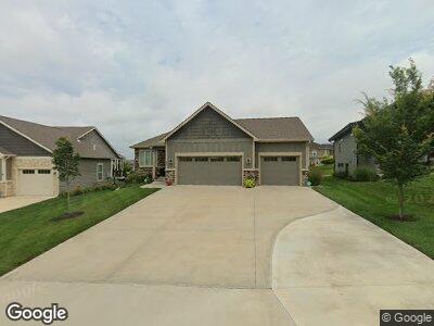
430 Freemont Dr Unit Freemont Lawrence, KS 66049
Gateway NeighborhoodEstimated Value: $593,000 - $619,000
4
Beds
3
Baths
1,621
Sq Ft
$373/Sq Ft
Est. Value
About This Home
This home is located at 430 Freemont Dr Unit Freemont, Lawrence, KS 66049 and is currently estimated at $604,996, approximately $373 per square foot. 430 Freemont Dr Unit Freemont is a home located in Douglas County with nearby schools including Langston Hughes Elementary School, Southwest Middle School, and Lawrence Free State High School.
Ownership History
Date
Name
Owned For
Owner Type
Purchase Details
Closed on
Oct 1, 2018
Sold by
R & H Builders Incorporated
Bought by
Littleton Family Trust
Current Estimated Value
Home Financials for this Owner
Home Financials are based on the most recent Mortgage that was taken out on this home.
Original Mortgage
$75,000
Outstanding Balance
$67,464
Interest Rate
4.8%
Mortgage Type
Commercial
Purchase Details
Closed on
Aug 31, 2017
Sold by
Oregon Trall Holdings Llc
Bought by
R & H Builders Cin
Create a Home Valuation Report for This Property
The Home Valuation Report is an in-depth analysis detailing your home's value as well as a comparison with similar homes in the area
Home Values in the Area
Average Home Value in this Area
Purchase History
| Date | Buyer | Sale Price | Title Company |
|---|---|---|---|
| Littleton Family Trust | -- | Continental Title | |
| R & H Builders Cin | -- | Kansas Secured Title |
Source: Public Records
Mortgage History
| Date | Status | Borrower | Loan Amount |
|---|---|---|---|
| Open | Littleton Brent L | $75,000 | |
| Open | Littleton Family Trust | $357,600 | |
| Previous Owner | R & H Builders | $304,000 |
Source: Public Records
Tax History Compared to Growth
Tax History
| Year | Tax Paid | Tax Assessment Tax Assessment Total Assessment is a certain percentage of the fair market value that is determined by local assessors to be the total taxable value of land and additions on the property. | Land | Improvement |
|---|---|---|---|---|
| 2024 | $8,198 | $65,240 | $8,625 | $56,615 |
| 2023 | $7,938 | $61,272 | $8,050 | $53,222 |
| 2022 | $7,483 | $57,385 | $8,050 | $49,335 |
| 2021 | $6,955 | $51,842 | $7,820 | $44,022 |
| 2020 | $6,861 | $51,405 | $7,473 | $43,932 |
| 2019 | $6,854 | $51,405 | $7,473 | $43,932 |
| 2018 | $1,587 | $12,078 | $6,903 | $5,175 |
| 2017 | $985 | $7,204 | $7,204 | $0 |
| 2016 | $1,291 | $1,288 | $1,288 | $0 |
| 2015 | -- | $1,980 | $1,980 | $0 |
| 2014 | -- | $360 | $360 | $0 |
Source: Public Records
Map
Nearby Homes
- 5245 Overland Dr Unit D6
- 5245 Overland Dr
- 5714 Silverstone Dr
- 209 Eisenhower Dr
- 905 Wheaton Dr
- 5117 Parker Ct
- 5113 Parker Ct
- 5204 Deer Run Ct
- 1024 April Rain Rd
- 1032 Stonecreek Dr
- 6205 Blue Nile Dr
- 969 Coving Dr
- 6204 Berando Ct
- 5719 Plymouth Dr
- 237 Landon Ct
- 5012 Congressional Way
- 0 E 902 Rd Unit 158902
- 1008 N 1700 Rd
- 1108 Brynwood Ct
- 225 Landon Ct
- 430 Freemont Dr
- 430 Freemont Dr Unit Freemont
- 434 Freemont Dr
- 426 Freemont Dr
- 438 Freemont Dr
- 422 Freemont Dr
- 411 Fort Laramie Dr
- 429 Freemont Dr
- 343 Headwaters Dr
- 418 Freemont Dr
- 423 Freemont Dr
- 415 Fort Laramie Dr
- 339 Sawhill Dr
- 437 Freemont Dr
- 407 Fort Laramie Dr
- 339 Headwaters Dr
- 414 Freemont Dr
- 347 Headwaters Dr
- 5753 Chimney Rocks Cir
- 335 Sawhill Dr