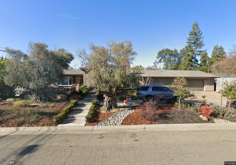
4301 Virgusell Cir Carmichael, CA 95608
Del Paso Vale NeighborhoodEstimated Value: $625,000 - $687,326
3
Beds
2
Baths
2,380
Sq Ft
$272/Sq Ft
Est. Value
About This Home
This home is located at 4301 Virgusell Cir, Carmichael, CA 95608 and is currently estimated at $647,582, approximately $272 per square foot. 4301 Virgusell Cir is a home located in Sacramento County with nearby schools including Cameron Ranch Elementary School, Winston Churchill Middle School, and Mira Loma High School.
Ownership History
Date
Name
Owned For
Owner Type
Purchase Details
Closed on
Jun 22, 2004
Sold by
Mcclain Linda and Dickson David
Bought by
Dickson David and Mcconnell Tami
Current Estimated Value
Home Financials for this Owner
Home Financials are based on the most recent Mortgage that was taken out on this home.
Original Mortgage
$150,000
Interest Rate
6.29%
Mortgage Type
New Conventional
Purchase Details
Closed on
May 19, 1995
Sold by
Dickson Karla Janet and Nelson Karla J
Bought by
Dickson Mickey Preston and Dickson Karla Janet
Create a Home Valuation Report for This Property
The Home Valuation Report is an in-depth analysis detailing your home's value as well as a comparison with similar homes in the area
Home Values in the Area
Average Home Value in this Area
Purchase History
| Date | Buyer | Sale Price | Title Company |
|---|---|---|---|
| Dickson David | -- | Financial Title Company | |
| Dickson Mickey Preston | -- | -- |
Source: Public Records
Mortgage History
| Date | Status | Borrower | Loan Amount |
|---|---|---|---|
| Closed | Dickson David | $150,000 |
Source: Public Records
Tax History
| Year | Tax Paid | Tax Assessment Tax Assessment Total Assessment is a certain percentage of the fair market value that is determined by local assessors to be the total taxable value of land and additions on the property. | Land | Improvement |
|---|---|---|---|---|
| 2025 | $2,706 | $236,001 | $24,055 | $211,946 |
| 2024 | $2,706 | $231,375 | $23,584 | $207,791 |
| 2023 | $2,635 | $226,839 | $23,122 | $203,717 |
| 2022 | $2,620 | $222,392 | $22,669 | $199,723 |
| 2021 | $2,575 | $218,032 | $22,225 | $195,807 |
| 2020 | $2,526 | $215,798 | $21,998 | $193,800 |
| 2019 | $2,474 | $211,567 | $21,567 | $190,000 |
| 2018 | $2,444 | $207,420 | $21,145 | $186,275 |
| 2017 | $1,540 | $131,589 | $20,731 | $110,858 |
| 2016 | $1,437 | $129,010 | $20,325 | $108,685 |
| 2015 | $1,411 | $127,073 | $20,020 | $107,053 |
| 2014 | $1,380 | $124,584 | $19,628 | $104,956 |
Source: Public Records
Map
Nearby Homes
- 5258 Woodvale Way
- 4312 Virgusell Cir
- 4343 Virgusell Cir
- 5412 Wildflower Cir
- 5424 Valhalla Dr
- 4221 Waymar Ct
- 5107 Bellwood Way
- 4141 Walnut Ave
- 4524 Bela Way
- 5500 Stately Oak Ln
- 5531 Cypress Ave
- 4016 Knoll Top Ct
- 5443 Aris Way
- 4007 Oak Villa Cir
- 5004 Cypress Ave
- 3923 Oak Villa Cir
- 5213 Gibbons Dr
- 5622 Cypress Ave
- 4941 Wendy Ct
- 4448 Hackberry Ln
- 5249 Locust Ave
- 5266 Woodvale Way
- 4300 Virgusell Cir
- 4242 Pueblo St
- 4306 Virgusell Cir
- 5241 Locust Ave
- 5261 Bellwood Way
- 5246 Locust Ave
- 5253 Bellwood Way
- 4238 Pueblo St
- 5309 Locust Ave
- 5240 Locust Ave
- 5308 Locust Ave
- 5250 Woodvale Way
- 4313 Virgusell Cir
- 4234 Pueblo St
- 5234 Locust Ave
- 5312 Locust Ave
- 5485 Wildflower Cir
- 5247 Norcrest Ave
Your Personal Tour Guide
Ask me questions while you tour the home.