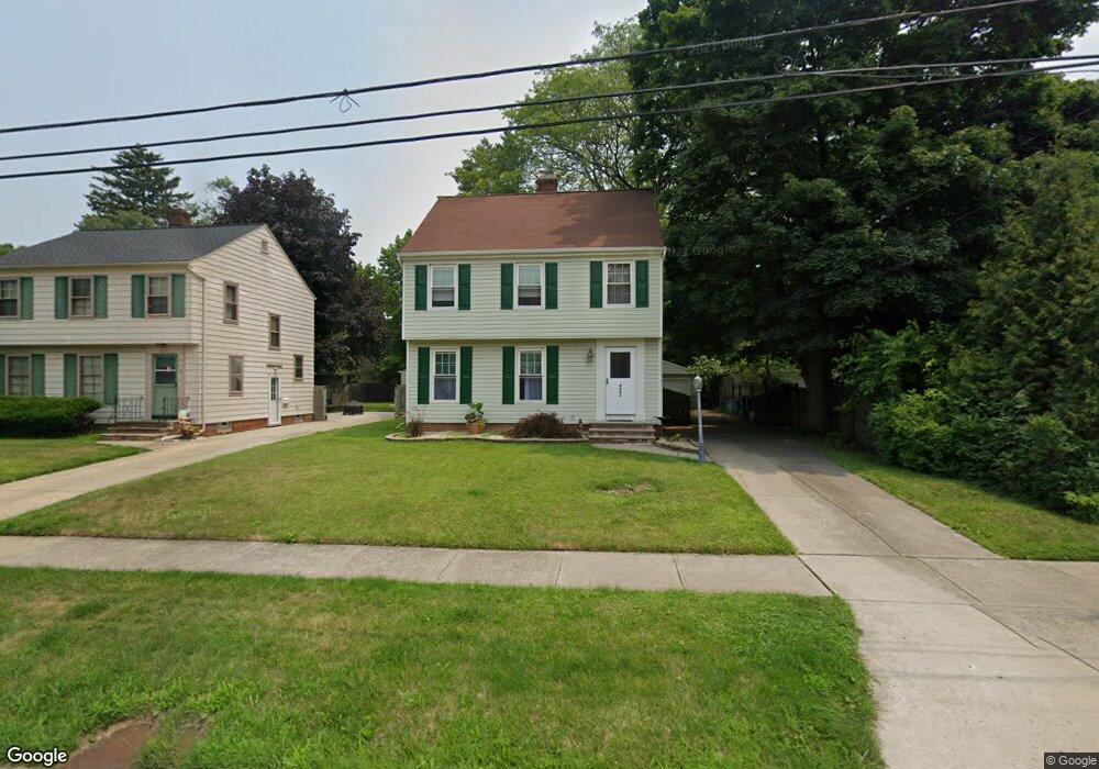
4305 W 204th St Cleveland, OH 44126
Estimated Value: $239,000 - $261,052
3
Beds
1
Bath
1,274
Sq Ft
$198/Sq Ft
Est. Value
About This Home
This home is located at 4305 W 204th St, Cleveland, OH 44126 and is currently estimated at $252,263, approximately $198 per square foot. 4305 W 204th St is a home located in Cuyahoga County with nearby schools including Gilles-Sweet Elementary School, Lewis F Mayer Middle School, and Fairview High School.
Ownership History
Date
Name
Owned For
Owner Type
Purchase Details
Closed on
May 13, 1994
Sold by
Friend Richard N
Bought by
Leisinger Maureen
Current Estimated Value
Purchase Details
Closed on
Dec 22, 1992
Sold by
Windt Gary L and Mary Lou
Bought by
Friend Richard N
Purchase Details
Closed on
Aug 1, 1975
Sold by
Daniels James A
Bought by
Windt Gary L and Mary Lou
Purchase Details
Closed on
Jan 1, 1975
Bought by
Daniels James A
Create a Home Valuation Report for This Property
The Home Valuation Report is an in-depth analysis detailing your home's value as well as a comparison with similar homes in the area
Home Values in the Area
Average Home Value in this Area
Purchase History
| Date | Buyer | Sale Price | Title Company |
|---|---|---|---|
| Leisinger Maureen | $114,500 | -- | |
| Friend Richard N | $96,000 | -- | |
| Windt Gary L | $36,500 | -- | |
| Daniels James A | -- | -- |
Source: Public Records
Tax History Compared to Growth
Tax History
| Year | Tax Paid | Tax Assessment Tax Assessment Total Assessment is a certain percentage of the fair market value that is determined by local assessors to be the total taxable value of land and additions on the property. | Land | Improvement |
|---|---|---|---|---|
| 2024 | $5,177 | $74,900 | $13,510 | $61,390 |
| 2023 | $5,299 | $65,840 | $12,110 | $53,730 |
| 2022 | $5,168 | $65,840 | $12,110 | $53,730 |
| 2021 | $5,277 | $65,840 | $12,110 | $53,730 |
| 2020 | $4,855 | $53,100 | $9,770 | $43,330 |
| 2019 | $4,316 | $151,700 | $27,900 | $123,800 |
| 2018 | $4,204 | $53,100 | $9,770 | $43,330 |
| 2017 | $4,284 | $48,730 | $8,720 | $40,010 |
| 2016 | $4,256 | $48,730 | $8,720 | $40,010 |
| 2015 | $4,019 | $48,730 | $8,720 | $40,010 |
| 2014 | $4,019 | $46,420 | $8,300 | $38,120 |
Source: Public Records
Map
Nearby Homes
- 20187 Grannis Rd
- 4348 W 202nd St
- 20663 Woodstock Ave
- 20778 Woodstock Ave
- 20877 Fairpark Dr
- 19640 Lorain Rd
- 4336 W 196th St
- 21143 Westwood Rd
- 4352 W 211th St
- 19510 Lorain Rd Unit 201
- 21237 Westwood Rd
- 21236 Northwood Ave
- 19270 Lorain Rd
- 3712 Addington Ct
- 19575 Henry Rd
- 4291 W 215th St
- 19190 S Sagamore Rd
- 3420 W 210th St
- 4298 W 215th St
- 3340 W 210th St
- 4299 W 204th St
- 4289 W 204th St
- 4279 W 204th St
- 20312 Lorain Rd Unit 309
- 20312 Lorain Rd Unit 116
- 20312 Lorain Rd
- 20312 Lorain Rd Unit 206
- 20312 Lorain Rd Unit 209
- 20312 Lorain Rd Unit 310
- 20312 Lorain Rd Unit 104
- 20312 Lorain Rd Unit 102
- 20312 Lorain Rd Unit 312
- 20312 Lorain Rd Unit 203
- 20312 Lorain Rd Unit 305
- 20312 Lorain Rd Unit 201
- 20312 Lorain Rd Unit 303
- 20312 Lorain Rd
- 20312 Lorain Rd Unit 213
- 20312 Lorain Rd Unit 215
- 20312 Lorain Rd Unit 115