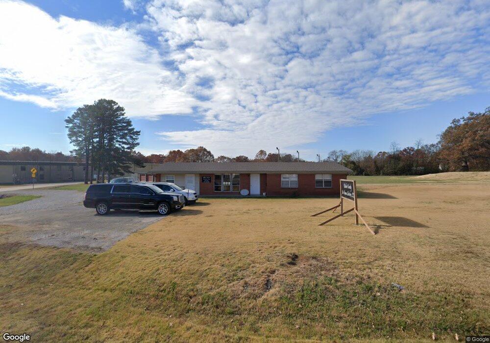
4310 Highway Pp Poplar Bluff, MO 63901
Estimated Value: $161,001 - $226,000
--
Bed
--
Bath
1,642
Sq Ft
$117/Sq Ft
Est. Value
About This Home
This home is located at 4310 Highway Pp, Poplar Bluff, MO 63901 and is currently estimated at $192,750, approximately $117 per square foot. 4310 Highway Pp is a home located in Butler County with nearby schools including Oak Grove Elementary School, Poplar Bluff Fifth & Sixth Grade Center, and Poplar Bluff Junior High School.
Ownership History
Date
Name
Owned For
Owner Type
Purchase Details
Closed on
Dec 17, 2018
Sold by
Sells Management Company Inc
Bought by
Jones David E and Jones Cheryl A
Current Estimated Value
Purchase Details
Closed on
Jan 14, 2015
Sold by
Boyers Steven D and K M W Irrevocable Living Trust
Bought by
Sells Ron
Home Financials for this Owner
Home Financials are based on the most recent Mortgage that was taken out on this home.
Original Mortgage
$110,000
Interest Rate
3.93%
Mortgage Type
Future Advance Clause Open End Mortgage
Purchase Details
Closed on
Jul 17, 2007
Sold by
Casey John and Casey Earlene
Bought by
Boyers Steven D and Kmw Irrevocable Living Trust
Home Financials for this Owner
Home Financials are based on the most recent Mortgage that was taken out on this home.
Original Mortgage
$136,990
Interest Rate
6.73%
Mortgage Type
Future Advance Clause Open End Mortgage
Create a Home Valuation Report for This Property
The Home Valuation Report is an in-depth analysis detailing your home's value as well as a comparison with similar homes in the area
Home Values in the Area
Average Home Value in this Area
Purchase History
| Date | Buyer | Sale Price | Title Company |
|---|---|---|---|
| Jones David E | -- | Heritage Title Company | |
| Sells Ron | -- | None Available | |
| Boyers Steven D | -- | -- |
Source: Public Records
Mortgage History
| Date | Status | Borrower | Loan Amount |
|---|---|---|---|
| Previous Owner | Sells Ron | $110,000 | |
| Previous Owner | Boyers Steven D | $136,990 |
Source: Public Records
Tax History Compared to Growth
Tax History
| Year | Tax Paid | Tax Assessment Tax Assessment Total Assessment is a certain percentage of the fair market value that is determined by local assessors to be the total taxable value of land and additions on the property. | Land | Improvement |
|---|---|---|---|---|
| 2024 | $9 | $20,320 | $0 | $0 |
| 2023 | $905 | $20,320 | $0 | $0 |
| 2022 | $885 | $19,910 | $0 | $0 |
| 2021 | $885 | $19,910 | $0 | $0 |
| 2020 | $1,159 | $24,960 | $0 | $0 |
| 2019 | $860 | $24,960 | $0 | $0 |
| 2018 | $860 | $19,070 | $0 | $0 |
| 2017 | -- | $19,070 | $0 | $0 |
| 2016 | -- | $19,360 | $0 | $0 |
| 2015 | -- | $19,360 | $0 | $0 |
| 2014 | -- | $22,390 | $0 | $0 |
| 2012 | $853 | $22,390 | $0 | $0 |
Source: Public Records
Map
Nearby Homes
- 103 Lincoln Dr
- 2163 Township Line Rd
- 547 County Road 448
- 135 County Road 4415
- 46 Red Cedar Blvd
- 6115 Greenbriar Dr
- 1149 Mistletoe Ln
- 148 County Road 4421
- 383 Golden Ln
- 1460 Victoria Rd
- 381 Golden Ln
- 54 Century Ave Unit 54
- 53 Century Ave Unit 53
- Lot 11 Timber Way Dr
- 223 Timberway Dr
- 210 Berkshire Dr
- 5100 Crabapple Ln
- 267 Misty Lake Rd
- 5711 Cedar Valley Dr
- 5705 Cedar Valley Dr
- 4310 State Highway Pp
- 1 County Road 448
- 3 County Road 448
- 16 County Road 448
- 7 County Road 448
- 6 County Road 448
- 4 County Road 448
- 0 Cr 448 (Miller Road) Unit 9928266
- 4358 Highway Pp
- 4358 Highway Pp
- 4345 Highway Pp
- 2611 Township Line Rd
- 0 County Road 441
- 0 Township Line Rd
- 187 County Road 448
- 5808 Quail Meadows Dr
- 2457 Township Line Rd
- 2APTS County Road 448
- 5811 Quail Meadows Dr
- 4803 West Blvd