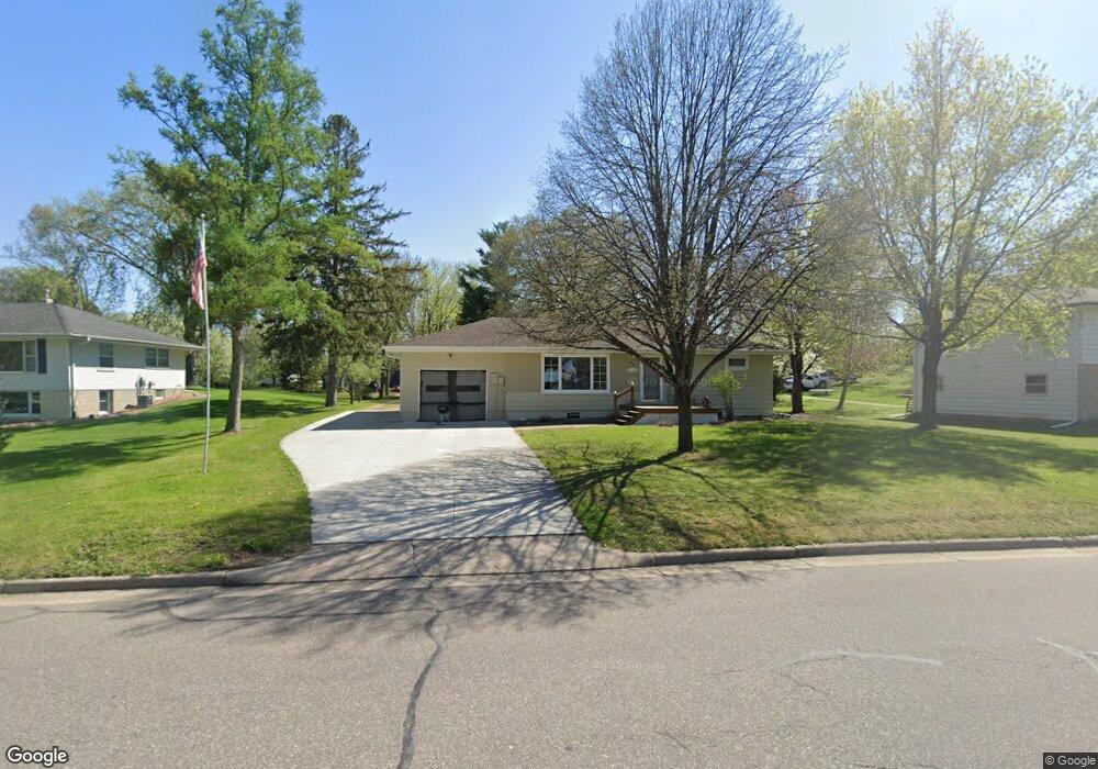
433 Elm Ave E Delano, MN 55328
Estimated Value: $276,000 - $299,000
5
Beds
2
Baths
1,052
Sq Ft
$273/Sq Ft
Est. Value
About This Home
This home is located at 433 Elm Ave E, Delano, MN 55328 and is currently estimated at $287,013, approximately $272 per square foot. 433 Elm Ave E is a home located in Wright County with nearby schools including Delano Elementary School, Delano Middle School, and Delano Senior High School.
Ownership History
Date
Name
Owned For
Owner Type
Purchase Details
Closed on
Aug 2, 2023
Sold by
Howes Martin and Howes Christine
Bought by
Howes Jonathan
Current Estimated Value
Home Financials for this Owner
Home Financials are based on the most recent Mortgage that was taken out on this home.
Original Mortgage
$226,400
Outstanding Balance
$221,105
Interest Rate
6.67%
Mortgage Type
New Conventional
Estimated Equity
$65,908
Purchase Details
Closed on
Aug 1, 2022
Sold by
Howes Martin and Howes Christine
Bought by
Howes Jonathan
Create a Home Valuation Report for This Property
The Home Valuation Report is an in-depth analysis detailing your home's value as well as a comparison with similar homes in the area
Home Values in the Area
Average Home Value in this Area
Purchase History
| Date | Buyer | Sale Price | Title Company |
|---|---|---|---|
| Howes Jonathan | $250,000 | -- | |
| Pj Property Group Llc | $283,000 | -- | |
| Howes Jonathan | $250,000 | -- |
Source: Public Records
Mortgage History
| Date | Status | Borrower | Loan Amount |
|---|---|---|---|
| Open | Pj Property Group Llc | $226,400 |
Source: Public Records
Tax History
| Year | Tax Paid | Tax Assessment Tax Assessment Total Assessment is a certain percentage of the fair market value that is determined by local assessors to be the total taxable value of land and additions on the property. | Land | Improvement |
|---|---|---|---|---|
| 2025 | $3,146 | $261,700 | $77,000 | $184,700 |
| 2024 | $2,786 | $259,900 | $81,000 | $178,900 |
| 2023 | $2,786 | $253,600 | $80,000 | $173,600 |
| 2022 | $2,468 | $233,800 | $73,000 | $160,800 |
| 2021 | $2,344 | $188,000 | $56,000 | $132,000 |
| 2020 | $2,338 | $178,700 | $51,000 | $127,700 |
| 2019 | $2,352 | $171,600 | $0 | $0 |
| 2018 | $2,234 | $145,700 | $0 | $0 |
| 2017 | $2,090 | $137,100 | $0 | $0 |
| 2016 | $2,070 | $0 | $0 | $0 |
| 2015 | $1,618 | $0 | $0 | $0 |
| 2014 | -- | $0 | $0 | $0 |
Source: Public Records
Map
Nearby Homes
- 408 2nd St N
- 217 Franklin Ave E
- 113 3rd St S
- 575 Bonita Cir
- 428 Saint Peter Ave E
- 679 Marsh Dr
- 158 Kings Pointe Dr
- 309 4th St S
- 942 Crossing Way
- 124 Oak Ridge Dr
- 982 Crossing Way
- 628 Goldenrod Ct
- 955 Crossings Way
- 737 Elm Ave E
- 1253 Willowbrook Cir
- 1257 Willowbrook Cir
- xxxx Lincoln St
- 200 Franklin Ave W
- 217 2nd St SW
- 1333 Vixen Ln
Your Personal Tour Guide
Ask me questions while you tour the home.