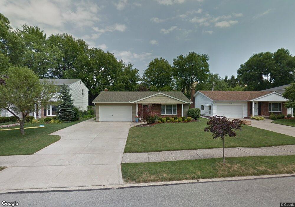
4369 W 202nd St Cleveland, OH 44126
Estimated Value: $270,000 - $328,000
3
Beds
2
Baths
1,488
Sq Ft
$197/Sq Ft
Est. Value
About This Home
This home is located at 4369 W 202nd St, Cleveland, OH 44126 and is currently estimated at $293,096, approximately $196 per square foot. 4369 W 202nd St is a home located in Cuyahoga County with nearby schools including Gilles-Sweet Elementary School, Lewis F Mayer Middle School, and Fairview High School.
Ownership History
Date
Name
Owned For
Owner Type
Purchase Details
Closed on
Feb 22, 2005
Sold by
Koster Barbara L and Koster Jeffrey A
Bought by
Koster Jeffrey A and Koster Barbara L
Current Estimated Value
Purchase Details
Closed on
Aug 14, 2002
Sold by
Valco Jerome R and Valco Magda E
Bought by
Woodford Barbara L
Home Financials for this Owner
Home Financials are based on the most recent Mortgage that was taken out on this home.
Original Mortgage
$115,000
Outstanding Balance
$48,975
Interest Rate
6.64%
Estimated Equity
$244,121
Purchase Details
Closed on
Oct 14, 1987
Sold by
Schneider Ann M
Bought by
Valco Jerome R
Purchase Details
Closed on
Jan 1, 1975
Bought by
Schneider Ann M
Create a Home Valuation Report for This Property
The Home Valuation Report is an in-depth analysis detailing your home's value as well as a comparison with similar homes in the area
Home Values in the Area
Average Home Value in this Area
Purchase History
| Date | Buyer | Sale Price | Title Company |
|---|---|---|---|
| Koster Jeffrey A | -- | -- | |
| Woodford Barbara L | $165,000 | Real Living Title Agency Ltd | |
| Valco Jerome R | $95,000 | -- | |
| Schneider Ann M | -- | -- |
Source: Public Records
Mortgage History
| Date | Status | Borrower | Loan Amount |
|---|---|---|---|
| Open | Woodford Barbara L | $115,000 |
Source: Public Records
Tax History Compared to Growth
Tax History
| Year | Tax Paid | Tax Assessment Tax Assessment Total Assessment is a certain percentage of the fair market value that is determined by local assessors to be the total taxable value of land and additions on the property. | Land | Improvement |
|---|---|---|---|---|
| 2024 | $5,342 | $87,115 | $22,190 | $64,925 |
| 2023 | $5,097 | $72,350 | $16,770 | $55,580 |
| 2022 | $5,004 | $72,350 | $16,770 | $55,580 |
| 2021 | $5,109 | $72,350 | $16,770 | $55,580 |
| 2020 | $4,858 | $61,810 | $14,320 | $47,500 |
| 2019 | $4,320 | $176,600 | $40,900 | $135,700 |
| 2018 | $4,201 | $61,810 | $14,320 | $47,500 |
| 2017 | $4,273 | $57,270 | $11,870 | $45,400 |
| 2016 | $4,245 | $57,270 | $11,870 | $45,400 |
| 2015 | $3,973 | $57,270 | $11,870 | $45,400 |
| 2014 | $3,973 | $54,540 | $11,310 | $43,230 |
Source: Public Records
Map
Nearby Homes
- 4348 W 202nd St
- 20187 Grannis Rd
- 20663 Woodstock Ave
- 19640 Lorain Rd
- 4336 W 196th St
- 20778 Woodstock Ave
- 19510 Lorain Rd Unit 201
- 19270 Lorain Rd
- 19575 Henry Rd
- 20877 Fairpark Dr
- 21143 Westwood Rd
- 19190 S Sagamore Rd
- 21236 Northwood Ave
- 4352 W 211th St
- 21237 Westwood Rd
- 3712 Addington Ct
- 3420 W 210th St
- 3167 Linden Rd Unit 503
- 3167 Linden Rd Unit 309
- 3167 Linden Rd Unit 103
- 4377 W 202nd St
- 4361 W 202nd St
- 4353 W 202nd St
- 4385 W 202nd St
- 4376 W 202nd St
- 4349 W 202nd St
- 4368 W 202nd St
- 4380 W 202nd St
- 4360 W 202nd St
- 4384 W 202nd St
- 4341 W 202nd St
- 4352 W 202nd St
- 4386 W 202nd St
- 20163 Grannis Rd Unit 7
- 20127 Grannis Rd
- 20163 Grannis Rd
- 20157 Grannis Rd
- 20127 Grannis Rd Unit 13
- 20157 Grannis Rd Unit 8
- 4333 W 202nd St