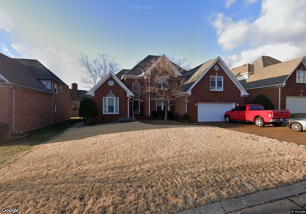
439 Forrest Park Cir Franklin, TN 37064
McEwen NeighborhoodEstimated Value: $730,156 - $810,000
--
Bed
4
Baths
2,618
Sq Ft
$298/Sq Ft
Est. Value
About This Home
This home is located at 439 Forrest Park Cir, Franklin, TN 37064 and is currently estimated at $779,539, approximately $297 per square foot. 439 Forrest Park Cir is a home located in Williamson County with nearby schools including Moore Elementary School, Freedom Intermediate School, and Freedom Middle School.
Ownership History
Date
Name
Owned For
Owner Type
Purchase Details
Closed on
Apr 30, 1998
Sold by
Steven Tinney Richard and Emily Mary
Bought by
Weber Steven Brian and Weber Jenni A
Current Estimated Value
Home Financials for this Owner
Home Financials are based on the most recent Mortgage that was taken out on this home.
Original Mortgage
$188,700
Outstanding Balance
$35,602
Interest Rate
7.03%
Estimated Equity
$743,937
Create a Home Valuation Report for This Property
The Home Valuation Report is an in-depth analysis detailing your home's value as well as a comparison with similar homes in the area
Home Values in the Area
Average Home Value in this Area
Purchase History
| Date | Buyer | Sale Price | Title Company |
|---|---|---|---|
| Weber Steven Brian | $235,900 | Southland Title & Escrow Co |
Source: Public Records
Mortgage History
| Date | Status | Borrower | Loan Amount |
|---|---|---|---|
| Open | Weber Steven Brian | $188,700 |
Source: Public Records
Tax History Compared to Growth
Tax History
| Year | Tax Paid | Tax Assessment Tax Assessment Total Assessment is a certain percentage of the fair market value that is determined by local assessors to be the total taxable value of land and additions on the property. | Land | Improvement |
|---|---|---|---|---|
| 2025 | $3,348 | $180,050 | $52,500 | $127,550 |
| 2024 | $3,348 | $118,250 | $22,500 | $95,750 |
| 2023 | $3,218 | $118,250 | $22,500 | $95,750 |
| 2022 | $3,218 | $118,250 | $22,500 | $95,750 |
| 2021 | $3,218 | $118,250 | $22,500 | $95,750 |
| 2020 | $2,982 | $92,400 | $21,250 | $71,150 |
| 2019 | $2,982 | $92,400 | $21,250 | $71,150 |
| 2018 | $2,917 | $92,400 | $21,250 | $71,150 |
| 2017 | $2,871 | $92,400 | $21,250 | $71,150 |
| 2016 | $2,861 | $92,400 | $21,250 | $71,150 |
| 2015 | -- | $73,600 | $18,750 | $54,850 |
| 2014 | -- | $73,600 | $18,750 | $54,850 |
Source: Public Records
Map
Nearby Homes
- 515 Forrest Park Cir
- 500 Forrest Park Cir
- 512 Riverview Dr
- 505 Overview Ln
- 165 Rivergate Dr
- 208 Turnbrook Ln
- 1628 Forrest Crossing Blvd
- 425 Chelsey Cove
- 1107 Culpepper Cir
- 3465 Carothers Pkwy
- 2073 Roderick Cir
- 318 Meadowglade Ln
- 1107 Gardner Dr
- 454 River Bluff Dr
- 812 Hartington Ct
- 3012 Braidwood Ln
- 2056 Braidwood Ln
- 3013 Natures Landing Dr
- 2216 Falcon Creek Dr
- 545 Sydenham Dr
- 443 Forrest Park Cir
- 431 Forrest Park Cir
- 720 Hampton Cove
- 427 Forrest Park Cir
- 716 Hampton Cove
- 451 Forrest Park Cir
- 447 Forrest Park Cir
- 725 Hampton Cove
- 438 Forrest Park Cir
- 423 Forrest Park Cir
- 434 Forrest Park Cir
- 455 Forrest Park Cir
- 712 Hampton Cove
- 430 Forrest Park Cir
- 721 Hampton Cove
- 620 Hampton Ct
- 444 Forrest Park Cir
- 624 Hampton Ct
- 419 Forrest Park Cir