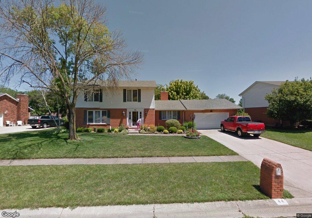
44 Lora Ln Hamilton, OH 45013
Estimated Value: $394,706 - $449,000
4
Beds
4
Baths
3,212
Sq Ft
$129/Sq Ft
Est. Value
About This Home
This home is located at 44 Lora Ln, Hamilton, OH 45013 and is currently estimated at $414,677, approximately $129 per square foot. 44 Lora Ln is a home located in Butler County with nearby schools including Bridgeport Elementary School, Wilson Middle School, and Hamilton High School Main Campus.
Ownership History
Date
Name
Owned For
Owner Type
Purchase Details
Closed on
Jun 14, 2010
Sold by
Mignery Mark E and Mignery Alison N
Bought by
Dole Douglas H and Dole Cheryl L
Current Estimated Value
Purchase Details
Closed on
Aug 16, 2005
Sold by
U S Bank Na
Bought by
Mignery Mark E and Mignery Alison N
Home Financials for this Owner
Home Financials are based on the most recent Mortgage that was taken out on this home.
Original Mortgage
$115,000
Interest Rate
5.8%
Mortgage Type
Fannie Mae Freddie Mac
Purchase Details
Closed on
Oct 15, 1999
Sold by
Spiegel Howard K and Spiegel Janice M
Bought by
Shelton & Sons Inc
Purchase Details
Closed on
Jan 1, 1988
Purchase Details
Closed on
Mar 1, 1987
Create a Home Valuation Report for This Property
The Home Valuation Report is an in-depth analysis detailing your home's value as well as a comparison with similar homes in the area
Home Values in the Area
Average Home Value in this Area
Purchase History
| Date | Buyer | Sale Price | Title Company |
|---|---|---|---|
| Dole Douglas H | $198,500 | None Available | |
| Mignery Mark E | $185,000 | -- | |
| Shelton & Sons Inc | $183,000 | -- | |
| -- | $119,000 | -- | |
| -- | $108,000 | -- |
Source: Public Records
Mortgage History
| Date | Status | Borrower | Loan Amount |
|---|---|---|---|
| Previous Owner | Mignery Mark E | $115,000 |
Source: Public Records
Tax History
| Year | Tax Paid | Tax Assessment Tax Assessment Total Assessment is a certain percentage of the fair market value that is determined by local assessors to be the total taxable value of land and additions on the property. | Land | Improvement |
|---|---|---|---|---|
| 2025 | $4,097 | $106,590 | $15,060 | $91,530 |
| 2024 | $4,097 | $106,590 | $15,060 | $91,530 |
| 2023 | $4,092 | $106,590 | $15,060 | $91,530 |
| 2022 | $3,728 | $78,760 | $15,060 | $63,700 |
| 2021 | $3,049 | $76,080 | $15,060 | $61,020 |
| 2020 | $3,176 | $76,080 | $15,060 | $61,020 |
| 2019 | $4,879 | $66,640 | $14,840 | $51,800 |
| 2018 | $2,691 | $66,640 | $14,840 | $51,800 |
| 2017 | $2,714 | $66,640 | $14,840 | $51,800 |
| 2016 | $2,823 | $66,140 | $14,840 | $51,300 |
| 2015 | $2,808 | $66,140 | $14,840 | $51,300 |
| 2014 | $2,494 | $66,140 | $14,840 | $51,300 |
| 2013 | $2,494 | $63,030 | $14,840 | $48,190 |
Source: Public Records
Map
Nearby Homes
- 1319 Peregrine Way
- 1331 Peregrine Way
- 22 Hughes Ct
- 548 Shultz Dr
- 850 NW Washington Blvd
- 1365 Taft Place
- 3 Amanda Ct
- 124 Gregory Ln
- 15 Amanda Ct
- 1210 Stephanie Dr
- 1210 Stephanie Dr Unit 3
- 1754 Thall Dr
- 1192 Deerfield Cir Unit 35
- 1683 Thall Dr
- 1460 Lawrence Ave
- 1420 Alexander Dr
- 1401 Park Ave
- 450 Hamilton View
- 458 Hamilton View
- 466 Hamilton View Dr
Your Personal Tour Guide
Ask me questions while you tour the home.