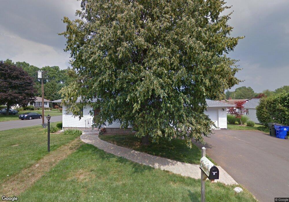
44 Yale St Wethersfield, CT 06109
Estimated Value: $326,000 - $369,000
3
Beds
2
Baths
1,162
Sq Ft
$295/Sq Ft
Est. Value
About This Home
This home is located at 44 Yale St, Wethersfield, CT 06109 and is currently estimated at $342,850, approximately $295 per square foot. 44 Yale St is a home located in Hartford County with nearby schools including Emerson-Williams School, Silas Deane Middle School, and Wethersfield High School.
Ownership History
Date
Name
Owned For
Owner Type
Purchase Details
Closed on
May 2, 2023
Sold by
Brunelle Rolande M
Bought by
Rolande M Brunelle Ret and Brunelle
Current Estimated Value
Purchase Details
Closed on
Mar 28, 2008
Sold by
Gajda Casimir Est and Lania
Bought by
Brunelle Rolande M
Home Financials for this Owner
Home Financials are based on the most recent Mortgage that was taken out on this home.
Original Mortgage
$93,000
Interest Rate
5.76%
Mortgage Type
Purchase Money Mortgage
Create a Home Valuation Report for This Property
The Home Valuation Report is an in-depth analysis detailing your home's value as well as a comparison with similar homes in the area
Home Values in the Area
Average Home Value in this Area
Purchase History
| Date | Buyer | Sale Price | Title Company |
|---|---|---|---|
| Rolande M Brunelle Ret | -- | None Available | |
| Brunelle Rolande M | $215,000 | -- |
Source: Public Records
Mortgage History
| Date | Status | Borrower | Loan Amount |
|---|---|---|---|
| Previous Owner | Brunelle Rolande M | $80,500 | |
| Previous Owner | Brunelle Rolande M | $60,000 | |
| Previous Owner | Brunelle Rolande M | $90,000 | |
| Previous Owner | Brunelle Rolande M | $93,000 |
Source: Public Records
Tax History
| Year | Tax Paid | Tax Assessment Tax Assessment Total Assessment is a certain percentage of the fair market value that is determined by local assessors to be the total taxable value of land and additions on the property. | Land | Improvement |
|---|---|---|---|---|
| 2025 | $8,731 | $211,820 | $72,830 | $138,990 |
| 2024 | $6,817 | $157,720 | $72,100 | $85,620 |
| 2023 | $6,590 | $157,720 | $72,100 | $85,620 |
| 2022 | $6,479 | $157,720 | $72,100 | $85,620 |
| 2021 | $6,414 | $157,720 | $72,100 | $85,620 |
| 2020 | $6,418 | $157,720 | $72,100 | $85,620 |
| 2019 | $6,426 | $157,720 | $72,100 | $85,620 |
| 2018 | $6,651 | $163,100 | $71,800 | $91,300 |
| 2017 | $6,486 | $163,100 | $71,800 | $91,300 |
| 2016 | $6,286 | $163,100 | $71,800 | $91,300 |
| 2015 | $6,229 | $163,100 | $71,800 | $91,300 |
| 2014 | $5,992 | $163,100 | $71,800 | $91,300 |
Source: Public Records
Map
Nearby Homes
- 295 Ridge Rd Unit 8
- 1 Bristol St
- 19 Albert Ave
- 192 Wolcott Hill Rd
- 20 Forest Dr
- 273 Forest Dr
- 764 Ridge Rd
- 173 Timber Trail
- 219-221 Jordan Ln
- 23 Hillcrest Ave
- 158 Dix Rd
- 129 Goff Rd
- 35 Kingston St
- 87 Somerset St
- 137 Dale Rd
- 91 Somerset St
- 18 Avalon Place
- 455 Brimfield Rd
- 15 Potter Crossing
- 62 Schoolhouse Crossing
Your Personal Tour Guide
Ask me questions while you tour the home.