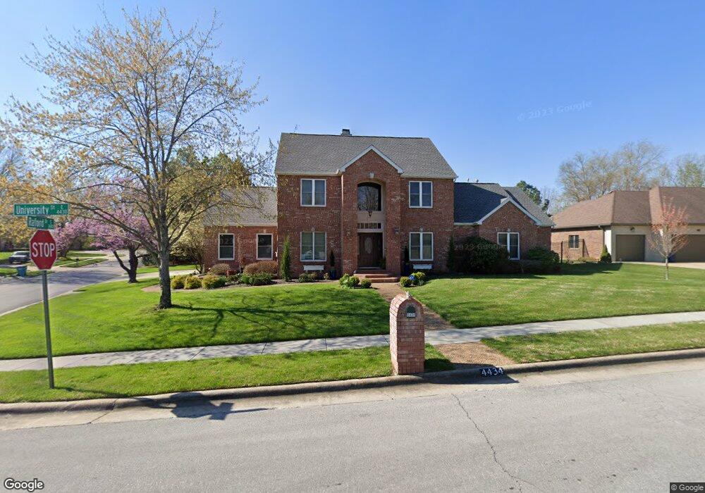
4434 E University St Springfield, MO 65809
Southeast Springfield NeighborhoodEstimated Value: $516,000 - $592,000
4
Beds
3
Baths
3,398
Sq Ft
$163/Sq Ft
Est. Value
About This Home
This home is located at 4434 E University St, Springfield, MO 65809 and is currently estimated at $554,672, approximately $163 per square foot. 4434 E University St is a home located in Greene County with nearby schools including Wilder Elementary School, Glendale High School, and Grace Classical Academy.
Ownership History
Date
Name
Owned For
Owner Type
Purchase Details
Closed on
Apr 27, 2015
Sold by
Boulware Kelly and Boulware Zachrey
Bought by
Nutt Leon and Killingsworth Roscoe
Current Estimated Value
Purchase Details
Closed on
Apr 4, 2007
Sold by
Sterling Rick L and Sterling Linda K
Bought by
Tinsley Scott B and Tinsley Marion Ann
Home Financials for this Owner
Home Financials are based on the most recent Mortgage that was taken out on this home.
Original Mortgage
$59,800
Interest Rate
5.91%
Mortgage Type
Stand Alone Second
Create a Home Valuation Report for This Property
The Home Valuation Report is an in-depth analysis detailing your home's value as well as a comparison with similar homes in the area
Home Values in the Area
Average Home Value in this Area
Purchase History
| Date | Buyer | Sale Price | Title Company |
|---|---|---|---|
| Nutt Leon | -- | None Available | |
| Tinsley Scott B | -- | None Available |
Source: Public Records
Mortgage History
| Date | Status | Borrower | Loan Amount |
|---|---|---|---|
| Previous Owner | Tinsley Scott B | $59,800 | |
| Previous Owner | Tinsley Scott B | $239,200 |
Source: Public Records
Tax History
| Year | Tax Paid | Tax Assessment Tax Assessment Total Assessment is a certain percentage of the fair market value that is determined by local assessors to be the total taxable value of land and additions on the property. | Land | Improvement |
|---|---|---|---|---|
| 2025 | $4,134 | $87,040 | $11,400 | $75,640 |
| 2024 | $4,134 | $74,250 | $7,600 | $66,650 |
| 2023 | $3,926 | $74,250 | $7,600 | $66,650 |
| 2022 | $2,924 | $53,870 | $7,600 | $46,270 |
| 2021 | $2,924 | $53,870 | $7,600 | $46,270 |
| 2020 | $3,066 | $53,870 | $7,600 | $46,270 |
| 2019 | $2,981 | $53,870 | $7,600 | $46,270 |
| 2018 | $2,688 | $48,580 | $7,600 | $40,980 |
| 2017 | $2,662 | $45,710 | $7,600 | $38,110 |
| 2016 | $2,504 | $45,710 | $7,600 | $38,110 |
| 2015 | $2,485 | $45,710 | $7,600 | $38,110 |
| 2014 | $2,279 | $43,660 | $7,600 | $36,060 |
Source: Public Records
Map
Nearby Homes
- 3706 E Linwood St
- 4103 E Crighton Place
- 4129 E Linwood St
- 1456 S Bright Oak Ave
- 4094 E Washita St
- 4308 E Catalpa St
- 4257 E Misty Woods St
- 2118 S Forrest Heights Ave
- Lot 12 S Markham Ct
- Tract 2 S Post Oak Ct
- 1957 S Oakmont Ave
- 3931 E Stanford St
- 3901 E Kingsbury St
- 1318 S Jones Mill Ln
- 2173 S Pin Oak Dr
- 2149 S Cedar Hill Ave
- 2328 S Celebration Ave
- 3803 E Linwood St
- 1520 S Devon Rd
- 3715 E Alameda St
- 4424 E University St
- 1694 S Raford Dr
- 1684 S Raford Dr
- 1673 S Raford Dr
- 4414 E University St
- 1704 S Raford Dr
- 1674 S Raford Dr
- 4415 E State Highway D
- 4405 E University St
- 4404 E University St
- 4419 E State Highway D
- 1663 S Raford Dr
- 1664 S Raford Dr
- 1724 S Raford Dr
- 4411 E State Highway D Unit H
- 4411 E State Highway D Unit A
- 4411 E Sunshine St
- 4411 E Sunshine St Unit Ste D
- 4411 E Sunshine St Unit Ste H
- 4411 E State Highway D Unit C
Your Personal Tour Guide
Ask me questions while you tour the home.