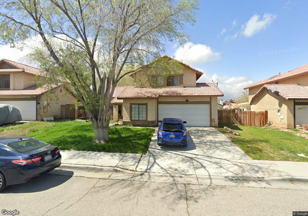
44821 Caboose Dr Lancaster, CA 93535
East Lancaster NeighborhoodEstimated Value: $435,460 - $478,000
3
Beds
3
Baths
1,771
Sq Ft
$256/Sq Ft
Est. Value
About This Home
This home is located at 44821 Caboose Dr, Lancaster, CA 93535 and is currently estimated at $452,615, approximately $255 per square foot. 44821 Caboose Dr is a home located in Los Angeles County with nearby schools including Discovery Elementary School, Piute Middle School, and Eastside High School.
Ownership History
Date
Name
Owned For
Owner Type
Purchase Details
Closed on
Oct 24, 2014
Sold by
Welsh Matthew R
Bought by
Moore Amber M
Current Estimated Value
Home Financials for this Owner
Home Financials are based on the most recent Mortgage that was taken out on this home.
Original Mortgage
$91,500
Outstanding Balance
$30,841
Interest Rate
4.2%
Mortgage Type
New Conventional
Estimated Equity
$421,774
Purchase Details
Closed on
Apr 23, 2009
Sold by
Deutsche Bank National Trust Company
Bought by
Moore Amber M and Welsh Matthew R
Home Financials for this Owner
Home Financials are based on the most recent Mortgage that was taken out on this home.
Original Mortgage
$97,200
Interest Rate
4.78%
Mortgage Type
Purchase Money Mortgage
Purchase Details
Closed on
Dec 8, 2008
Sold by
Haro Aldo I
Bought by
Deutsche Bank National Trust Company
Purchase Details
Closed on
Nov 8, 2004
Sold by
Zarnowiec Stephen A
Bought by
Haro Aldo I
Home Financials for this Owner
Home Financials are based on the most recent Mortgage that was taken out on this home.
Original Mortgage
$202,000
Interest Rate
5.65%
Mortgage Type
Purchase Money Mortgage
Purchase Details
Closed on
Jun 30, 2000
Sold by
White Mountains Services Corp
Bought by
Zarnowiec Stephen A and Zarnowiec Trudy L
Home Financials for this Owner
Home Financials are based on the most recent Mortgage that was taken out on this home.
Original Mortgage
$112,772
Interest Rate
8.2%
Mortgage Type
FHA
Purchase Details
Closed on
Jan 5, 2000
Sold by
Cherry Jamie
Bought by
White Mountains Services Corp and Source One Mtg Services Corp
Purchase Details
Closed on
Dec 28, 1998
Sold by
Federal National Mortgage Association
Bought by
Cherry Jamie
Home Financials for this Owner
Home Financials are based on the most recent Mortgage that was taken out on this home.
Original Mortgage
$104,652
Interest Rate
6.76%
Mortgage Type
FHA
Purchase Details
Closed on
Aug 18, 1998
Sold by
Stewart James K and Stewart Julie G
Bought by
Federal National Mortgage Association
Create a Home Valuation Report for This Property
The Home Valuation Report is an in-depth analysis detailing your home's value as well as a comparison with similar homes in the area
Home Values in the Area
Average Home Value in this Area
Purchase History
| Date | Buyer | Sale Price | Title Company |
|---|---|---|---|
| Moore Amber M | -- | Old Republic Title Company | |
| Moore Amber M | $108,000 | First American Title Company | |
| Deutsche Bank National Trust Company | $121,000 | Service Link | |
| Haro Aldo I | $252,500 | First American Title Company | |
| Zarnowiec Stephen A | $113,500 | First American Title Co | |
| White Mountains Services Corp | $92,000 | Fidelity National Title Ins | |
| Cherry Jamie | $105,000 | Fidelity Title | |
| Federal National Mortgage Association | $84,000 | American Title Co |
Source: Public Records
Mortgage History
| Date | Status | Borrower | Loan Amount |
|---|---|---|---|
| Open | Moore Amber M | $91,500 | |
| Previous Owner | Moore Amber M | $97,200 | |
| Previous Owner | Haro Aldo I | $202,000 | |
| Previous Owner | Zarnowiec Stephen A | $112,772 | |
| Previous Owner | Cherry Jamie | $104,652 | |
| Closed | Haro Aldo I | $50,500 |
Source: Public Records
Tax History
| Year | Tax Paid | Tax Assessment Tax Assessment Total Assessment is a certain percentage of the fair market value that is determined by local assessors to be the total taxable value of land and additions on the property. | Land | Improvement |
|---|---|---|---|---|
| 2025 | $3,537 | $176,909 | $40,762 | $136,147 |
| 2024 | $3,537 | $173,441 | $39,963 | $133,478 |
| 2023 | $3,466 | $170,041 | $39,180 | $130,861 |
| 2022 | $3,274 | $166,708 | $38,412 | $128,296 |
| 2021 | $2,885 | $163,440 | $37,659 | $125,781 |
| 2019 | $2,809 | $158,594 | $36,543 | $122,051 |
| 2018 | $2,761 | $155,485 | $35,827 | $119,658 |
| 2016 | $2,620 | $149,449 | $34,437 | $115,012 |
| 2015 | $2,589 | $147,205 | $33,920 | $113,285 |
| 2014 | $2,220 | $113,449 | $22,688 | $90,761 |
Source: Public Records
Map
Nearby Homes
- 44839 16th St E
- 44827 Rock Island Dr
- 0 15th St E Unit 22010063
- 1620 E Lingard St
- 1639 E Kettering St
- 1609 Silvia Ave
- 0 Cor 17th Ste Ketteing St Unit 25000899
- 1304 E Avenue I Unit 8
- 1304 E Avenue I Unit Spc 35
- 1558 Crestview Ct
- 45050 Bevington Ave
- 1607 E Norberry St
- 44606 Foxboro Ct
- 45628 Rachel Ave
- 1733 E Norberry St
- 1814 E Milling St
- 44910 12th St E
- 45133 17th St E
- 45064 18th St E
- 44526 15th St E Unit 4
- 44815 Caboose Dr
- 44827 Caboose Dr
- 44809 Caboose Dr
- 44835 Caboose Dr
- 44820 Rock Island Dr
- 44814 Rock Island Dr
- 44826 Rock Island Dr
- 44832 Rock Island Dr
- 44803 Caboose Dr
- 44820 Caboose Dr
- 44826 Caboose Dr
- 44814 Caboose Dr
- 60 Landsford St
- 44832 Caboose Dr
- 44808 Caboose Dr
- 44845 Caboose Dr
- 44838 Caboose Dr
- 44802 Caboose Dr
- 44844 Rock Island Dr
- 44842 Caboose Dr
Your Personal Tour Guide
Ask me questions while you tour the home.