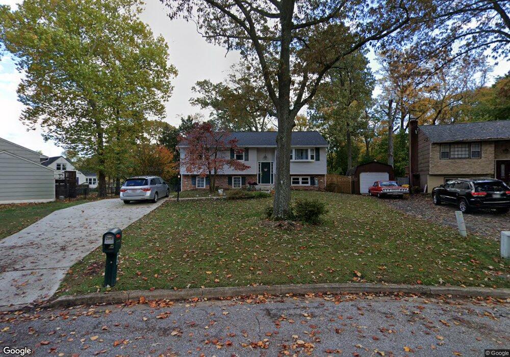
449 David Dr Arnold, MD 21012
Estimated Value: $445,867 - $487,000
Studio
2
Baths
948
Sq Ft
$497/Sq Ft
Est. Value
About This Home
This home is located at 449 David Dr, Arnold, MD 21012 and is currently estimated at $470,967, approximately $496 per square foot. 449 David Dr is a home located in Anne Arundel County with nearby schools including Belvedere Elementary School, Severn River Middle School, and Broadneck High School.
Ownership History
Date
Name
Owned For
Owner Type
Purchase Details
Closed on
Jun 2, 2025
Sold by
Ober Philip Earl and Ober Rebecca A
Bought by
Potensky Levi Ikaika and Potensky Diana M
Current Estimated Value
Home Financials for this Owner
Home Financials are based on the most recent Mortgage that was taken out on this home.
Original Mortgage
$445,550
Outstanding Balance
$444,395
Interest Rate
6.76%
Mortgage Type
New Conventional
Estimated Equity
$26,572
Purchase Details
Closed on
Jun 29, 1994
Sold by
Rumbley Robert M
Bought by
Ober Philip E
Home Financials for this Owner
Home Financials are based on the most recent Mortgage that was taken out on this home.
Original Mortgage
$151,450
Interest Rate
8.55%
Create a Home Valuation Report for This Property
The Home Valuation Report is an in-depth analysis detailing your home's value as well as a comparison with similar homes in the area
Home Values in the Area
Average Home Value in this Area
Purchase History
| Date | Buyer | Sale Price | Title Company |
|---|---|---|---|
| Potensky Levi Ikaika | $469,000 | First American Title | |
| Potensky Levi Ikaika | $469,000 | First American Title | |
| Ober Philip E | $143,000 | -- |
Source: Public Records
Mortgage History
| Date | Status | Borrower | Loan Amount |
|---|---|---|---|
| Open | Potensky Levi Ikaika | $445,550 | |
| Closed | Potensky Levi Ikaika | $445,550 | |
| Previous Owner | Ober Philip E | $151,450 |
Source: Public Records
Tax History
| Year | Tax Paid | Tax Assessment Tax Assessment Total Assessment is a certain percentage of the fair market value that is determined by local assessors to be the total taxable value of land and additions on the property. | Land | Improvement |
|---|---|---|---|---|
| 2025 | $4,264 | $390,500 | -- | -- |
| 2024 | $4,264 | $376,200 | $257,100 | $119,100 |
| 2023 | $4,140 | $358,400 | $0 | $0 |
| 2022 | $3,859 | $340,600 | $0 | $0 |
| 2020 | $3,671 | $313,967 | $0 | $0 |
| 2019 | $3,582 | $305,133 | $0 | $0 |
| 2018 | $3,004 | $296,300 | $184,000 | $112,300 |
| 2017 | $3,345 | $290,667 | $0 | $0 |
| 2016 | -- | $285,033 | $0 | $0 |
| 2015 | -- | $279,400 | $0 | $0 |
| 2014 | -- | $272,633 | $0 | $0 |
Source: Public Records
Map
Nearby Homes
- 854 Imperial Rd
- 797 David Dr
- 852 Birchwood Ct
- 856 Imperial Rd
- 406 Elmwood Ct
- 413 Ridgeview Ct
- 746 Match Point Dr
- 836 Mill Creek Rd
- 243 and 245 Haverton Rd
- 805 Barrett Ave
- 342 Buena Vista Ave
- 319 Alameda Pkwy
- 404 Alameda Pkwy
- 201 Mill Ct
- 308 Clifton Ave
- 889 Lynch Dr
- 876 Nancy Lynn Ln
- 930 Whitstable Blvd
- 360 Magothy Rd Unit 8H
- 360 Magothy Rd Unit 5A
Your Personal Tour Guide
Ask me questions while you tour the home.