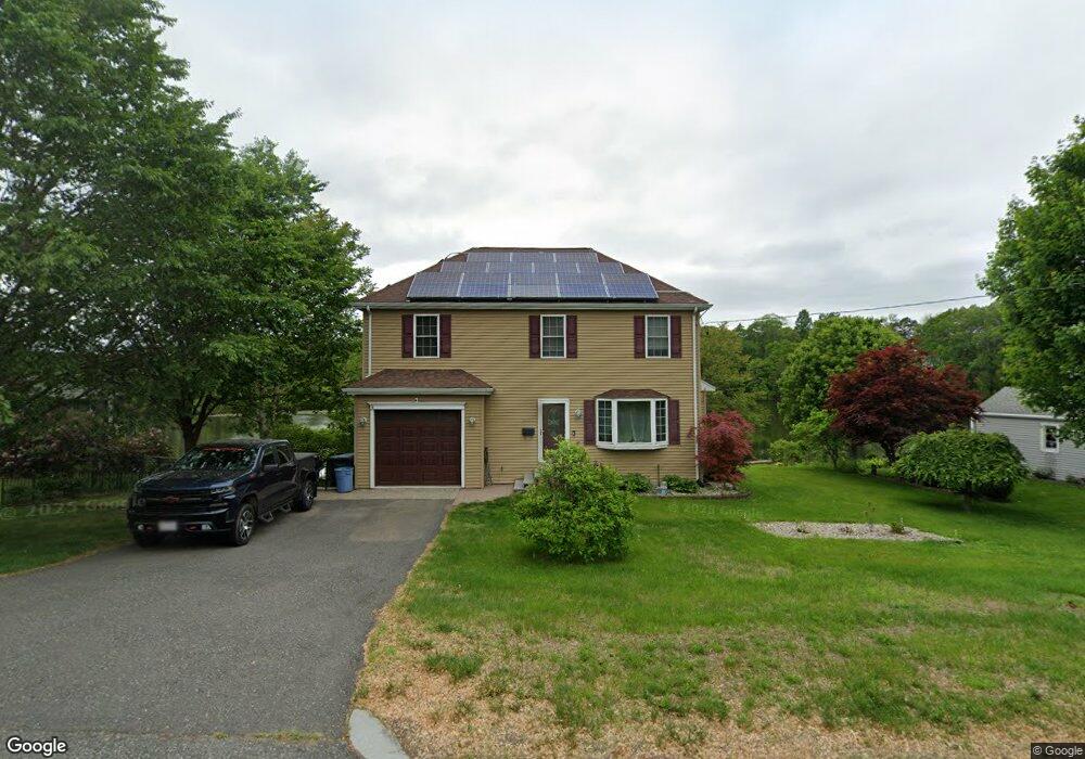
450 Roosevelt Ave Springfield, MA 01118
East Forest Park NeighborhoodEstimated Value: $390,000 - $449,000
3
Beds
3
Baths
1,725
Sq Ft
$241/Sq Ft
Est. Value
About This Home
This home is located at 450 Roosevelt Ave, Springfield, MA 01118 and is currently estimated at $416,334, approximately $241 per square foot. 450 Roosevelt Ave is a home located in Hampden County with nearby schools including Mary A. Dryden Veterans Memorial School, M Marcus Kiley Middle, and Springfield High School of Science and Technology.
Ownership History
Date
Name
Owned For
Owner Type
Purchase Details
Closed on
May 14, 2025
Sold by
Canning Robert F and Canning Ruth H
Bought by
Canning Clay K and Canning Kimberly J
Current Estimated Value
Purchase Details
Closed on
Sep 16, 2005
Sold by
Obrien Christopher and Laporte Kelly
Bought by
Canning Kimberly Ann
Home Financials for this Owner
Home Financials are based on the most recent Mortgage that was taken out on this home.
Original Mortgage
$176,000
Interest Rate
5.84%
Mortgage Type
Purchase Money Mortgage
Purchase Details
Closed on
Jul 17, 2001
Sold by
Est Olson Thomas A and Olson Steven T
Bought by
Obrien Christopher and Laporte Kelly
Home Financials for this Owner
Home Financials are based on the most recent Mortgage that was taken out on this home.
Original Mortgage
$104,000
Interest Rate
7.2%
Mortgage Type
Purchase Money Mortgage
Create a Home Valuation Report for This Property
The Home Valuation Report is an in-depth analysis detailing your home's value as well as a comparison with similar homes in the area
Home Values in the Area
Average Home Value in this Area
Purchase History
| Date | Buyer | Sale Price | Title Company |
|---|---|---|---|
| Canning Clay K | -- | -- | |
| Canning Clay K | -- | -- | |
| Canning Robert F | -- | None Available | |
| Canning Robert F | -- | None Available | |
| Canning Kimberly Ann | $220,000 | -- | |
| Canning Kimberly Ann | $220,000 | -- | |
| Obrien Christopher | $130,000 | -- | |
| Obrien Christopher | $130,000 | -- |
Source: Public Records
Mortgage History
| Date | Status | Borrower | Loan Amount |
|---|---|---|---|
| Previous Owner | Canning Kimberly Ann | $176,000 | |
| Previous Owner | Canning Kimberly Ann | $33,000 | |
| Previous Owner | Obrien Christopher | $125,500 | |
| Previous Owner | Obrien Christopher | $104,000 |
Source: Public Records
Tax History Compared to Growth
Tax History
| Year | Tax Paid | Tax Assessment Tax Assessment Total Assessment is a certain percentage of the fair market value that is determined by local assessors to be the total taxable value of land and additions on the property. | Land | Improvement |
|---|---|---|---|---|
| 2025 | $6,071 | $387,200 | $48,000 | $339,200 |
| 2024 | $5,632 | $350,700 | $48,000 | $302,700 |
| 2023 | $5,413 | $317,500 | $45,700 | $271,800 |
| 2022 | $5,569 | $295,900 | $45,700 | $250,200 |
| 2021 | $5,549 | $293,600 | $41,500 | $252,100 |
| 2020 | $5,490 | $281,100 | $41,500 | $239,600 |
| 2019 | $5,569 | $283,000 | $41,500 | $241,500 |
| 2018 | $5,503 | $279,600 | $41,500 | $238,100 |
| 2017 | $5,143 | $261,600 | $41,500 | $220,100 |
| 2016 | $4,762 | $242,200 | $41,500 | $200,700 |
| 2015 | $5,024 | $255,400 | $41,500 | $213,900 |
Source: Public Records
Map
Nearby Homes
- 54 S Shore Dr
- 384 Abbott St
- 236 Pondview Dr
- 74 Oregon St
- 97 Lancaster St
- 100 Derryfield Ave
- 91 Lancaster St
- 7 Ashbrook St
- 283 Plumtree Rd
- 190 Whittum Ave
- 75 Carnavon Cir
- 141 Hartford Terrace
- 74 Judith St
- 138 Abbott St
- 867 Roosevelt Ave
- 134 Eddywood St
- 34 Ina St
- 100 Abbott St
- 95 Benz St
- 74 Leatherleaf Dr
- 460 Roosevelt Ave
- 440 Roosevelt Ave
- 470 Roosevelt Ave
- 453 Roosevelt Ave
- 445 Roosevelt Ave
- 430 Roosevelt Ave
- 435 Roosevelt Ave
- 465 Roosevelt Ave
- 480 Roosevelt Ave
- 17 Arvesta St
- 420 Roosevelt Ave
- 477 Roosevelt Ave
- 18 Kipling St
- 16 Arvesta St
- 421 Roosevelt Ave
- 490 Roosevelt Ave
- 25 Arvesta St
- 24 Arvesta St
- 26 Kipling St
- 408 Roosevelt Ave