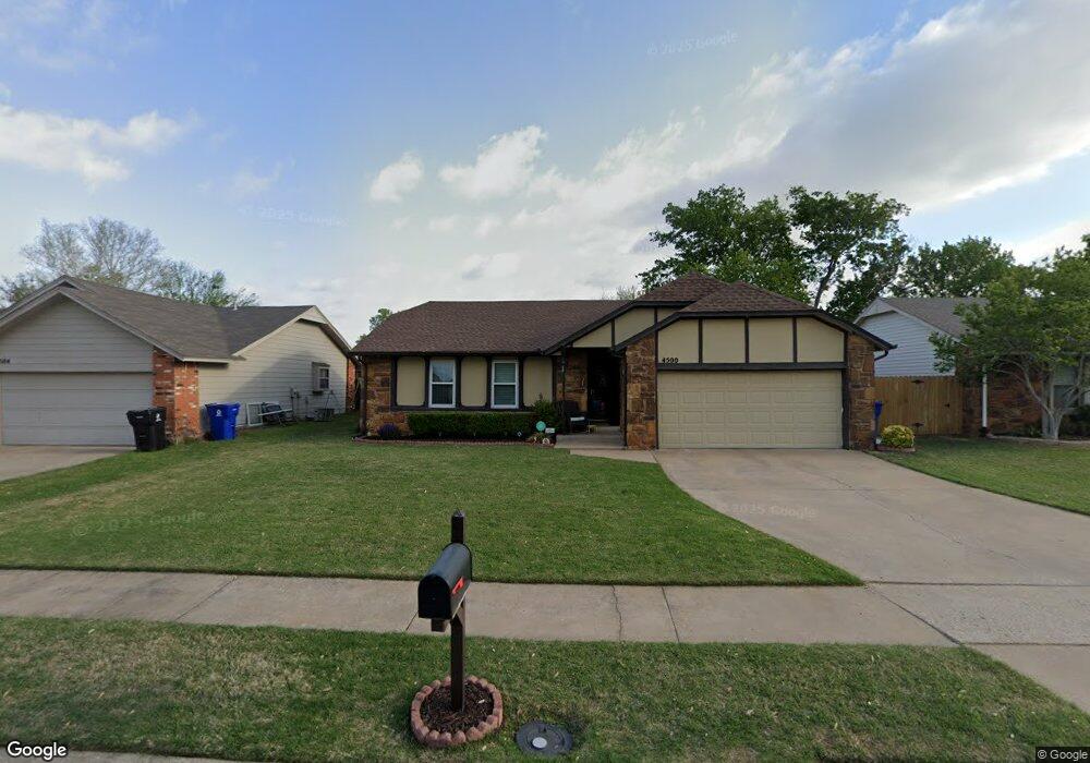
4500 W Uniontown St Broken Arrow, OK 74012
Southbrook NeighborhoodEstimated Value: $193,167 - $216,000
3
Beds
2
Baths
1,290
Sq Ft
$162/Sq Ft
Est. Value
About This Home
This home is located at 4500 W Uniontown St, Broken Arrow, OK 74012 and is currently estimated at $209,042, approximately $162 per square foot. 4500 W Uniontown St is a home located in Tulsa County with nearby schools including McAuliffe Elementary School, Union 8th Grade Center, and Union 6th-7th Grade Center.
Ownership History
Date
Name
Owned For
Owner Type
Purchase Details
Closed on
Jan 16, 2004
Sold by
Turner Crystal N and Turner Arlo W
Bought by
Harlin Michelle
Current Estimated Value
Purchase Details
Closed on
Dec 10, 1998
Sold by
Stephens Charles Michael and Stephens Charles C
Bought by
Cook Crystal N and Turner Arlo W
Purchase Details
Closed on
Feb 11, 1998
Sold by
Stephens Janet K
Bought by
Stephens Charles Michael
Purchase Details
Closed on
May 1, 1983
Create a Home Valuation Report for This Property
The Home Valuation Report is an in-depth analysis detailing your home's value as well as a comparison with similar homes in the area
Home Values in the Area
Average Home Value in this Area
Purchase History
| Date | Buyer | Sale Price | Title Company |
|---|---|---|---|
| Harlin Michelle | $96,000 | The Executives Title & Escro | |
| Cook Crystal N | $79,500 | Guaranty Abstract Company | |
| Stephens Charles Michael | -- | -- | |
| -- | $61,000 | -- |
Source: Public Records
Tax History Compared to Growth
Tax History
| Year | Tax Paid | Tax Assessment Tax Assessment Total Assessment is a certain percentage of the fair market value that is determined by local assessors to be the total taxable value of land and additions on the property. | Land | Improvement |
|---|---|---|---|---|
| 2025 | $1,656 | $12,616 | $2,021 | $10,595 |
| 2024 | $1,527 | $12,220 | $2,220 | $10,000 |
| 2023 | $1,527 | $12,834 | $2,432 | $10,402 |
| 2022 | $1,491 | $11,460 | $3,032 | $8,428 |
| 2021 | $1,449 | $11,097 | $2,936 | $8,161 |
| 2020 | $1,458 | $11,097 | $2,936 | $8,161 |
| 2019 | $1,443 | $10,996 | $2,909 | $8,087 |
| 2018 | $1,393 | $10,647 | $2,817 | $7,830 |
| 2017 | $1,366 | $11,307 | $2,992 | $8,315 |
| 2016 | $1,305 | $10,978 | $3,201 | $7,777 |
| 2015 | $1,306 | $10,978 | $3,201 | $7,777 |
| 2014 | $1,298 | $10,978 | $3,201 | $7,777 |
Source: Public Records
Map
Nearby Homes
- 1812 N Butternut Ave
- 1908 N Cypress Ave
- 11860 E 62nd Place
- 4441 W Queens St
- 11329 E 61st St
- 1429 N Yellowood Ave
- 6526 S 111th East Ave
- 6529 S 110th Ave E
- 6727 S 112th East Ave
- 1216 N Cypress Ave
- 6407 S 109th East Ave
- 1312 N Willow Ave
- 2416 W Lansing Place
- 911 N Butternut Ct
- 905 N Butternut Ave
- 1316 N Nyssa Ave
- 708 N Aster Ave
- 3413 W Norman St
- 4501 W Hartford St
- 3108 W Norman Cir
- 4432 W Uniontown St
- 4504 W Uniontown St
- 11816 E 64th St
- 4428 W Uniontown St
- 11812 E 64th St
- 4508 W Uniontown St
- 11822 E 64th St
- 4501 W Uniontown St
- 11826 E 64th St
- 11806 E 64th St
- 4505 W Uniontown St
- 4424 W Uniontown St
- 1913 N Butternut Ave
- 4509 W Uniontown St
- 11832 E 64th St
- 4420 W Uniontown St
- 4516 W Uniontown St
- 4513 W Uniontown St
- 1909 N Butternut Ave
- 11817 E 64th St
