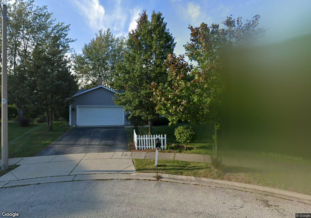
4506 Sundance Ct Hoffman Estates, IL 60192
South Ridge NeighborhoodEstimated Value: $462,000 - $523,000
4
Beds
3
Baths
1,954
Sq Ft
$255/Sq Ft
Est. Value
About This Home
This home is located at 4506 Sundance Ct, Hoffman Estates, IL 60192 and is currently estimated at $497,904, approximately $254 per square foot. 4506 Sundance Ct is a home located in Cook County with nearby schools including Frank C. Whiteley Elementary School, Plum Grove Jr High School, and William Fremd High School.
Ownership History
Date
Name
Owned For
Owner Type
Purchase Details
Closed on
Jun 20, 2025
Sold by
Staackman Robin and Hanrahan Patrick
Bought by
Hanrahan Patrick and Staackmann Robin
Current Estimated Value
Home Financials for this Owner
Home Financials are based on the most recent Mortgage that was taken out on this home.
Original Mortgage
$115,000
Outstanding Balance
$114,723
Interest Rate
7.13%
Mortgage Type
New Conventional
Estimated Equity
$383,181
Purchase Details
Closed on
Mar 29, 2004
Sold by
Anderson Marcella L
Bought by
Staackmann Peter and Staackmann Robin
Home Financials for this Owner
Home Financials are based on the most recent Mortgage that was taken out on this home.
Original Mortgage
$100,000
Interest Rate
5.65%
Mortgage Type
Unknown
Create a Home Valuation Report for This Property
The Home Valuation Report is an in-depth analysis detailing your home's value as well as a comparison with similar homes in the area
Home Values in the Area
Average Home Value in this Area
Purchase History
| Date | Buyer | Sale Price | Title Company |
|---|---|---|---|
| Hanrahan Patrick | -- | None Listed On Document | |
| Staackmann Peter | $309,000 | Rtc |
Source: Public Records
Mortgage History
| Date | Status | Borrower | Loan Amount |
|---|---|---|---|
| Open | Hanrahan Patrick | $115,000 | |
| Previous Owner | Staackmann Peter | $100,000 |
Source: Public Records
Tax History Compared to Growth
Tax History
| Year | Tax Paid | Tax Assessment Tax Assessment Total Assessment is a certain percentage of the fair market value that is determined by local assessors to be the total taxable value of land and additions on the property. | Land | Improvement |
|---|---|---|---|---|
| 2024 | $9,514 | $37,000 | $7,481 | $29,519 |
| 2023 | $9,950 | $37,000 | $7,481 | $29,519 |
| 2022 | $9,950 | $37,000 | $7,481 | $29,519 |
| 2021 | $8,372 | $28,332 | $5,195 | $23,137 |
| 2020 | $8,263 | $28,332 | $5,195 | $23,137 |
| 2019 | $8,178 | $31,411 | $5,195 | $26,216 |
| 2018 | $9,356 | $32,967 | $4,779 | $28,188 |
| 2017 | $9,200 | $32,967 | $4,779 | $28,188 |
| 2016 | $8,792 | $32,967 | $4,779 | $28,188 |
| 2015 | $8,610 | $30,327 | $4,363 | $25,964 |
| 2014 | $8,464 | $30,327 | $4,363 | $25,964 |
| 2013 | $8,232 | $30,327 | $4,363 | $25,964 |
Source: Public Records
Map
Nearby Homes
- 1195 Old Timber Ct
- 1208 Old Timber Ln
- 1404 W Sapphire Dr
- 4827 Turnberry Dr
- 4658 Burnham Dr
- 4944 Somerton Dr
- 4890 Prestwick Place
- 4760 Amber Cir
- 4950 Rochester Dr
- 4320 Lombardy Ln
- 5015 Rochester Dr
- 330 Poteet Ave
- 13 Chipping Campden Dr
- 5190 Chambers Dr
- 70 Ela Rd
- 3925 Charlemagne Dr
- 121 Florence Ave
- 85 Ela Rd
- 2022 Abbotsford Dr
- 26 Forest Ln
- 4512 Sundance Ct
- 4500 Sundance Ct
- 4567 Opal Dr
- 4598 Mumford Dr
- 4590 Mumford Dr
- 4518 Sundance Cir
- 4569 Opal Dr
- 4494 Sundance Cir
- 4600 Mumford Dr
- 4580 Mumford Dr
- 4602 Mumford Dr
- 4571 Opal Dr
- 4604 Mumford Dr
- 4570 Mumford Dr
- 4524 Sundance Cir
- 4570 Opal Dr
- 4606 Mumford Dr
- 4573 Opal Dr
- 4488 Sundance Cir
- 4608 Mumford Dr Unit 1