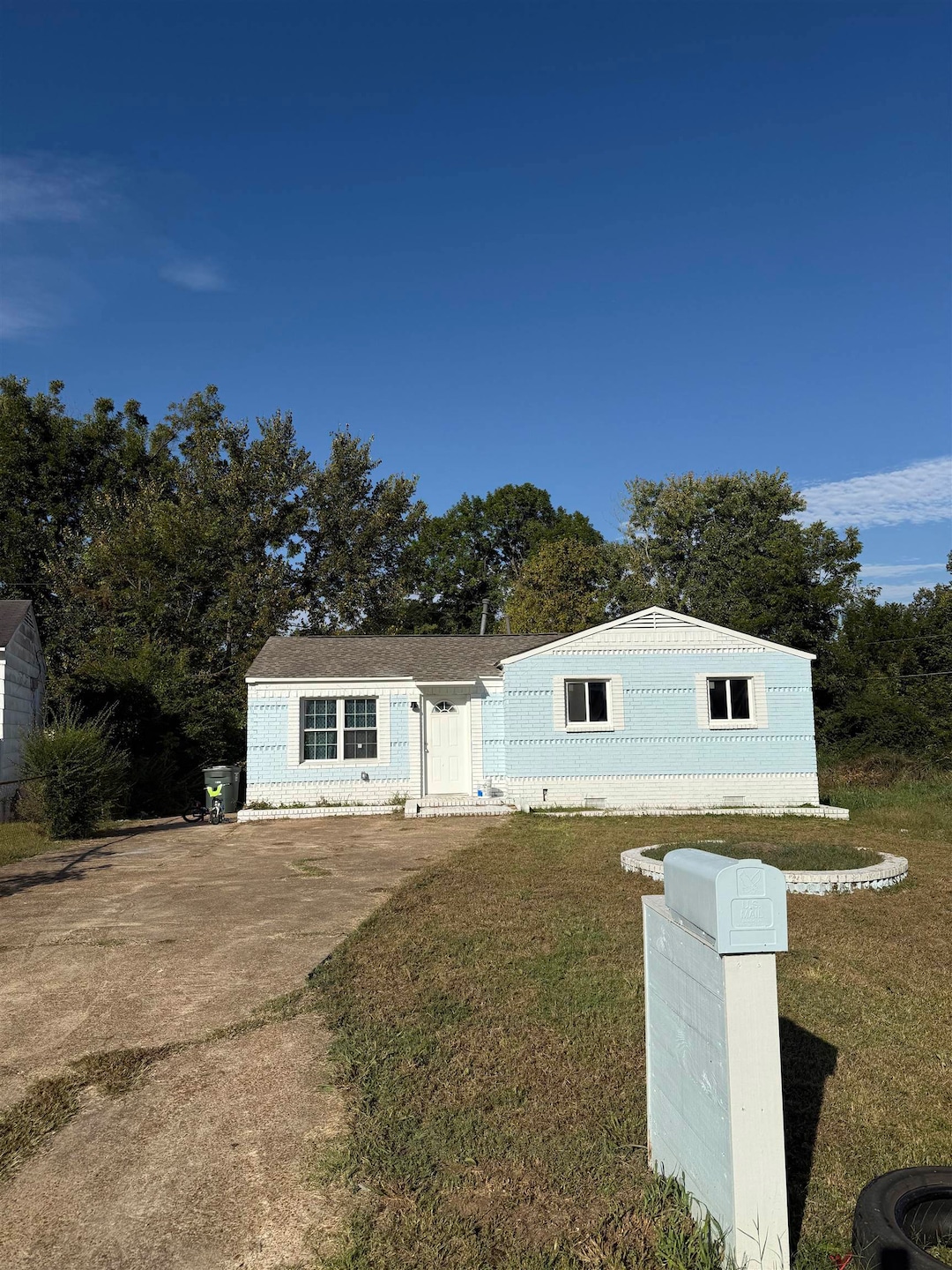
4511 Range Line Rd Memphis, TN 38127
Frayser NeighborhoodEstimated payment $671/month
Highlights
- Traditional Architecture
- Level Lot
- 1-Story Property
- Central Air
- Heating Available
About This Home
Calling investors looking to build their rental portfolio! Cash flowing, turn-key property. Seller prefers to sell as a 12-property package deal, bringing in over $10k per month. 9 of the 12 properties have tenants in place with leases that end October 2026. Seller may consider selling separately. Tenant rights. Do not disturb tenants. No showings without an accepted offer. See MLS docs for other property addresses.
Home Details
Home Type
- Single Family
Year Built
- Built in 1960
Lot Details
- 8,712 Sq Ft Lot
- Lot Dimensions are 40x126
- Level Lot
Parking
- Driveway
Home Design
- Traditional Architecture
Interior Spaces
- 852 Sq Ft Home
- 1-Story Property
Bedrooms and Bathrooms
- 3 Main Level Bedrooms
- 1 Full Bathroom
Utilities
- Central Air
- Heating Available
Community Details
- Ridgegrove B Subdivision
Listing and Financial Details
- Assessor Parcel Number 071061 00004
Map
Home Values in the Area
Average Home Value in this Area
Tax History
| Year | Tax Paid | Tax Assessment Tax Assessment Total Assessment is a certain percentage of the fair market value that is determined by local assessors to be the total taxable value of land and additions on the property. | Land | Improvement |
|---|---|---|---|---|
| 2025 | $194 | $14,800 | $1,375 | $13,425 |
| 2024 | -- | -- | -- | -- |
| 2022 | $606 | $9,950 | $1,250 | $8,700 |
| 2021 | $613 | $9,950 | $1,250 | $8,700 |
| 2020 | $542 | $7,475 | $1,250 | $6,225 |
| 2019 | $239 | $7,475 | $1,250 | $6,225 |
| 2018 | $239 | $7,475 | $1,250 | $6,225 |
| 2017 | $245 | $7,475 | $1,250 | $6,225 |
| 2016 | $338 | $7,725 | $0 | $0 |
| 2014 | $338 | $7,725 | $0 | $0 |
Property History
| Date | Event | Price | List to Sale | Price per Sq Ft |
|---|---|---|---|---|
| 12/03/2025 12/03/25 | Price Changed | $124,500 | -0.2% | $146 / Sq Ft |
| 11/25/2025 11/25/25 | Price Changed | $124,700 | -0.1% | $146 / Sq Ft |
| 11/15/2025 11/15/25 | Price Changed | $124,800 | -0.1% | $146 / Sq Ft |
| 11/05/2025 11/05/25 | Price Changed | $124,900 | -0.1% | $147 / Sq Ft |
| 10/21/2025 10/21/25 | For Sale | $125,000 | -- | $147 / Sq Ft |
Purchase History
| Date | Type | Sale Price | Title Company |
|---|---|---|---|
| Quit Claim Deed | -- | None Listed On Document | |
| Quit Claim Deed | $39,800 | None Listed On Document | |
| Quit Claim Deed | -- | None Listed On Document | |
| Interfamily Deed Transfer | -- | None Available | |
| Interfamily Deed Transfer | -- | Tri State Title & Escrow Inc | |
| Quit Claim Deed | -- | Tri State Title | |
| Quit Claim Deed | -- | Tri State Title |
Mortgage History
| Date | Status | Loan Amount | Loan Type |
|---|---|---|---|
| Previous Owner | $61,800 | No Value Available |
Source: Memphis Area Association of REALTORS®
MLS Number: 10208204
APN: 07-1061-0-0004
Disclaimer: Certain information contained herein is derived from information provided by parties other than Homes.com. All information provided is deemed reliable, but is not guaranteed to be accurate and should be independently verified.
![]() Listing content and images Copyright 2025 Memphis Area Association of REALTORS®. Information provided is for the consumer’s personal, non-commercial use and may not be used for any purpose other than to identify prospective properties consumers may be interested in purchasing. Do not rely upon listing data without independently verifying it.
Listing content and images Copyright 2025 Memphis Area Association of REALTORS®. Information provided is for the consumer’s personal, non-commercial use and may not be used for any purpose other than to identify prospective properties consumers may be interested in purchasing. Do not rely upon listing data without independently verifying it.
Some or all of the listings displayed may not belong to the firm whose website is being visited.
- 4502 Beacon Hill Cove
- 4530 Beacon Hill Dr
- 4520 Beacon Hill Dr
- 4499 Range Line Rd
- 4498 Beacon Hill Cove
- 4494 Beacon Hill Cove
- 4511 Beacon Hill Dr
- 4503 Beacon Hill Dr
- 4489 Beacon Hill Dr
- 4485 Beacon Hill Dr
- 4464 Range Line Rd
- 2620 Maverick Ave
- 4537 Suncrest Dr
- 4579 Range Line Rd
- 4446 Range Line Rd
- 2548 Sunny Hill Dr
- 4522 Sunny View Dr
- 4446 Suncrest Dr
- 4589 Range Line Rd
- 2531 Smith Ridge Rd
- 4436 Ryan St
- 4620 Sunnybrook St
- 2516 Chattering Ln
- 4234 University St
- 2240 Lisa Ave
- 2192 Lisa Ave
- 2097 Sharon Ln
- 2831 Gruber Dr
- 2956 Lake Park Rd
- 2188 St Elmo Ave
- 4320 Old Allen Rd
- 3403 Brockcrest Cove
- 3432 Tellico Dr
- 3705 Suzanne Dr
- 2603 Pojest Dr
- 2474 Corning Ave
- 3740 Marvin St
- 3622 University St
- 3646 Overton Crossing St
- 1733 Carlyle Ave
